Handikhola
| Handikhola हाँडिखोला | |
|---|---|
| Village development committee | |
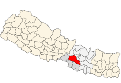
 Handikhola Location in Nepal | |
| Coordinates: 27°26′N 84°53′E / 27.43°N 84.89°ECoordinates: 27°26′N 84°53′E / 27.43°N 84.89°E | |
| Country |
|
| Zone | Narayani Zone |
| District | Makwanpur District |
| Population (2011) | |
| • Total | 18,415 |
| Time zone | Nepal Time (UTC+5:45) |
Handikhola is a village development committee in Makwanpur District in the Narayani Zone of southern Nepal. At the time of the 2011 Nepal census it had a population of 24,662 people living in 3,975 individual households.[1]
References
- ↑ cbs.gov.np/wp-content/uploads/2012/11/VDC_Municipality.pdf?
This article is issued from Wikipedia - version of the 3/7/2016. The text is available under the Creative Commons Attribution/Share Alike but additional terms may apply for the media files.