Haltwhistle Burn
| Haltwhistle Burn | |
 Haltwhistle Burn | |
| Country | United Kingdom |
|---|---|
| County | Northumberland |
| Mouth | |
| - coordinates | 54°58′00″N 2°26′37″W / 54.9666°N 2.4437°WCoordinates: 54°58′00″N 2°26′37″W / 54.9666°N 2.4437°W |
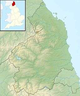 Location within Northumberland | |
The Haltwhistle Burn is a river which lies to the east of the Northumbrian town of Haltwhistle. Rising in the peaty uplands below the ridge of the Whin Sill, the burn passes through the Roman Military Zone south of Hadrian's Wall and through a dramatic sandstone gorge before descending between wooded banks to the South Tyne Valley. Today the Burn is a haven for wildlife and a popular walk for residents and tourists but from Roman times until the 1930s the combination of valuable minerals and water power attracted a succession of industries which provided goods and employment to the town.
Geology and associated industries
The rocks underlying this part of Northumberland were laid down during the Carboniferous Period when variations in sea level resulted in successive deposits of limestone, shale, sandstone, and coal, known in the UK as Yoredale cycles and in the US as cyclothems. The water of the Haltwhistle Burn has cut through these deposits giving access to building stone, clay and coal, leading to the development of the associated industries of quarrying, lime burning, brick, tile and pipe manufacture, coal mining and coke (fuel) and coal-gas production. Ironstone, found in association with the coal seams was also smelted on the banks of the burn.[1][2]
Water power
The bed of the burn descends into the valley at a gentle angle of approximately 1 degree but the fall is sufficient to have run a corn mill and three woollen manufactories during the 18th and 19th centuries. The earliest of these processes to be mechanised was fulling, with the first records on the site dating to 1612. Later, with advances in technology, the carding and spinning of wool was also carried out in watermills. The advent of steam-driven mills led to the abandonment of woollen processing along the burn. Two mills were demolished in the 1930s and the remaining fulling mill is now a dwelling.[3][4]
Roman fort

The remains of Haltwhistle Burn Roman Fort are situated on the eastern bank of Haltwhistle Burn, just north of the point where it is crossed by the B6318 (on the course of the Stanegate).
References
- ↑ Ancient Frontiers. Exploring the geology and landscape of the Hadrian's Wall Area, published by the British Geological Survey, 2006, ISBN 0-85272-541-8.
- ↑ Northumbrian Rocks and Landscape; a field guide. ed. Colin Scrutton, published by Yorkshire Geological Society 1995 ISBN 1-873551-11-8.
- ↑ History of the Manor and Church of Haltwhistle, C.E. Adamson, 1861, published by George Nicholson, Southshields.
- ↑ History, Topography, & Directory of Northumberland (Hexham Division) ed. T.F. Bulmer 1886, pub. T. Bulmer & Co. Manchester