Halls Creek, Western Australia
| Halls Creek Western Australia | |||||||
|---|---|---|---|---|---|---|---|
 Halls Creek | |||||||
| Coordinates | 18°14′S 127°40′E / 18.23°S 127.67°ECoordinates: 18°14′S 127°40′E / 18.23°S 127.67°E | ||||||
| Population | 1,211 (2006 census)[1] | ||||||
| Established | 1887/1949 | ||||||
| Postcode(s) | 6770 | ||||||
| Elevation | 422 m (1,385 ft) | ||||||
| Location | |||||||
| LGA(s) | Shire of Halls Creek | ||||||
| State electorate(s) | Kimberley | ||||||
| Federal Division(s) | Durack | ||||||
| |||||||
Halls Creek is a town situated in the East Kimberley region of Western Australia. It is located between the towns of Fitzroy Crossing and Turkey Creek (Warmun) on the Great Northern Highway. It is the only sizeable town for 600 km on the Highway.
Halls Creek is also the northern end of the Canning Stock Route, which runs 1,850 km through the Great Sandy Desert until the southern end of the route at Wiluna.
The town functions as a major hub for the local indigenous population and as a support centre for cattle stations in the area.
Halls Creek is the administration centre for Halls Creek Shire Council.
History
The land now known as Halls Creek has been occupied for thousands of years. The land is crossed by songlines and trading paths stretching from the coasts to the deserts, some passing near the modern town. The story of that long occupation remains alive today and it is revealed in the culture of the Jaru, Kija, Kukatja, Walmajarri, Gooniyandi and other indigenous people who live in Halls Creek shire. That ancient world changed late in the 1800s when Europeans arrived, searching for minerals for wealth and land for cattle. On Christmas Day 1885 prospector Charlie Hall found a huge 870-gram (28-troy-ounce) gold nugget at a site that would eventually be named after him.
News of the discovery drew more than 15,000 people to what is now Old Halls Creek to try their luck. It proved an inhospitable land for these people and the graves of some can be found in Old Town's small cemetery. The gold rush lasted less than 3 months and Halls Creek became a trading centre for cattle stations, aboriginal communities and miners who stayed in the area. The post office with its telegraph line that terminated here, the police station, government office, racecourse and stores gave the town a purpose. In 1918 the Australian Inland Mission built a hospital and the old town struggled on, short of inhabitants and water. In 1948 an airfield was built near the site of the present town and over the next decade the old town moved nearer to this new site. Except for the police station, which finally relocated in 1961, the old town was abandoned by 1954.
Tourism
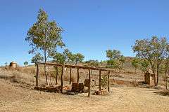
.jpg)
For tourists, there are several nearby attractions such as:
- China Wall
- Old Halls Creek
- Duncan Road
- Wolfe Creek Crater, 200 km to the south on the Tanami Road
- Purnululu National Park (the Bungle Bungles), 120 km to the north.
Impact Craters
Aside from the well known and well preserved Wolfe Creek Crater, averaging about 875 metres in diameter, nearby there is also Goat Paddock crater, 7 km in diameter and 106 km west-southwest of Halls Creek, and Piccaninny crater, 7 km in diameter, within the Purnululu (Bungle Bungle) National Park. Near the other end of the Tanami Road in the Northern Territory, over 1000 km away from Halls Creek, is Gosses Bluff crater, with the 5 km diameter, 180 m high crater-like feature, now exposed, being interpreted as the eroded relic of the crater's central uplift.
Indigenous population
It is home to the indigenous Jaru (Djar-u) and Kija (gKid-ja) peoples as well as some Tjurabalan peoples from the desert to the south of the town. Indigenous people represent over 70% of the town's population.[1]
In 2006, The West Australian newspaper ran a series of articles highlighting the living conditions and health of the Halls Creek indigenous population. However, Halls Creek is by no means unusual in this regard, with many other towns and communities in the Pilbara, Kimberley, and other parts of the state facing the same issues. Prior to the introduction of a ban on the sale of alcohol it was estimated that many pregnant women in the town consumed alcohol, with nearly a third of babies suffering Fetal Alcohol Syndrome.[2]
In May 2009 the state Director of Liquor Licensing imposed a "prohibition on the sale of packaged liquor with an alcohol content greater than 2.7 per cent from licensed premises" in the town.[3] In September 2009 it was reported that assaults and drink driving arrests had decreased dramatically as a result of the bans.[4]
Climate
| Climate data for Halls Creek (1941–2012) | |||||||||||||
|---|---|---|---|---|---|---|---|---|---|---|---|---|---|
| Month | Jan | Feb | Mar | Apr | May | Jun | Jul | Aug | Sep | Oct | Nov | Dec | Year |
| Record high °C (°F) | 44.0 (111.2) |
43.3 (109.9) |
42.2 (108) |
39.6 (103.3) |
36.9 (98.4) |
34.2 (93.6) |
34.4 (93.9) |
37.2 (99) |
39.9 (103.8) |
43.8 (110.8) |
45.0 (113) |
44.9 (112.8) |
45.0 (113) |
| Average high °C (°F) | 36.7 (98.1) |
35.6 (96.1) |
35.4 (95.7) |
33.8 (92.8) |
29.9 (85.8) |
27.2 (81) |
27.2 (81) |
30.0 (86) |
34.0 (93.2) |
37.1 (98.8) |
38.3 (100.9) |
37.8 (100) |
33.6 (92.5) |
| Average low °C (°F) | 24.3 (75.7) |
23.7 (74.7) |
22.8 (73) |
20.4 (68.7) |
16.7 (62.1) |
13.6 (56.5) |
12.6 (54.7) |
14.8 (58.6) |
19.0 (66.2) |
22.7 (72.9) |
24.4 (75.9) |
24.7 (76.5) |
20.0 (68) |
| Record low °C (°F) | 15.6 (60.1) |
17.7 (63.9) |
15.6 (60.1) |
11.0 (51.8) |
7.1 (44.8) |
3.0 (37.4) |
0.2 (32.4) |
4.9 (40.8) |
8.3 (46.9) |
12.8 (55) |
13.5 (56.3) |
15.6 (60.1) |
0.2 (32.4) |
| Average rainfall mm (inches) | 151.4 (5.961) |
143.7 (5.657) |
81.6 (3.213) |
21.6 (0.85) |
12.8 (0.504) |
5.5 (0.217) |
6.1 (0.24) |
1.9 (0.075) |
4.7 (0.185) |
17.6 (0.693) |
37.2 (1.465) |
82.2 (3.236) |
568.9 (22.398) |
| Average rainy days | 13.4 | 12.8 | 8.2 | 2.6 | 2.0 | 1.0 | 0.8 | 0.5 | 0.9 | 3.3 | 6.4 | 10.7 | 62.6 |
| Mean monthly sunshine hours | 251.1 | 221.2 | 269.7 | 297.0 | 272.8 | 297.0 | 322.4 | 319.3 | 315.0 | 306.9 | 300.0 | 266.6 | 3,439 |
| Source: Australian Bureau of Meteorology[5] | |||||||||||||
Possible Development
The mining company Northern Minerals is planning to start mining heavy rare earth elements in the area in 2016.[6] With mining companies surveying the area for its iron ore, the Shire Of Halls creek is set to become the fastest growing settlement in the state. The town is expected to quadruple in size by 2016 if the mining corporations go ahead with their exploration for Iron Ore in the area. The commercial industry in the small town is projected to grow massively, with McDonalds, Woolworths, Coles, Kmart and many other stores planning to develop if the mining companies choose to mine in the surrounding area.
| Historical population | ||
|---|---|---|
| Year | Pop. | ±% |
| 1986 | 315 | — |
| 1991 | 479 | +52.1% |
| 1996 | 382 | −20.3% |
| 2001 | 672 | +75.9% |
| 2006 | 987 | +46.9% |
| 2011 | 1,157 | +17.2% |
| 2014 | 1,194 | +3.2% |
| 2016 | 3,638 | +204.7% |
| 2021 | 12,482 | +243.1% |
| 2052 | 34,670 | +177.8% |
| Source: Shire of Halls Creek[7][8] | ||
See also
References
- 1 2 2006 Census QuickStats: Halls Creek (Urban Centre/Locality)
- ↑ http://www.abc.net.au/lateline/content/2008/s2530393.htm
- ↑ Ministerial Media Statements re prohibition on the sale of liquor
- ↑ Halls Creek crime 'down' after liquor ban
- ↑ "Climate statistics for Australian locations". 7 June 2012.
- ↑ "Halls Creek turning into a hub for rare earths". 27 November 2011. Retrieved 10 September 2012.
- ↑ "Halls Creek population figures" (PDF). City of. Archived from the original (PDF) on October 29, 2007. Retrieved 2 April 2008.
- ↑ "Halls Creek Population figures" (PDF). ABS. Retrieved 2 April 2008.