Haleburg, Alabama
| Haleburg, Alabama | |
|---|---|
| Town | |
|
Haleburg General Store | |
 Location in Henry County and the state of Alabama | |
| Coordinates: 31°24′32″N 85°8′9″W / 31.40889°N 85.13583°W | |
| Country | United States |
| State | Alabama |
| County | Henry |
| Area | |
| • Total | 3.8 sq mi (9.9 km2) |
| • Land | 3.8 sq mi (9.9 km2) |
| • Water | 0 sq mi (0 km2) |
| Elevation | 344 ft (105 m) |
| Population (2000) | |
| • Total | 108 |
| • Density | 28.4/sq mi (10.9/km2) |
| Time zone | Central (CST) (UTC-6) |
| • Summer (DST) | CDT (UTC-5) |
| FIPS code | 01-32656 |
| GNIS feature ID | 0119562 |

Haleburg is a town in Henry County, Alabama, United States. It is part of the Dothan, Alabama Metropolitan Statistical Area. At the 2000 census the population was 108. Established in 1885 as Halesburgh, the town was incorporated in September, 1911, as Halesburg. Since then, for reasons unknown, it has become known as the current Haleburg.[1]
Geography
Haleburg is located at 31°24′32″N 85°8′10″W / 31.40889°N 85.13611°W (31.408960, -85.136035).[2]
According to the U.S. Census Bureau, the town has a total area of 3.8 square miles (9.8 km2), all land.
Demographics
| Historical population | |||
|---|---|---|---|
| Census | Pop. | %± | |
| 1930 | 274 | — | |
| 1940 | 232 | −15.3% | |
| 1950 | 93 | −59.9% | |
| 1970 | 104 | — | |
| 1980 | 106 | 1.9% | |
| 1990 | 97 | −8.5% | |
| 2000 | 108 | 11.3% | |
| 2010 | 103 | −4.6% | |
| Est. 2015 | 101 | [3] | −1.9% |
| U.S. Decennial Census[4] 2013 Estimate[5] | |||

As of the census[6] of 2000, there were 108 people, 48 households, and 36 families residing in the town. The population density was 28.1 people per square mile (10.9/km²). There were 60 housing units at an average density of 15.6 per square mile (6.0/km²). The racial makeup of the town was 77.78% White, 18.52% Black or African American, and 3.70% from two or more races. 0.93% of the population were Hispanic or Latino of any race.
There were 48 households out of which 22.9% had children under the age of 18 living with them, 56.3% were married couples living together, 10.4% had a female householder with no husband present, and 25.0% were non-families. 25.0% of all households were made up of individuals and 12.5% had someone living alone who was 65 years of age or older. The average household size was 2.25 and the average family size was 2.67.
In the town the population was spread out with 20.4% under the age of 18, 6.5% from 18 to 24, 23.1% from 25 to 44, 28.7% from 45 to 64, and 21.3% who were 65 years of age or older. The median age was 45 years. For every 100 females there were 100.0 males. For every 100 females age 18 and over, there were 95.5 males.
The median income for a household in the town was $25,500, and the median income for a family was $28,750. Males had a median income of $30,417 versus $21,250 for females. The per capita income for the town was $11,657. There were 14.3% of families and 23.3% of the population living below the poverty line, including 35.7% of under eighteens and 18.5% of those over 64.
Notable people
- Grover C. Hall, American newspaper editor
- Monte Irvin, former Negro league and Major League Baseball player. He was inducted into the Baseball Hall of Fame in 1973. On June 26, 2010, the San Francisco Giants retired his number 20 uniform.
- Curley Money, rockabilly musician. Inducted into the Rockabilly Hall of Fame in 2003.
References
- ↑ http://www.algw.org/henry/towns/haleburg.htm. Missing or empty
|title=(help) - ↑ "US Gazetteer files: 2010, 2000, and 1990". United States Census Bureau. 2011-02-12. Retrieved 2011-04-23.
- ↑ "Annual Estimates of the Resident Population for Incorporated Places: April 1, 2010 to July 1, 2015". Retrieved July 2, 2016.
- ↑ "U.S. Decennial Census". Census.gov. Retrieved June 6, 2013.
- ↑ "Annual Estimates of the Resident Population: April 1, 2010 to July 1, 2013". Retrieved June 3, 2014.
- ↑ "American FactFinder". United States Census Bureau. Retrieved 2008-01-31.
Coordinates: 31°24′32″N 85°08′10″W / 31.40896°N 85.136035°W
Municipalities and communities of Henry County, Alabama, United States | ||
|---|---|---|
| Cities | 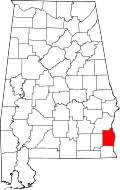 | |
| Towns | ||
| Unincorporated communities | ||
| Footnotes | ‡This populated place also has portions in an adjacent county or counties | |