Hōnaunau, Hawaii
| Hōnaunau, Hawaii | |
|---|---|
| Unincorporated community | |
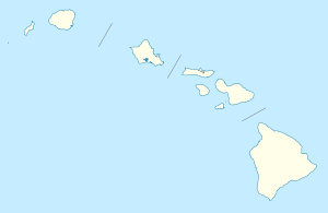 Hōnaunau, Hawaii Location within the state of Hawaii | |
| Coordinates: 19°25′37″N 155°54′47″W / 19.42694°N 155.91306°WCoordinates: 19°25′37″N 155°54′47″W / 19.42694°N 155.91306°W | |
| Country | United States |
| State | Hawaii |
| County | Hawaii |
| Elevation | 52 ft (16 m) |
| Time zone | Hawaii-Aleutian (HAST) (UTC-10) |
| • Summer (DST) | HADT (UTC-9) |
| ZIP codes | 96726 |
| GNIS feature ID | 359269 |
Hōnaunau (also spelled Honaunau) is an unincorporated community on the island of Hawaii in Hawaii County, Hawaii, United States. It lies just off Hawaii Belt Road on the opposite side of the island from Hilo, the county seat of Hawaii County.[1] Its elevation is 52 feet (16 m). Because the community has borne multiple names, the Board on Geographic Names officially designated it "Honaunau" in 1914 and 1954 before changing to the current spelling in 2000.[2] Although it is unincorporated, it has a post office, with the ZIP code 96726.[3]
Hōnaunau is part of the census-designated place of Honaunau-Napoopoo.[4] Puʻuhonua o Hōnaunau National Historical Park, formerly known as the City of Refuge, is located at Hōnaunau.[1]
References
- 1 2 Rand McNally. The Road Atlas '09. Chicago: Rand McNally, 2008, p. 30.
- ↑ U.S. Geological Survey Geographic Names Information System: Hōnaunau, Hawaii, Geographic Names Information System, 2003-09-30. Accessed 2008-04-08.
- ↑ Zip Code Lookup
- ↑ Comparison of location on atlas with this map