Gyong La
| Gyong La | |
|---|---|
 | |
| Elevation | 5,686 m (18,655 ft)[1] |
| Location | Controlled by India |
| Range | Eastern Karakoram Range |
| Coordinates | 35°10′29″N 77°04′15″E / 35.17472°N 77.07083°ECoordinates: 35°10′29″N 77°04′15″E / 35.17472°N 77.07083°E |
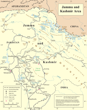
Gyong La is a mountain pass situated on Saltoro Ridge southwest of the vast Siachen Glacier, some 20 km (12 mi) directly north of map point NJ9842 which defined the end of the 1972 Line of Control between India and Pakistan. With Pakistan controlling areas just to the west along Chumik Glacier, the immediate Gyong La area has been under India's control since 1989.[2][3][4] Dozens of Indian military tents and other equipment are visible on October 2013 Google Earth imagery both 670 meters northeast and 2.7 km east-northeast of Gyong La, linked by clear trails. The former Pakistani "Naveed Top" site 3.85 km west-northwest of Gyong La is visible on September 2001 Google Earth imagery at 5,800 m (19,000 ft) elevation, higher than both the Indian positions and Gyong La.
Geopolitical issues

There was military action at Gyong La, and nearby passes Sia La and Bilafond La, starting in 1984 during Operation Meghdoot, the first military action of the Siachen Conflict, which was part of a larger conflict, the Kashmir Conflict.[5] Since 1989 Gyong La has been controlled by Indian forces, with Pakistani forces controlling areas i.e. Gyong and Chumik glaciers to the west.
In March 1989 Operation Ibex by the Indian Army attempted to seize the Pakistani post overlooking the Chumik Glacier. The operation was unsuccessful at dislodging Pakistani troops from their positions. The Indian Army under Brig. R. K. Nanavatty then launched an artillery attack on Kauser Base, the Pakistani logistical node on Chumik Glacier. The destruction of Kauser Base induced Pakistani troops to vacate their Chumik posts just west of Gyong La, and Operation Ibex concluded.[6]
In June 1999, the Indian Army under Brig. P. C. Katoch, Col. Konsam Himalaya Singh seized control of pt 5770 (Naveed Top/Cheema Top/Bilal Top) on the southern edge of the Saltoro defense line, about 4 km west of Gyong La, from Pakistan troops.[7]
See also
References
- ↑ "Gyong". Retrieved 2009-08-06.
- ↑ Hakeem, Asad; Gurmeet Kanwal; Michael Vannoni; Gaurav Rajen (2007-09-01). "Demilitarization of the Siachen Conflict Zone" (PDF). Sandia Report. Sandia National Laboratories, Albuquerque, NM, USA. Retrieved 2016-09-09. See pages 19-20 plus the map on p. 21 outlining in detail Indian control over Gyong La and Pakistani control over the heights just to the west (east of Chumik Glacier, southeast of "Naveed Top" as on the p. 21 map), contradicting the oft-copied misstatement in the old error-plagued summary at http://www.globalsecurity.org/military/world/war/siachen.htm ; The article at http://www.outlookindia.com/website/story/tryst-with-deceit/280653 describes 1984-89 Pakistani Gyong La control, and points out that since then, Pakistan has controlled both the Gyong and Chumik Glaciers to the west of Gyong La.
- ↑ "A Slow Thaw". Time. 2005-11-07. Retrieved 2010-05-04.
- ↑ Joshi, Manoj (2016-05-02). "The Shooting's Over But Siachen Will Keep Taking Its Toll". The Wire, New Delhi, India. Retrieved 2016-09-09.
- ↑ Barua, Pradeep P. (30 June 2005). The State at War in South Asia (Studies in War, Society, and the Military). University of Nebraska Press. pp. 253–255. ISBN 978-0-8032-1344-9. Retrieved 2009-08-06.
- ↑ The fight for Siachen, Brig. Javed Hassan (Retd) April 22, 2012, The Tribune (Pakistan)
- ↑ Endgame at Siachen, Maj Gen Raj Mehta, AVSM, VSM (Retd) December 2, 2014, South Asia Defence and Strategic Review