Gyál
| Gyál | |
|---|---|
 Gyál Location of Gyál | |
| Coordinates: 47°23′10″N 19°13′09″E / 47.38607°N 19.21922°ECoordinates: 47°23′10″N 19°13′09″E / 47.38607°N 19.21922°E | |
| Country |
|
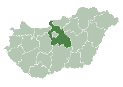
| County | Pest |
| Area | |
| • Total | 24.93 km2 (9.63 sq mi) |
| Population (2007) | |
| • Total | 22,552 |
| • Density | 873.12/km2 (2,261.4/sq mi) |
| Time zone | CET (UTC+1) |
| • Summer (DST) | CEST (UTC+2) |
| Postal code | 2360 |
| Area code(s) | 29 |
Gyál is a town in Pest county, Budapest metropolitan area, Hungary. It has a population of 22,552. In 1949 it had only 4,104 inhabitants. During the socialist era, Gyál become a garden suburb of Budapest.

Aerialphotography of Gyál
External links
- Street map (Hungarian)
This article is issued from Wikipedia - version of the 3/17/2013. The text is available under the Creative Commons Attribution/Share Alike but additional terms may apply for the media files.