Guye Peak
| Guye Peak | |
|---|---|
 | |
| Highest point | |
| Elevation | 5,168 ft (1,575 m) NGVD 29[1] |
| Prominence | 528 ft (161 m) [1] |
| Coordinates | 47°26′29″N 121°24′33″W / 47.4415013°N 121.4092611°WCoordinates: 47°26′29″N 121°24′33″W / 47.4415013°N 121.4092611°W[2] |
| Geography | |
| Location | King County, Washington, U.S. |
| Parent range | Cascade Range |
| Topo map | USGS Snoqualmie Pass |
| Climbing | |
| Easiest route | Exposed Scramble, class 3 |
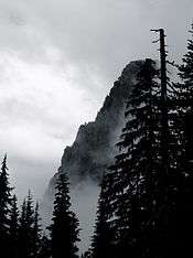
Guye Peak is a mountain in Washington State, United States. Named for Francis M. Guye, who held an iron mining claim on it in the 1880s,[3] it lies in the Alpine Lakes Wilderness area of the Cascade Range and overlooks Snoqualmie Pass from the north.
Guye Peak was first climbed on October 6, 1912 by Charles Hazlehurst, Hector Abel, Paul Dubuar, and Mary Hard.[3] The climb is 2,000 feet (600 m) from the pass valley and has mixed rock climbing and scrambling, ranging from class 3 to class 5.6. It is popular partly because of easy access from Interstate 90.
Like other hiking experiences in the region, Guye Peak has wet-climate hazards such as mossy or otherwise slippery rocks in the summer and avalanches in the winter. At least eight climbers have died in falls on Guye Peak, including the mathematician Oded Schramm in 2008.[4]
References
- 1 2 "Guye Peak, Washington". Peakbagger.com. Retrieved 2010-01-03.
- ↑ "Guye Peak". Geographic Names Information System. United States Geological Survey. Retrieved 2010-01-03.
- 1 2 Majors, Harry M. (1975). Exploring Washington. Van Winkle Publishing Co. p. 86. ISBN 978-0-918664-00-6.
- ↑ Chang, Kenneth (September 10, 2008), "Oded Schramm, 46, Mathematician, Is Dead", New York Times