Gurtnellen
| Gurtnellen | ||
|---|---|---|
 | ||
| ||
 Gurtnellen | ||
|
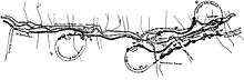
Location of Gurtnellen  | ||
| Coordinates: 46°43′N 8°37′E / 46.717°N 8.617°ECoordinates: 46°43′N 8°37′E / 46.717°N 8.617°E | ||
| Country | Switzerland | |
| Canton | Uri | |
| District | n.a. | |
| Area[1] | ||
| • Total | 83.35 km2 (32.18 sq mi) | |
| Elevation | 928 m (3,045 ft) | |
| Population (Dec 2015[2]) | ||
| • Total | 577 | |
| • Density | 6.9/km2 (18/sq mi) | |
| Postal code | 6482 | |
| SFOS number | 1209 | |
| Surrounded by | Andermatt, Erstfeld, Göschenen, Silenen, Tujetsch (GR), Wassen | |
| Website |
www SFSO statistics | |

Gurtnellen is a village and a municipality in the canton of Uri in Switzerland.
History
Gurtnellen is first mentioned in 1257 as Chuno und die Gurteneller. In 1321 it was mentioned as Gruntellon, and in 1359 as Gurtenellen.[3]
Geography
Gurtnellen has an area, as of 2006, of 83.4 km2 (32.2 sq mi). Of this area, 11.9% is used for agricultural purposes, while 25.1% is forested. Of the rest of the land, 1.3% is settled (buildings or roads) and the remainder (61.7%) is non-productive (rivers, glaciers or mountains).[4] In the 1993/97 land survey, 16.9% of the total land area was heavily forested, while 5.2% is covered in small trees and shrubbery. Of the agricultural land, 0.0% is used for farming or pastures, while 2.9% is used for orchards or vine crops and 9.0% is used for alpine pastures. Of the settled areas, 0.2% is covered with buildings, 0.1% is industrial, 0.2% is classed as special developments, and 0.8% is transportation infrastructure. Of the unproductive areas, 0.1% is unproductive standing water (ponds or lakes), 0.9% is unproductive flowing water (rivers), 39.3% is too rocky for vegetation, and 21.4% is other unproductive land.[5]
The municipality is located above the Reuss along the Gotthard rail line. It consists of the village sections of Dorf, Wiler, Intschi, Arni as well as part of the area on the left side of the Reuss near Amsteg and Silenen.
Demographics
Gurtnellen has a population (as of 31 December 2015) of 577.[6] As of 2007, 4.4% of the population was made up of foreign nationals. Over the last 10 years the population has decreased at a rate of -8.7%. Most of the population (as of 2000) speaks German (97.3%), with Portuguese being second most common ( 1.6%) and French being third ( 0.5%).[4] As of 2007 the gender distribution of the population was 50.0% male and 50.0% female.[7]
In the 2007 federal election the FDP party received 90.6% of the vote.[4]
The entire Swiss population is generally well educated. In Gurtnellen about 43.9% of the population (between age 25-64) have completed either non-mandatory upper secondary education or additional higher education (either university or a Fachhochschule).[4]
Gurtnellen has an unemployment rate of 0.65%. As of 2005, there were 82 people employed in the primary economic sector and about 38 businesses involved in this sector. 64 people are employed in the secondary sector and there are 3 businesses in this sector. 168 people are employed in the tertiary sector, with 21 businesses in this sector.[4]
The historical population is given in the following table:[3][8]
| year | population |
|---|---|
| 1837 | 615 |
| 1850 | 675 |
| 1880 | 1,541a |
| 1900 | 1,112 |
| 1920 | 1,631b |
| 1950 | 1,132 |
| 1970 | 1,048 |
| 1980 | 813 |
| 1990 | 688 |
| 2000 | 631 |
| 2005 | 640 |
| 2007 | 638 |
- ^a Population increase due to construction of the Gotthard rail tunnel.
- ^b Population increase due to bridge construction and electrification of the Gotthard rail tunnel.
References
- ↑ Arealstatistik Standard - Gemeindedaten nach 4 Hauptbereichen
- ↑ Swiss Federal Statistical Office - STAT-TAB, online database – Ständige und nichtständige Wohnbevölkerung nach institutionellen Gliederungen, Geburtsort und Staatsangehörigkeit (German) accessed 30 August 2016
- 1 2 Gurtnellen in German, French and Italian in the online Historical Dictionary of Switzerland.
- 1 2 3 4 5 Swiss Federal Statistical Office accessed 09-Sep-2009
- ↑ Canton Uri - Ground use statistics (German) accessed 8 September 2009
- ↑ Swiss Federal Statistical Office - STAT-TAB, online database – Ständige und nichtständige Wohnbevölkerung nach institutionellen Gliederungen, Geburtsort und Staatsangehörigkeit (German) accessed 30 August 2016
- ↑ Uri Population statistics (German) accessed 8 September 2009
- ↑ Uri in Numbers 2009/10 edition (German) accessed 8 September 2009
External links
- Gurtnellen in German, French and Italian in the online Historical Dictionary of Switzerland.
| Wikimedia Commons has media related to Gurtnellen. |