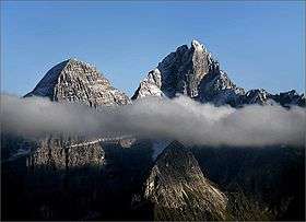
Gurktal Alps
| Gurktal Alps | |
|---|---|
 Wöllaner Nock, 2,145 m (7,037 ft) | |
| Highest point | |
| Peak | Eisenhut |
| Elevation | 2,441 m (8,009 ft) |
| Coordinates | 46°57′11″N 13°55′45″E / 46.95306°N 13.92917°E |
| Geography | |
| Country | Austria |
| States | Carinthia, Styria and Salzburg |
| Range coordinates | 46°57′N 13°56′E / 46.95°N 13.93°ECoordinates: 46°57′N 13°56′E / 46.95°N 13.93°E |
| Parent range |
Central Eastern Alps Carinthian-Styrian Alps (Noric Alps) |
The Gurktal Alps (German: Gurktaler Alpen, Slovene: Krške Alpe) are a mountain range of the Central Eastern Alps in Austria, named after the valley of the Gurk River.
Geography

The range is located between the Mur Valley in the north, separating it from the Niedere Tauern, and the Drava in the south, where it borders on the Gailtal Alps and Karavanke ranges of the Southern Limestone Alps. In the west, the Gurktal Alps reach up to the Katschberg Pass and the Ankogel Group of the Hohe Tauern range. In the east, the Neumarkt Pass in Upper Styria separates it from the adjacent Lavanttal Alps.
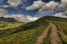
The highest peaks are located within the Nock Mountains (Nockberge, from Nock meaning "rounded hilltop", cf. Nockerl) subgroup west of Flattnitz Pass, including Mt. Eisenhut, 2,441 m (8,009 ft), in Styria. The Nationalpark Nockberge along the scenic Nockalm Road in Carinthia since 1987 is a protected landscape area (IUCN V). The Nock Mountains also stretch down to major Carinthian lakes like Millstätter See and Ossiacher See.
The Gurktal Alps together with the adjacent Lavanttal Alps in the east are also referred to as Noric Alps.
Economy
The extended mountain pastures had been the site of transhumance agriculture since ancient times. The Gurktal Alps were also a mining area for iron and silver, still magnesite deposits are exploited near Radenthein.
Today the local population mainly depends on tourism. In summer, the Carinthian lakes are a popular destination, while in winter, several ski resorts are located around Bad Kleinkirchheim, Kreischberg, Turracher Höhe, Sankt Urban, Krems, and Rennweg am Katschberg.