Gummi, Nigeria
| Gummi | |
|---|---|
| LGA and town | |
 Gummi Location in Nigeria | |
| Coordinates: 12°03′N 5°10′E / 12.050°N 5.167°ECoordinates: 12°03′N 5°10′E / 12.050°N 5.167°E | |
| Country |
|
| State | Zamfara State |
| Area | |
| • Total | 2,610 km2 (1,010 sq mi) |
| Population (2006 census) | |
| • Total | 204,539 |
| Time zone | WAT (UTC+1) |
| 3-digit postal code prefix | 891 |
| ISO 3166 code | NG.ZA.GM |
Gummi is a Local Government Area in Zamfara State, Nigeria. Its headquarters are in the town of Gummi at12°08′30″N 5°07′30″E / 12.14167°N 5.12500°E .
It has an area of 2,610 km² and a population of 204,539 at the 2006 census.
The postal code of the area is 891.[1]
Gummi was carved out of the former larger Sokoto state, which included the present Zamfara and Kebbi states. Gummi has a long history of relative peace and security.
The great majority of the people of the area are Hausa Fulani and Muslims and are predominantly farmers; the principal crop is calabash.
References
- ↑ "Post Offices- with map of LGA". NIPOST. Retrieved 2009-10-20.
State capital: Gusau | ||
| LGAs | 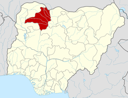 | |
This article is issued from Wikipedia - version of the 2/21/2013. The text is available under the Creative Commons Attribution/Share Alike but additional terms may apply for the media files.