Guignicourt-sur-Vence
| Guignicourt-sur-Vence | ||
|---|---|---|
|
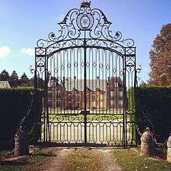
Chateau of Guignicourt | ||
| ||
 Guignicourt-sur-Vence | ||
|
Location within Grand Est region  Guignicourt-sur-Vence | ||
| Coordinates: 49°40′56″N 4°39′10″E / 49.6822°N 4.6528°ECoordinates: 49°40′56″N 4°39′10″E / 49.6822°N 4.6528°E | ||
| Country | France | |
| Region | Grand Est | |
| Department | Ardennes | |
| Arrondissement | Charleville-Mézières | |
| Canton | Flize | |
| Intercommunality | Crêtes Préardennaises | |
| Government | ||
| • Mayor (2008–2014) | Bernard Champenois | |
| Area1 | 9.44 km2 (3.64 sq mi) | |
| Population (2008)2 | 299 | |
| • Density | 32/km2 (82/sq mi) | |
| Time zone | CET (UTC+1) | |
| • Summer (DST) | CEST (UTC+2) | |
| INSEE/Postal code | 08203 / 08430 | |
|
1 French Land Register data, which excludes lakes, ponds, glaciers > 1 km² (0.386 sq mi or 247 acres) and river estuaries. 2 Population without double counting: residents of multiple communes (e.g., students and military personnel) only counted once. | ||

Guignicourt-sur-Vence is a commune in the Ardennes department in northern France.
Population
| Historical population | ||
|---|---|---|
| Year | Pop. | ±% |
| 1962 | 242 | — |
| 1968 | 269 | +11.2% |
| 1975 | 267 | −0.7% |
| 1982 | 257 | −3.7% |
| 1990 | 313 | +21.8% |
| 1999 | 317 | +1.3% |
| 2008 | 299 | −5.7% |
Sights
- Arboretum de Guignicourt-sur-Vence
- Guignicourt castle, belonging to the princely family of Merode.
See also
References
| Wikimedia Commons has media related to Guignicourt-sur-Vence. |
This article is issued from Wikipedia - version of the 1/16/2016. The text is available under the Creative Commons Attribution/Share Alike but additional terms may apply for the media files.