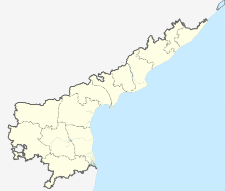
Gudur, Nellore district
| Gudur గూడూరు | |
|---|---|
| Town | |
 Gudur Location in Andhra Pradesh, India | |
| Coordinates: 14°08′50″N 79°50′52″E / 14.14733°N 79.84771°ECoordinates: 14°08′50″N 79°50′52″E / 14.14733°N 79.84771°E | |
| Country | India |
| State | Andhra Pradesh |
| Area[1] | |
| • Total | 9.42 km2 (3.64 sq mi) |
| Population (2015)[2] | |
| • Total | 107,325 |
| • Density | 11,000/km2 (30,000/sq mi) |
| Languages | |
| • Official | Telugu |
| Time zone | IST (UTC+5:30) |
| PIN | 524 101 |
| Telephone code | +91–8624 |
| Vehicle registration | AP–26 |
| Sex ratio | 1:1(approx) ♂/♀ |
| Website | Gudur Municipality |
Gudur is a town in Nellore district of the Indian state of Andhra Pradesh. It is a municipality and the headquarters of Gudur mandal and Gudur revenue division.[3][4]
Demographics
As of 2011 census of India, the town had a population of 60,625. The total population constitute, 29,786 males, 30,839 females and 5,672 children, in the age group of 0–6 years. The average literacy rate stands at 74.06% with 44,901 literates, slightly higher than the national average of 73.00%.[5]
Geography
Climate
The climate here is tropical. The summers here have a good deal of rainfall, while the winters have very little. This location is classified as Aw by Köppen and Geiger. In Gudur, the average annual temperature is 29.2 °C. About 1025 mm of precipitation falls annually.[6]
Economy
Gudur's economy depends on agriculture, mica, lemons, and aquaculture. The mica belt around Gudur is considered the 2nd largest in the country. The mica deposits are located in a 1000sq.km. area covering Gudur, Sydapuram, Rapur & Atmakur mandals of the Nellore district. Muscovite, quartz, feldspar and vermiculite type of mica are found around this area.
Transport
National Highway 16 passes through the town, which connects Kolkata and Chennai. The Andhra Pradesh State Road Transport Corporation operates bus services from Gudur bus station.[7] Gudur Junction is a major railway junction, which connects Howrah-Chennai main line and Renigunta branch line. It is classified as an A–category station and recognised as an Adarsh station in the Vijayawada railway division of South Central Railway zone.[8] The nearest airports are Chennai International Airport and Tirupati Airport.
Governance
Civic administration
The municipality was established in the year 1954. Its jurisdictional area covers 9.14 km2 (3.53 sq mi).[1] The urban agglomeration of the town consists of Gudur municipality and its out growths. The out growths include Guduru (east), Guduru (west), Chennuru–II, Nellatur, Chillakur.[9]
Politics
Gudur is a part of Gudur (SC) (Assembly constituency) for Andhra Pradesh Legislative Assembly. Pasim Sunil Kumar is the present MLA of the constituency from TDP (recently joined back). In April 8th 2016 he is joined in TDP without resign from YSR Congress Party. [10] It is also a part of Tirupati (Lok Sabha constituency).[11][12] P.Gopinath is the municipal commissioner of the city[13] and Ponaka Devasena is the Municipal Chair Person.
Education
The primary and secondary school education is imparted by government, aided and private schools, under the School Education Department of the state.[14][15] The medium of instruction followed by different schools are English, Telugu.
See also
References
- 1 2 "Basic Information of Municipality". Municipal Administration & Urban Development Department. Government of Andhra Pradesh. Retrieved 17 June 2015.
- ↑ "Census 2011". The Registrar General & Census Commissioner, India. Retrieved 20 August 2014.
- ↑ "Revenue Setup". Official website of Sri Potti Sri Ramulu Nellore District. National Informatics Centre. Retrieved 10 June 2015.
- ↑ "Guntur District Mandals" (PDF). Census of India. p. 234. Retrieved 19 January 2015.
- ↑ "Chapter–3 (Literates and Literacy rate)" (PDF). Registrar General and Census Commissioner of India. Retrieved 20 August 2014.
- ↑ "Climate: Gudur - Temperature, Climate graph, Climate table - Climate-Data.org". en.climate-data.org. Retrieved 2016-11-10.
- ↑ "Bus Stations in Districts". Andhra Pradesh State Road Transport Corporation. Retrieved 9 March 2016.
- ↑ "Vijayawada Division – a profile" (PDF). Indian Railways. Retrieved 2013-02-13.
- ↑ "List of Urban Agglomerations and their Constituent Units - 2011" (PDF). Census of India. p. 24. Retrieved 14 August 2015.
- ↑ "MLA". AP State Portal. Retrieved 13 October 2014.
- ↑ "MP (Lok Sabha)". Government of AP. Retrieved 4 May 2015.
- ↑ "Delimitation of Parliamentary and Assembly Constituencies Order, 2008" (pdf). Election Commission of India. p. 22,31. Retrieved 11 October 2014.
- ↑ "Municipality commissioner". Commissioner & Director of Municipal Administration. Government of Andhra Pradesh. Retrieved 8 May 2015.
- ↑ "School Eduvation Department" (PDF). School Education Department, Government of Andhra Pradesh. Retrieved 7 November 2016.
- ↑ "The Department of School Education - Official AP State Government Portal | AP State Portal". www.ap.gov.in. Retrieved 7 November 2016.
