Guadalupe Victoria, Puebla
| Guadalupe Victoria Municipality | |
|---|---|
| Municipality | |
|
Guadalupe Victoria Municipality | |
| Coordinates: 19°17′00″N 97°20′00″W / 19.28333°N 97.33333°WCoordinates: 19°17′00″N 97°20′00″W / 19.28333°N 97.33333°W | |
| Country |
|
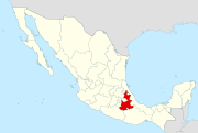
| State | Puebla |
| Area | |
| • Total | 239.83 km2 (92.60 sq mi) |
| Population (2005)Municipality | |
| • Total | 15,041 |
| Time zone | CST (UTC-6) |
| Website | (Spanish) |
Guadalupe Victoria Municipality is a municipality in the Mexican state of Puebla. According to the National Statistics Institute (INEGI), it had a population of 15,041 inhabitants in the 2005 census. Its total area is 239.83 km². It is named after Guadalupe Victoria, the first president of Mexico.
Its geographical coordinates are 19° 17′ North, and 97° 20′ West. Its average altitude is 2,440 metres (8,005 ft) above sea level. Its highest elevation is the rhyolitic twin dome volcano Las Derrumbadas (3480 m).
External links
http://www.e-local.gob.mx/work/templates/enciclo/puebla/Mpios/21067a.htm
This article is issued from Wikipedia - version of the 11/3/2016. The text is available under the Creative Commons Attribution/Share Alike but additional terms may apply for the media files.