Groveville, New Jersey
| Groveville, New Jersey | |
|---|---|
| Census-designated place | |
|
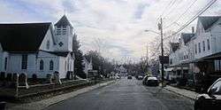
Along Church Street (CR 609) | |
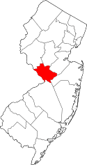
 Location in Mercer County and the state of New Jersey. | |
| Coordinates: 40°10′12″N 74°39′05″W / 40.170048°N 74.651278°WCoordinates: 40°10′12″N 74°39′05″W / 40.170048°N 74.651278°W | |
| Country |
|
| State |
|
| County | Mercer |
| Township | Hamilton |
| Area[1] | |
| • Total | 2.160 sq mi (5.593 km2) |
| • Land | 2.123 sq mi (5.498 km2) |
| • Water | 0.037 sq mi (0.096 km2) 1.71% |
| Elevation[2] | 49 ft (15 m) |
| Population (2010 Census)[3] | |
| • Total | 2,945 |
| • Density | 1,387.4/sq mi (535.7/km2) |
| Time zone | Eastern (EST) (UTC-5) |
| • Summer (DST) | Eastern (EDT) (UTC-4) |
| ZIP code | 08620 - Trenton[4] |
| FIPS code | 3428620[1][5] |
| GNIS feature ID | 02583996[1][6] |
Groveville is an unincorporated community and census-designated place (CDP) located within Hamilton Township, in Mercer County, New Jersey, United States.[7] As of the 2010 United States Census, the CDP's population was 2,945.[3] Before the 2010 Census, the area was part of the Yardville-Groville CDP, which was split into two CDPs, Yardville and Groveville.[8]
Geography
According to the United States Census Bureau, the CDP had a total area of 2.160 square miles (5.593 km2), including 2.123 square miles (5.498 km2) of land and 0.037 square miles (0.096 km2) of water (1.71%).[1][9]
Demographics
2010 Census
At the 2010 United States Census, there were 2,945 people, 1,046 households, and 809.6 families residing in the CDP. The population density was 1,387.4 per square mile (535.7/km2). There were 1,093 housing units at an average density of 514.9 per square mile (198.8/km2). The racial makeup of the CDP was 84.58% (2,491) White, 8.59% (253) Black or African American, 0.10% (3) Native American, 3.29% (97) Asian, 0.00% (0) Pacific Islander, 1.73% (51) from other races, and 1.70% (50) from two or more races. Hispanics or Latinos of any race were 7.13% (210) of the population.[3]
There were 1,046 households, of which 38.6% had children under the age of 18 living with them, 59.3% were married couples living together, 12.9% had a female householder with no husband present, and 22.6% were non-families. 18.2% of all households were made up of individuals, and 6.1% had someone living alone who was 65 years of age or older. The average household size was 2.81 and the average family size was 3.21.[3]
In the CDP, 25.1% of the population were under the age of 18, 9.7% from 18 to 24, 24.1% from 25 to 44, 30.7% from 45 to 64, and 10.4% who were 65 years of age or older. The median age was 39.6 years. For every 100 females there were 94.6 males. For every 100 females age 18 and over, there were 92.7 males.[3]
References
- 1 2 3 4 Gazetteer of New Jersey Places, United States Census Bureau. Accessed July 21, 2016.
- ↑ U.S. Geological Survey Geographic Names Information System: Groveville Census Designated Place, Geographic Names Information System. Accessed November 20, 2012.
- 1 2 3 4 5 DP-1 - Profile of General Population and Housing Characteristics: 2010 Demographic Profile Data for Groveville CDP, New Jersey, United States Census Bureau. Accessed November 20, 2012.
- ↑ Look Up a ZIP Code for Groveville, NJ, United States Postal Service. Accessed November 20, 2012.
- ↑ American FactFinder, United States Census Bureau. Accessed September 4, 2014.
- ↑ US Board on Geographic Names, United States Geological Survey. Accessed September 4, 2014.
- ↑ Locality Search, State of New Jersey. Accessed April 18, 2015.
- ↑ New Jersey: 2010 - Population and Housing Unit Counts - 2010 Census of Population and Housing (CPH-2-32), P. III-4. United States Census Bureau, August 2012. Accessed November 20, 2012. "Mercer County—Name Changes: Robbinsville township name changed from Washington; New CDPs: Groveville (formed from part of deleted Yardville-Groveville CDP and additional area), Hamilton Square (formed from part of deleted Mercerville-Hamilton Square CDP and additional area), Mercerville (formed from part of deleted Mercerville-Hamilton Square CDP), Robbinsville, and Yardville (formed from part of deleted Yardville-Groveville CDP and additional area)"
- ↑ US Gazetteer files: 2010, 2000, and 1990, United States Census Bureau. Accessed September 4, 2014.