Groton Township, Erie County, Ohio
| Groton Township, Erie County, Ohio | |
|---|---|
| Township | |
|
Fields and woods in northern Groton Township | |
 Location of Groton Township in Erie County | |
| Coordinates: 41°19′41″N 82°46′47″W / 41.32806°N 82.77972°WCoordinates: 41°19′41″N 82°46′47″W / 41.32806°N 82.77972°W | |
| Country | United States |
| State | Ohio |
| County | Erie |
| Area | |
| • Total | 25.8 sq mi (66.7 km2) |
| • Land | 25.6 sq mi (66.3 km2) |
| • Water | 0.2 sq mi (0.4 km2) |
| Elevation[1] | 722 ft (220 m) |
| Population (2010) | |
| • Total | 1,427 |
| • Density | 56/sq mi (21.5/km2) |
| Time zone | Eastern (EST) (UTC-5) |
| • Summer (DST) | EDT (UTC-4) |
| FIPS code | 39-32578[2] |
| GNIS feature ID | 1086063[1] |

Groton Township is one of the nine townships of Erie County, Ohio, United States. It is part of the Sandusky, Ohio metropolitan statistical area. As of the 2010 census the population was 1,427.[3]
Geography
Located in the southwestern corner of the county, it borders the following townships:
- Margaretta Township - north
- Perkins Township - northeast corner
- Oxford Township - east
- Ridgefield Township, Huron County - southeast corner
- Lyme Township, Huron County - south
- York Township, Sandusky County - west
- Townsend Township, Sandusky County - northwest
A small corner of the city of Bellevue is located in southwestern Groton Township.
Name and history
It is the only Groton Township statewide.[4]
Government
The township is governed by a three-member board of trustees, who are elected in November of odd-numbered years to a four-year term beginning on the following January 1. Two are elected in the year after the presidential election and one is elected in the year before it. There is also an elected township fiscal officer,[5] who serves a four-year term beginning on April 1 of the year after the election, which is held in November of the year before the presidential election. Vacancies in the fiscal officership or on the board of trustees are filled by the remaining trustees.
References
- 1 2 "US Board on Geographic Names". United States Geological Survey. 2007-10-25. Retrieved 2008-01-31.
- ↑ "American FactFinder". United States Census Bureau. Retrieved 2008-01-31.
- ↑ "Geographic Identifiers: 2010 Demographic Profile Data (G001): Groton township, Erie County, Ohio". U.S. Census Bureau, American Factfinder. Retrieved March 9, 2016.
- ↑ "Detailed map of Ohio" (PDF). United States Census Bureau. 2000. Retrieved 2007-02-16.
- ↑ §503.24, §505.01, and §507.01 of the Ohio Revised Code. Accessed 4/30/2009.
External links
Municipalities and communities of Erie County, Ohio, United States | ||
|---|---|---|
| Cities | 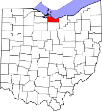 | |
| Villages | ||
| Townships | ||
| CDPs | ||
| Unincorporated communities | ||
| Footnotes | ‡This populated place also has portions in an adjacent county or counties | |