Grodzisk Mazowiecki County
| Grodzisk Mazowiecki County Powiat grodziski | ||
|---|---|---|
| County | ||
| ||
 Location within the voivodeship | ||
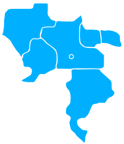 Division into gminas | ||
| Coordinates (Grodzisk Mazowiecki): 52°6′32″N 20°37′30″E / 52.10889°N 20.62500°ECoordinates: 52°6′32″N 20°37′30″E / 52.10889°N 20.62500°E | ||
| Country |
| |
| Voivodeship | Masovian | |
| Seat | Grodzisk Mazowiecki | |
| Gminas |
Total 6 (incl. 2 urban)
| |
| Area | ||
| • Total | 366.87 km2 (141.65 sq mi) | |
| Population (2006) | ||
| • Total | 78,208 | |
| • Density | 210/km2 (550/sq mi) | |
| • Urban | 46,539 | |
| • Rural | 31,669 | |
| Car plates | WGM | |
| Website | http://www.powiat-grodziski.pl | |
Grodzisk Mazowiecki County (Polish: powiat grodziski) is a unit of territorial administration and local government (powiat) in Masovian Voivodeship, east-central Poland. It came into being on 1 January 1999, as a result of the Polish local government reforms passed in 1998. Its administrative seat and largest town is Grodzisk Mazowiecki, which lies 29 kilometres (18 mi) south-west of Warsaw. The county also contains the towns of Milanówek, lying 2 km (1 mi) north-east of Grodzisk Mazowiecki, and Podkowa Leśna, 8 km (5 mi) east of Grodzisk Mazowiecki.
The county covers an area of 366.87 square kilometres (141.6 sq mi). As of 2006 its total population is 78,208, out of which the population of Grodzisk Mazowiecki is 27,055, that of Milanówek is 15,660, that of Podkowa Leśna is 3,824, and the rural population is 31,669.
Neighbouring counties
Grodzisk Mazowiecki County is bordered by Warsaw West County to the north-east, Pruszków County and Piaseczno County to the east, Grójec County to the south, and Żyrardów County and Sochaczew County to the west.
Administrative division
The county is subdivided into six gminas (two urban, one urban-rural and three rural). These are listed in the following table, in descending order of population.
| Gmina | Type | Area (km²) |
Population (2006) |
Seat |
| Gmina Grodzisk Mazowiecki | urban-rural | 107.0 | 37,432 | Grodzisk Mazowiecki |
| Milanówek | urban | 13.5 | 15,660 | |
| Gmina Jaktorów | rural | 55.2 | 10,090 | Jaktorów |
| Gmina Żabia Wola | rural | 105.6 | 6,347 | Żabia Wola |
| Gmina Baranów | rural | 75.4 | 4,855 | Baranów |
| Podkowa Leśna | urban | 10.1 | 3,824 | |
References
| Seat |  | |
|---|---|---|
| Urban gminas | ||
| Urban-rural gmina | ||
| Rural gminas | ||
