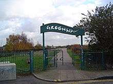
Greenway, London
The Greenway is a footpath and cycleway in east London (mainly London Borough of Newham) constructed on the embankment containing the Northern Outfall Sewer.[1] The western end of the path is at Wick Lane in Old Ford (Bow) but The Greenway actually continues a bit further north to Victoria Park, London alongside Wick Lane underpass on pavement under the East Cross Route in London Borough of Tower Hamlets and it crosses Stratford, West Ham and Plaistow. The eastern end is at Royal Docks Road in Beckton. It was known locally as Sewerbank before a full renovation in the mid-nineties. Work has taken place to resurface and renovate the route - especially around the Olympic Park.
Until late 2014 a section of the Greenway was closed between Marshgate Lane and Stratford High Street due to Crossrail building work.[2] The section of the Greenway between the Hackney Cut canal and the observation, information, education, cycle hire and cafe building (called View Tube) near Pudding Mill Lane DLR station was closed until December 2012 due to Olympic legacy building work. The section between West Ham station and Stratford High Street was closed in 2015. The Greenway reopened in April 2016. Newham Council is also lighting part of the Greenway as part of a pilot project. If successful, lighting will be extended to the whole Greenway. Finally, negotiations are underway for 24-hour access.[3][4]
The Capital Ring Walk (section 14) follows the Greenway for most of its distance.
Start and end points
- 51°32′15″N 0°01′29″W / 51.53750°N 0.02472°W The route's start point
- 51°31′08″N 0°04′21″E / 51.51889°N 0.07250°E The route's end point
See also
References
- ↑ Shepheard, Paul. "East London's Greenway by Adams & Sutherland Architects". BDOnline. Retrieved 28 March 2016.
- ↑ 'Temporary Closure of the Greenway', Crossrail
- ↑ "Closing The Greenway – Pt 2 – Building a network". Easternism - urban rumblings. Retrieved 28 March 2016.
- ↑ "Cycling - information and advice". London Borough of Newham. Retrieved 28 March 2016.
| Royal parks | 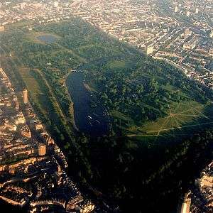 | |
|---|---|---|
| Large urban parks |
| |
| Country parks | ||
| Commons | ||
| Marshes & Wetlands | ||
| Woodland | ||
| House gardens |
| |
| Entry-fee charging | ||
| Community gardens |
| |
External links
- The Northern Outfall Sewer east of Stratford
- Olympic walkway comp won by Adams and Sutherland
- The Road to 2012
- View Tube
- Route plot (.kml)
- https://www.newham.gov.uk/Pages/ServiceChild/Cycling-routes-consultation.aspx
Coordinates: 51°31′19″N 0°02′58″E / 51.52194°N 0.04944°E