Greene Township, Pike County, Pennsylvania
| Greene Township | |
| Township | |
 La Anna United Methodist Church in the township | |
| Country | United States |
|---|---|
| State | Pennsylvania |
| County | Pike |
| Elevation | 1,709 ft (520.9 m) |
| Coordinates | 41°14′59″N 75°19′59″W / 41.24972°N 75.33306°WCoordinates: 41°14′59″N 75°19′59″W / 41.24972°N 75.33306°W |
| Area | 62.1 sq mi (160.8 km2) |
| - land | 59.9 sq mi (155 km2) |
| - water | 2.2 sq mi (6 km2), 3.54% |
| Population | 3,956 (2010) |
| Density | 66/sq mi (25.5/km2) |
| Timezone | EST (UTC-5) |
| - summer (DST) | EDT (UTC-4) |
| Area code | 570 |
 Location in Pike County and the state of Pennsylvania. | |
 Location of Pennsylvania in the United States | |
Greene Township is a township in Pike County, Pennsylvania, United States. The population was 3,956 at the 2010 census.
Geography
According to the United States Census Bureau, the township has a total area of 62.1 square miles (161 km2), of which, 59.9 square miles (155 km2) of it is land and 2.2 square miles (5.7 km2) of it (3.54%) is water.
Communities
The following villages are located in Greene Township:
Demographics
As of the census[6] of 2010, there were 3,956 people, 1,629 households, and 1,153 families residing in the township. The population density was 66 people per square mile (25.5/km²). There were 3,242 housing units at an average density of 54.1/sq mi (21.1/km²). The racial makeup of the township was 96% White, 1% African American, 0.4% Native American, 0.3% Asian, 0.7% from other races, and 1.6% from two or more races. Hispanic or Latino of any race were 3.9% of the population.
There were 1,629 households out of which 25.7% had children under the age of 18 living with them, 54.8% were married couples living together, 10.9% had a female householder with no husband present, and 29.2% were non-families. 24.6% of all households were made up of individuals and 10.7% had someone living alone who was 65 years of age or older. The average household size was 2.42 and the average family size was 2.85.
In the township the population was spread out with 21.4% under the age of 18, 59.6% from 18 to 64, and 19% who were 65 years of age or older. The median age was 46.4 years.
The median income for a household in the township was $33,962, and the median income for a family was $41,571. Males had a median income of $39,417 versus $22,931 for females. The per capita income for the township was $20,253. About 5.0% of families and 8.7% of the population were below the poverty line, including 7.3% of those under age 18 and 5.9% of those age 65 or over.
References
- 1 2 3 4 5 6 "GREENE: SECOND CLASS TOWNSHIP MAP" (PDF). Pennsylvania Department of Transportation. Commonwealth of Pennsylvania. 6 November 1998. Retrieved 15 December 2014.
- ↑ "Hemlock Grove". Geographic Names Information System. United States Geological Survey. 2 August 1979. Retrieved 15 December 2014.
- ↑ "La Anna". Geographic Names Information System. United States Geological Survey. 2 August 1979. Retrieved 15 December 2014.
- ↑ "Ledgedale". Geographic Names Information System. United States Geological Survey. 2 August 1979. Retrieved 15 December 2014.
- ↑ "Roemersville". Geographic Names Information System. United States Geological Survey. 2 August 1979. Retrieved 15 December 2014.
- ↑ "American FactFinder". United States Census Bureau. Retrieved 2011-05-14.
External links
Municipalities and communities of Pike County, Pennsylvania, United States | ||
|---|---|---|
| Boroughs | 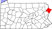 | |
| Townships | ||
| CDPs | ||
| Unincorporated communities | ||
| Footnotes | ‡This populated place also has portions in an adjacent county or counties. | |