Great Palm Island
| Native name: <span class="nickname" ">Bwgcolman | |
|---|---|
| Geography | |
| Coordinates | 18°44′11″S 146°37′04″E / 18.73633°S 146.617699°E |
| Archipelago | Greater Palm group |
| Area | 55 km2 (21 sq mi) |
| Highest elevation | 548 m (1,798 ft) |
| Administration | |
| Demographics | |
| Population | 1,984 (2006 census) |
Great Palm Island, also known as Palm Island, or by the Aboriginal name Bwgcolman;[1] is a tropical island with a resident community of about 2,000 people. The island has an area of 55 km2 (21 sq mi). The official area figure of 70.9 km² refers to Aboriginal Shire of Palm Island and includes nine smaller islands. It is in Queensland, Australia, off the east coast of northern Queensland, situated 65 kilometres (40 mi) northwest of Townsville, and 800 kilometres (500 mi) north of the Tropic of Capricorn. The Australia Post lists the local post office as Palm Island, QLD. It is the main island of the Greater Palm group, and consists of small bays, sandy beaches and steep forested mountains rising to a peak of 548 metres (1,798 ft).[2] The ocean surrounding the island is part of the Great Barrier Reef Marine Park where extraction and fishing are regulated.
Human habitation

Great Palm Island is often termed a classic "tropical paradise" given its natural endowments, but it has had a troubled history since the European settlement of Australia.[3] The local government is the Palm Island Aboriginal Shire Council, which has jurisdiction over ten of the islands in the Greater Palm group.[4] While the Australia Post lists the local post office as Palm Island, QLD, there is no formal name for the settled areas of the island.[5] Other names include or have included the Mission, Palm Island settlement, Palm Island Aborigines settlement, and Palm Island Community.
There are three settled areas. One settled area is at the southeast end of the airport. To the north on the west coast is a settled area with a pier and the government center—some locals call this the Mission.[5] Beyond a mountain to the north is a third settled area by Coolgaree Bay.
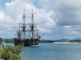
The islands in the area were named the "Palm Isles" by explorer James Cook in 1770 as he sailed up the eastern coast of Australia on his first voyage.[6] It is estimated that the population of the island at the time of Cook's visit was about 200 Manbarra people.[7][8] The name "Great Palm Island" for the island goes back at least as far as 1866.[9] Beginning in 1918 the island was used by the Queensland Government as a settlement for Aborigines.[10] As an end result, the island population is now a mix of Manbarra and other Aboriginal peoples, with few jobs and a shortage of housing.[5]
Geography

At 55 km2 (21 sq mi), Great Palm Island is nearly twice the size of Norfolk Island and of a similar size to Magnetic Island.[5][11] According to a Queensland government source, there are sixteen islands that make up the Greater Palm group.[12] The majority of these are micro-islands. Major islands within the Greater Palm group are Great Palm Island, Fantome Island, and Orpheus Island. Notable neighbouring islands outside the Greater Palm group include Rattlesnake Island, which is used for Air Force bombing practice, and Magnetic Island, an island suburb of Townsville.[12]
Topographically, the island is dominated in the center by the tallest peak Mount Bentley, and in the southwest by Mount Lindsay. The surface is covered by rainforest, with small areas cleared for settlements and the airstrip. The Palm Island airstrip nestles along a narrow low flatland at the southwest corner of the island.[13] Surrounding waters include Challenger (Gowyarowa) Bay, which is between Great Palm Island, Curacoa (Noogoo), and Fantome Islands.[14] Local bays of the island are listed in Table 1.
| Bay | Notes |
|---|---|
| Cannon (Numbullabudgee) | by Wallaby (Nullaree) Point |
| Bullumbooroo | |
| North East (Othoorakool) | |
| Barber | within view of Barber (Boodthean) Island |
| Mundy | |
| Butler (Surrumbroo) | at the southeast end of the airport |
| Pencil | |
| Casement | at the northwest end of the airport |
| Regina | |
| Coolgood | has a pier, a settled area is inland |
| Coolgaree Bay | a settled area is inland |
There are three man-made bodies of fresh water on the island, including Bamboo Dam near the peak of Mount Bentley, and Solomon Dam.[13]
Natural environment and cyclones

Great Palm Island is rich in natural beauty, both fauna and flora, however it has been impacted by human settlement and introduced species. Great Palm Island's rich volcanic soil supports tropical flora such as mangroves, eucalypt forest, rainforests, hoop pine, mango, banana, pawpaw (papaya) and wild plum trees.[3][11] The surrounding bays have a diverse marine fauna including coral trout, crayfish and coral reefs.[3] There has been significant dumping of car bodies and other environmental pollution on the island.
There are hundreds of brumbies on the island, they are considered to be community-owned.[15] Many of them have been tortured, starved to death, and beaten by local teenagers. A local Aboriginal, Wayne Coolwell, has been quoted as saying "I don't like to accuse my own people of things like this, but it's self-evident...and cruelty is cruelty, and when you see the photographs and you hear the stories, there's obviously a real problem on that island."[16]

As an island in northern Queensland, Great Palm Island is vulnerable to cyclones. In March 1997 Cyclone Justin passed over the Cairns coastline and remained near Great Palm Island causing a great deal of flash flooding. Peaking at Category 4, at landfall it was a Category 2 cyclone; it caused significant damage in the Cairns region during its relatively long, 3½ week life.
In April 2000 category 2 Cyclone Tessi passed directly over Great Palm Island, but caused little damage.[17]
The surrounding ocean
Great Palm Island is inside the Great Barrier Reef in the Coral Sea in the vicinity of Halifax Bay. The ocean surrounding the island is in the Great Barrier Reef Marine Park.[18] Under the zoning authority of the Great Barrier Reef Marine Park Authority (GBRMPA), the ocean on the western side of the island is in a Habitat Protection zone. The rest of the island is surrounded by a Conservation zone. These zones exist to protect the park from excess extraction and fishing.[19]
There are seven named reefs adjacent to the island, known as nearshore fringing reefs. The designation of the seven varies; for example, the seventh of the seven is called Great Palm Reef (No 7), 18-054G, Great Palm Reef G, and Reef 18054G.[20] As designated by the GBRMPA, Great Palm Island has the number 18-054, and the seven reefs are a, b, c, d, e, f, and g.[18]
Greater Palm group
Great Palm Island is the largest of the islands in the Greater Palm group. While originally named the "Palm Isles", many names are currently used for the group. Great Palm Island group and Palm Islands are two such names. The nearest island to the group is Pandora Reef.[18]
In Table 2 are the ten islands of the Greater Palm group in the jurisdiction of the Palm Island Aboriginal Shire Council. Two islands and one rock are in the Hinchinbrook jurisdiction. These are Orpheus (Goolboddi), Pelorus (Yanooa) or North Palm Island, and Albino Rock. Albino Rock is part of Orpheus Island National Park.[18][21] The remaining rocks owned by the Commonwealth are in the jurisdiction of the GBRMPA.[18] Table 3 lists additional micro-islands.[18]
| Island name | Aboriginal name | Group size | Brushfire risk | GBRMPA reef designation |
|---|---|---|---|---|
| Curra-cao or Curacoa Island | Noogoo or Inoogoo | major | medium | 18-052 |
| Fantome Island | Eumilli | major | medium | 18-053 |
| Great Palm Island or Palm Island | Bwgcolman | major | high | 18-054 |
| Havannah Island | major | medium | 18-065 | |
| Brisk Island | Culgarool | micro-island | medium | shared with Falcon Island |
| Eclipse Island | Garoogubbee | micro-island | not rated | 18-058 |
| Esk Island | Soopun | micro-island | not rated | 18-059 |
| Barber Island | Boodthean | micro-island | not rated | 18-061 |
| Falcon Island | Carbooroo | micro-island | not rated | 18-062 |
| Fly Island | micro-island | not rated | 18-064 |
| Island name | GBRMPA reef designation |
|---|---|
| Paluma Rock | 18-056 |
| Albino Rock (AKA White Rock) | 18-057 |
| Dido Rock | 18-060 |
| Chilcott Rocks | 18-063 |
| Hayman Rock.[9] | <none> |
Aerial photos and maps
Google (2011-01-04). "satellite view of Great Palm Island" (Map). Google Maps. Google. Retrieved 2011-01-04.
Google (2011-01-04). "Great Palm Island Reef (No 1)" (Map). Google Maps. Google. Retrieved 2011-01-04.
Google (2011-01-04). "Great Palm Island Reef (No 7)" (Map). Google Maps. Google. Retrieved 2011-01-04.
Footnotes
- 1 2 Bindloss, Joseph (2002) page 330
- ↑ Palm Island - The Place, Reconciliation and Social Justice Library (1996) Auslii website. Retrieved 23 January 2007.
- 1 2 3 Koch, Tony; MATP (4 December 2004). "Bitter Paradise". The Weekend Australian. sec. Features, p. 19.
- ↑ "Local Government Directory - Palm Island Aboriginal Shire Council". Queensland Department of Local Government & Planning. Retrieved 2007-01-25.
- 1 2 3 4 Townsend, Ian (29 April 2007). "Privatising Palm Island (Part One)". Background Briefing. Australian Broadcasting Corporation. Retrieved 2011-01-05.
- ↑ "Captain James Cook Biography". self-published extract by the author of Robson, J., Captain Cook's World, Random House, New Zealand, 2000. Retrieved 2011-01-04.
- ↑ Administrative Appeals Tribunal (15 March 2004). "The Manbarra People and Great Barrier Reef Marine Park Authority and Anor [2004] AATA 268". Australasian Legal Information Institute (AustLII). Retrieved 2007-01-30.
- ↑ Wilson, Paul (1985) pages 49-50
- 1 2 "Shipping Intelligence, Notice to Mariners". South Australian Register (Adelaide, SA : 1839-1900). Adelaide, SA: National Library of Australia. 25 May 1866. p. 2. Retrieved 7 January 2011.
- ↑ Meade, Kevin (26 January 1998). "Cathy Freeman, island of despair's patron saint". The Australian. p. 4.
- 1 2 Walker, Jamie (17 March 2007). "skin deep". Qweekend (Courier Mail). pp. 16–21.
- 1 2 "QLD, Gov Palm Island Communities".
- 1 2 3 4 NNTT map QI2005_005.jpg
- 1 2 "Indigenous Land Use Agreement: QI2003/052 Coolagree Sponge Farm ILUA". Retrieved 2011-01-03.
- ↑ Wilson, Ashleigh Wilson (29 July 2003). "RSPCA baulks on horse cruelty". The Australian. p. 3.
- ↑ "Palm Island animal abuse". The World Today. Australian Broadcasting Corporation. 28 July 2003. Retrieved 2007-02-02.
- ↑ Taylor, John (3 April 2000). "Tropical Cyclone Tessi batters Townsville". AM (ABC Radio). ABC. Retrieved 2007-01-31.
- 1 2 3 4 5 6 7 "Great Barrier Reef Marine Park Authority, Detailed maps, MPZ8 - Townsville (3.2 Mb)". Australian Government, Great Barrier Reef Marine Park Authority. 24 April 2006. Retrieved 2011-01-04.
- ↑ "Interpreting Zones". Australian Government, Great Barrier Reef Marine Park Authority. Retrieved 2011-01-04.
- ↑ "Great Palm Island Extension, Density, and Calcification Data for 1872 to 1985". NOAA Coral Reef Conservation Program, World Data Center for Paleoclimatology, Boulder, Colorado. March 2001. Retrieved 2011-01-04.
- ↑ "Proposal to alter the boundary of Palm Island, creating new localities of Orpheus Island and Pelorus Island, map QPN1144". Queensland Government, Department of Environment and Resource Management ; not found November 2014. Archived from the original on 10 April 2011. Retrieved 15 January 2011.
- ↑ "Bushfire Risk Analysis for Palm Island Aboriginal Shire Council" (PDF). Queensland Government, Department of Community Safety. Retrieved 2011-01-04.
References
- Bindloss, Joseph (2002). Queensland. Lonely Planet. ISBN 0-86442-712-3.
- "Indigenous Land Use Agreement: Reservoir Ridge Subdivision C (Map QI2005/005)". National Native Title Tribunal. Retrieved 2011-01-03.