Grand Isle County, Vermont
| Grand Isle County, Vermont | |
|---|---|
 Grand Isle County Courthouse in North Hero | |
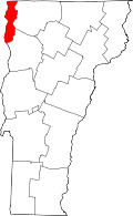 Location in the U.S. state of Vermont | |
 Vermont's location in the U.S. | |
| Founded | 1805 |
| Shire Town | North Hero |
| Largest town | Grand Isle |
| Area | |
| • Total | 195 sq mi (505 km2) |
| • Land | 82 sq mi (212 km2) |
| • Water | 113 sq mi (293 km2), 58% |
| Population (est.) | |
| • (2015) | 6,861 |
| • Density | 35.8/sq mi (14/km²) |
| Congressional district | At-large |
| Time zone | Eastern: UTC-5/-4 |
Grand Isle County is a county located in the state of Vermont, in the United States. As of the 2010 census, the population was 6,970,[1] making it the second-least populous county in Vermont. Its shire town (county seat) is the municipality of North Hero.[2] The county was created in 1802 and organized in 1805.[3][4]
Grand Isle County is part of the Burlington metropolitan area. The county does not have a high school; students choose from a number of high schools in neighboring counties.
History
Grand Isle County is one of several Vermont counties created from land ceded by the state of New York on January 15, 1777 when Vermont declared itself to be a distinct state from New York.[5][6][7] The land originally was contested by Massachusetts, New Hampshire, New France and New Netherland, but it remained undelineated until July 20, 1764 when King George III established the boundary between New Hampshire and New York along the west bank of the Connecticut River, north of Massachusetts and south of the parallel of 45 degrees north latitude. New York assigned the land gained to Albany County.[8][9] On March 12, 1772 Albany County was partitioned to create Charlotte County,[10] and this situation remained until Vermont's independence from New York and Britain, which, however, did not end the contest.
On September 3, 1783, as a result of the signing of the Treaty of Paris, the Revolutionary War ended with Great Britain recognizing the independence of the United States. Vermont's border with Quebec was established at 45 degrees north latitude,[11][12] which explains why this county has no dry-land connection to the rest of the United States.
Massachusetts did not formally withdraw its claim to the region, first made in 1629, until December 16, 1786.[13] New York, still not satisfied with the relinquishment of its land to Vermont, asked the U.S. Congress to arbitrate the matter. Congress ruled against New York on March 7, 1788.[14]
Subsequently, when Vermont petitioned for statehood, Congress ordered a joint commission to settle the border between New York and Vermont. This commission ruled prior to Vermont's admission, which took place on March 4, 1791, but a small change they permitted has never been acted upon.[15][16][17] Grand Isle County was created in 1802 from parts of Franklin and Chittenden Counties.[4]
In the late nineteenth century the Rutland Railroad ran service from northern New York State by the Canada–US border, along the west side of Vermont to Rutland, Vermont and further south to Chatham, New York. From 1899 a series of causeways provided continuous train service north-south through the Lake Champlain islands, making a direct connection to Burlington. The last service from Alburgh was in 1948.[18]
Geography
According to the U.S. Census Bureau, the county has a total area of 195 square miles (510 km2), of which 82 square miles (210 km2) is land and 113 square miles (290 km2) (58%) is water.[19] It has the highest proportion of water coverage of any county in the state. It is the smallest county in Vermont by area, and the second-smallest by population (behind Essex County). Four of its five towns (North Hero, South Hero, Grand Isle and Isle La Motte) are situated entirely on islands in Lake Champlain, while Alburgh is on a peninsula (an exclave known as the Alburgh Tongue) extending south into the lake from Quebec .
Adjacent counties
- Franklin County – east
- Chittenden County – southeast
- Clinton County, New York – west
- Le Haut-Richelieu Regional County Municipality, Quebec – north
Demographics
| Historical population | |||
|---|---|---|---|
| Census | Pop. | %± | |
| 1810 | 3,445 | — | |
| 1820 | 3,527 | 2.4% | |
| 1830 | 3,696 | 4.8% | |
| 1840 | 3,883 | 5.1% | |
| 1850 | 4,145 | 6.7% | |
| 1860 | 4,276 | 3.2% | |
| 1870 | 4,082 | −4.5% | |
| 1880 | 4,124 | 1.0% | |
| 1890 | 3,843 | −6.8% | |
| 1900 | 4,462 | 16.1% | |
| 1910 | 3,761 | −15.7% | |
| 1920 | 3,784 | 0.6% | |
| 1930 | 3,944 | 4.2% | |
| 1940 | 3,802 | −3.6% | |
| 1950 | 3,406 | −10.4% | |
| 1960 | 2,927 | −14.1% | |
| 1970 | 3,574 | 22.1% | |
| 1980 | 4,613 | 29.1% | |
| 1990 | 5,318 | 15.3% | |
| 2000 | 6,901 | 29.8% | |
| 2010 | 6,970 | 1.0% | |
| Est. 2015 | 6,861 | [20] | −1.6% |
| U.S. Decennial Census[21] 1790–1960[22] 1900–1990[23] 1990–2000[24] 2010–2014[1] | |||
2000 census
As of the census[25] of 2000, there were 6,901 people, 2,761 households, and 1,954 families residing in the county. The population density was 84 people per square mile (32/km²). There were 4,663 housing units at an average density of 56 per square mile (22/km²). The racial makeup of the county was 97.41% White, 0.14% Black or African American, 0.87% Native American, 0.23% Asian, 0.04% Pacific Islander, 0.03% from other races, and 1.28% from two or more races. 0.42% of the population were Hispanic or Latino of any race. 18.8% were of French, 14.6% French Canadian, 14.3% English, 10.6% American, 8.9% Irish and 7.4% German ancestry according to Census 2000. 95.0% spoke English and 3.8% French as their first language.
There were 2,761 households out of which 31.20% had children under the age of 18 living with them, 60.10% were married couples living together, 7.10% had a female householder with no husband present, and 29.20% were non-families. 22.20% of all households were made up of individuals and 8.20% had someone living alone who was 65 years of age or older. The average household size was 2.50 and the average family size was 2.93.
In the county, the population was spread out with 24.80% under the age of 18, 5.60% from 18 to 24, 28.70% from 25 to 44, 28.50% from 45 to 64, and 12.30% who were 65 years of age or older. The median age was 40 years. For every 100 females there were 99.90 males. For every 100 females age 18 and over, there were 97.90 males.
The median income for a household in the county was $43,033, and the median income for a family was $48,878. Males had a median income of $35,539 versus $26,278 for females. The per capita income for the county was $22,207. About 5.90% of families and 7.60% of the population were below the poverty line, including 9.20% of those under age 18 and 7.90% of those age 65 or over.
2010 census
As of the 2010 United States Census, there were 6,970 people, 2,902 households, and 2,027 families residing in the county.[26] The population density was 85.2 inhabitants per square mile (32.9/km2). There were 5,048 housing units at an average density of 61.7 per square mile (23.8/km2).[27] The racial makeup of the county was 95.3% white, 0.9% American Indian, 0.4% black or African American, 0.3% Asian, 0.1% Pacific islander, 0.3% from other races, and 2.8% from two or more races. Those of Hispanic or Latino origin made up 1.1% of the population.[26] In terms of ancestry, 18.0% were English, 14.2% were Irish, 10.6% were French Canadian, 10.3% were German, 10.3% were American, and 6.9% were Scottish.[28]
Of the 2,902 households, 28.4% had children under the age of 18 living with them, 56.2% were married couples living together, 8.6% had a female householder with no husband present, 30.2% were non-families, and 22.5% of all households were made up of individuals. The average household size was 2.40 and the average family size was 2.79. The median age was 45.5 years.[26]
The median income for a household in the county was $57,436 and the median income for a family was $66,686. Males had a median income of $46,569 versus $36,514 for females. The per capita income for the county was $30,499. About 6.1% of families and 6.4% of the population were below the poverty line, including 9.9% of those under age 18 and 3.7% of those age 65 or over.[29]
Politics
| Year | Democrat | Republican |
|---|---|---|
| 2016 | 51.0% 2,094 | 36.2% 1,487 |
| 2012 | 62.1% 2,531 | 36.1% 1,471 |
| 2008 | 63.1% 2,694 | 34.9% 1,490 |
| 2004 | 55.1% 2,246 | 43.0% 1,754 |
| 2000 | 50.4% 1,835 | 42.6% 1,550 |
In the 2004 U.S. Presidential Election, Grand Isle County chose John Kerry over George W. Bush by 12 points, with Kerry carrying all six municipalities.[31]
In 2008, Barack Obama carried the county by a 28.2% margin over John McCain, with Obama winning by 37% statewide.[32]
Communities
Towns
- Alburgh
- Grand Isle
- Isle La Motte
- North Hero (shire town)
- South Hero
Village
See also
- List of counties in Vermont
- List of towns in Vermont
- National Register of Historic Places listings in Grand Isle County, Vermont
References
- 1 2 "State & County QuickFacts". United States Census Bureau. Retrieved December 30, 2013.
- ↑ "Find a County". National Association of Counties. Retrieved 2011-06-07.
- ↑ "Vermont: Individual County Chronologies". Vermont Atlas of Historical County Boundaries. The Newberry Library. 2008. Retrieved June 30, 2015.
- 1 2 Aldrich, Lewis Cass (1891). History of Franklin and Grand Isle counties, Vermont. Syracuse, NY: D. Mason & Co. Retrieved June 30, 2015.
- ↑ Slade, William, Jr., comp. Vermont State Papers: Being a collection of Records and Documents Connected with the Assumption and Establishment of Government by the People of Vermont, Together with the Journal of the Council of Safety, the First Constitution, the Early Journals of the General Assembly, and the Laws from the Year 1779 to 1786, Inclusive. Middlebury, 1823. pp. 70–73.
- ↑ Van Zandt, Franklin K. Boundaries of the United States and the Several States. Geological Survey Professional Paper 909. Washington, DC; Government Printing Office, 1976. The Standard Compilation for its subject. P. 64.
- ↑ Williamson, Chilton. Vermont in Quandary: 1763–1825. Growth of Vermont series, Number 4.Montperler: Vermont Historical Series, 1949. PP. 82–84; map facing 95, 100–102, 112–113.
- ↑ Slade, William, Jr., comp. Vermont State Papers: Being a collection of Records and Documents Connected with the Assumption and Establishment of Government by the People of Vermont, Together with the Journal of the Council of Safety, the First Constitution, the Early Journals of the General Assembly, and the Laws from the Year 1779 to 1786, Inclusive. Middlebury, 1823. pp. 13–19.
- ↑ Van Zandt, Franklin K. Boundaries of the United States and the Several States. Geological Survey Professional Paper 909. Washington, DC; Government Printing Office, 1976. The Standard Compilation for its subject. P. 63.
- ↑ New York Colonial Laws, Chapter 1534; Section 5; Paragraph 321)
- ↑ Van Zandt, Franklin K. Boundaries of the United States and the Several States. Geological Survey Professional Paper 909. Washington, DC; Government Printing Office, 1976. The Standard Compilation for its subject. P. 12.
- ↑ Parry, Clive, ed. Consolidated Treaty Series. 231 Volumes. Dobbs Ferry, New York; Oceana Publications, 1969–1981. Volume 48; pp. 481; 487; 491–492.
- ↑ Van Zandt, Franklin K. Boundaries of the United States and the Several States. Geological Survey Professional Paper 909. Washington, DC; Government Printing Office, 1976. The Standard Compilation for its subject. P. 75.
- ↑ New York Laws, 1788, 11th Session, Chapter 63, pp. 746–747.
- ↑ United States. Statutes at Large of the United States of America, 1789–1873. volume 1, Chapter 7 (1791); Page 191.
- ↑ Slade, William, Jr., comp. Vermont State Papers: Being a collection of Records and Documents Connected with the Assumption and Establishment of Government by the People of Vermont, Together with the Journal of the Council of Safety, the First Constitution, the Early Journals of the General Assembly, and the Laws from the Year 1779 to 1786, Inclusive. Middlebury, 1823. P. 193.
- ↑ Thorne, Kathryn Ford, Compiler & Long, John H., Editor: New York Atlas of Historical County Boundaries; The Newbury Library; 1993.
- ↑ "Rutland Railroad" http://www.r2parks.net/RUT.html
- ↑ "2010 Census Gazetteer Files". United States Census Bureau. August 22, 2012. Retrieved June 29, 2015.
- ↑ "County Totals Dataset: Population, Population Change and Estimated Components of Population Change: April 1, 2010 to July 1, 2015". Retrieved July 2, 2016.
- ↑ "U.S. Decennial Census". United States Census Bureau. Retrieved June 29, 2015.
- ↑ "Historical Census Browser". University of Virginia Library. Retrieved June 29, 2015.
- ↑ Forstall, Richard L., ed. (March 27, 1995). "Population of Counties by Decennial Census: 1900 to 1990". United States Census Bureau. Retrieved June 29, 2015.
- ↑ "Census 2000 PHC-T-4. Ranking Tables for Counties: 1990 and 2000" (PDF). United States Census Bureau. April 2, 2001. Retrieved June 29, 2015.
- ↑ "American FactFinder". United States Census Bureau. Retrieved 2011-05-14.
- 1 2 3 "DP-1 Profile of General Population and Housing Characteristics: 2010 Demographic Profile Data". United States Census Bureau. Retrieved 2016-01-20.
- ↑ "Population, Housing Units, Area, and Density: 2010 - County". United States Census Bureau. Retrieved 2016-01-20.
- ↑ "DP02 SELECTED SOCIAL CHARACTERISTICS IN THE UNITED STATES – 2006-2010 American Community Survey 5-Year Estimates". United States Census Bureau. Retrieved 2016-01-20.
- ↑ "DP03 SELECTED ECONOMIC CHARACTERISTICS – 2006-2010 American Community Survey 5-Year Estimates". United States Census Bureau. Retrieved 2016-01-20.
- ↑ "Dave Leip's Atlas of U.S. Presidential Elections". Retrieved 2016-11-19.
- ↑ http://www.uselectionatlas.org/RESULTS/statesub.php?year=2004&fips=50013&f=0&off=0&elect=0
- ↑ http://www.uselectionatlas.org/RESULTS/state.php?year=2008&fips=50&f=0&off=0&elect=0
External links
| Wikimedia Commons has media related to Grand Isle County, Vermont. |
-
 Grand Isle County travel guide from Wikivoyage
 - National Register of Historic Places listing for Grand Isle Co., Vermont
- Grand Isle County Sheriff's Office
 |
Le Haut-Richelieu Regional County Municipality, Quebec, Canada | | ||
| Clinton County, New York | |
Franklin County | ||
| ||||
| | ||||
| Chittenden County |
Municipalities and communities of Grand Isle County, Vermont, United States | ||
|---|---|---|
| Towns | | |
| Village | ||
Montpelier (capital) | |
| Regions | |
| Counties | |
| Cities | |
| Towns (pop. >5000) | |
| Festivals | |
| Topics |
|
| Society |
|
Coordinates: 44°48′N 73°17′W / 44.80°N 73.29°W