Grade II* listed buildings in the City of Carlisle

There are over 20,000 Grade II* listed buildings in England. This page is a list of these buildings in the City of Carlisle in Cumbria.

List of buildings

Name Location Type Completed [note 1]Date designated Grid ref.[note 2]
Geo-coordinates
Entry number [note 3]Image
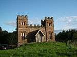
Brackenhill Tower Arthuret House 1586 1 April 1957 NY4458169480
55°01′00″N 2°52′06″W / 55.016764°N 2.868229°W / 55.016764; -2.868229 (Brackenhill Tower)
1087521
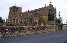
Church of St Michael Arthuret Church 1609 1 April 1957 NY3793967666
54°59′59″N 2°58′18″W / 54.99968°N 2.971692°W / 54.99968; -2.971692 (Church of St Michael)
1087523
Churchyard cross west of Church of St Michael Arthuret Cross 12th or 13th century 15 June 1984 NY3788967655
54°59′58″N 2°58′21″W / 54.999575°N 2.972472°W / 54.999575; -2.972472 (Churchyard cross west of Church of St Michael)
1087524
Coop House, north-west of Netherby Hall Netherby, Arthuret Estate cottage Mid-18th century 15 June 1984 NY3866971474
55°02′02″N 2°57′40″W / 55.033985°N 2.961101°W / 55.033985; -2.961101 (Coop House, north-west of Netherby Hall)
1204976
Netherby Hall Netherby, Arthuret House 15th century and later 1 April 1957 NY3966371613
55°02′07″N 2°56′44″W / 55.035356°N 2.945581°W / 55.035356; -2.945581 (Netherby Hall)
1204948
Church of St Mary Beaumont Church Late 12th century 1 May 1957 NY3481159298
54°55′27″N 3°01′07″W / 54.924095°N 3.018677°W / 54.924095; -3.018677 (Church of St Mary)
1335624
Church of St Cuthbert Bewcastle Church 13th century 1 April 1957 NY5654274561
55°03′49″N 2°40′55″W / 55.063611°N 2.681963°W / 55.063611; -2.681963 (Church of St Cuthbert)
1087539
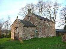
Church of St Martin (Brampton Old Church) Brampton Church 12th century 1 April 1951 NY5101461557
54°56′47″N 2°45′59″W / 54.94625°N 2.766276°W / 54.94625; -2.766276 (Church of St Martin (Brampton Old Church))
1087645
Four Gables Brampton House 1879 13 February 1963 NY5434661632
54°56′50″N 2°42′51″W / 54.94724°N 2.714275°W / 54.94724; -2.714275 (Four Gables)
1087651
Moot Hall Brampton, Brampton Moot hall 1817 1 April 1957 NY5307461088
54°56′32″N 2°44′03″W / 54.942234°N 2.734043°W / 54.942234; -2.734043 (Moot Hall)
1137330
Old Church Farmhouse Brampton Farmhouse Early 14th century 16 January 1984 NY5102861598
54°56′48″N 2°45′58″W / 54.946619°N 2.766065°W / 54.946619; -2.766065 (Old Church Farmhouse)
1087646
Barn adjoining to north of Moorhouse Farmhouse Moorhouse, Burgh By Sands Barn Late 17th century 22 November 1973 NY3298856826
54°54′06″N 3°02′48″W / 54.901643°N 3.04654°W / 54.901643; -3.04654 (Barn adjoining to north of Moorhouse Farmhouse)
1335655
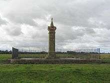
King Edward I Monument Sandsfield, Burgh By Sands Commemorative monument 1685 1 April 1957 NY3257460920
54°56′18″N 3°03′14″W / 54.938371°N 3.053956°W / 54.938371; -3.053956 (King Edward I Monument)
1087463
Lamonby Farmhouse and adjoining barn Burgh By Sands Farmhouse Mid-17th century 19 September 1984 NY3270859170
54°55′22″N 3°03′05″W / 54.922666°N 3.051455°W / 54.922666; -3.051455 (Lamonby Farmhouse and adjoining barn)
1039874
Church of St Michael and All Angels Dalston Church 12th century 19 September 1984 NY3694450162
54°50′32″N 2°59′00″W / 54.842283°N 2.9834°W / 54.842283; -2.9834 (Church of St Michael and All Angels)
1374153
Dalston Hall Dalston Fortified house 1433–99 19 September 1984 NY3765851566
54°51′18″N 2°58′21″W / 54.854987°N 2.972587°W / 54.854987; -2.972587 (Dalston Hall)
1087441
Dovecote to north-east of Rose Castle Dalston Dovecote 1700 19 September 1984 NY3712546348
54°48′29″N 2°58′47″W / 54.808036°N 2.979752°W / 54.808036; -2.979752 (Dovecote to north-east of Rose Castle)
1087474
Hawkesdale Hall Hawkesdale, Dalston House Late 17th century 19 September 1984 NY3746447710
54°49′13″N 2°58′29″W / 54.820316°N 2.974773°W / 54.820316; -2.974773 (Hawkesdale Hall)
1335649
Church of St Mary Magdalen Hayton Church 1780 1 April 1957 NY5078657692
54°54′41″N 2°46′09″W / 54.911498°N 2.769172°W / 54.911498; -2.769172 (Church of St Mary Magdalen)
1335622
Gelt Bridge Hayton Railway bridge 1832–35 1 April 1957 NY5324757324
54°54′30″N 2°43′51″W / 54.908429°N 2.730729°W / 54.908429; -2.730729 (Gelt Bridge)
1335587
Church of St Kentigern Irthington Church 12th century 1 April 1957 NY4987661634
54°56′49″N 2°47′03″W / 54.946828°N 2.784054°W / 54.946828; -2.784054 (Church of St Kentigern)
1335584
Church of St Andrew Kirkandrews on Esk Church 1776 1 April 1957 NY3911071982
55°02′19″N 2°57′16″W / 55.038604°N 2.954311°W / 55.038604; -2.954311 (Church of St Andrew)
1087506
Kirkandrews Tower Kirkandrews on Esk House 18th century 1 April 1957 NY3891471928
55°02′17″N 2°57′27″W / 55.038095°N 2.957366°W / 55.038095; -2.957366 (Kirkandrews Tower)
1205396
Riddings Junction Viaduct Kirkandrews on Esk Railway viaduct 1864 31 October 1996 NY4107275585
55°04′16″N 2°55′28″W / 55.071213°N 2.924361°W / 55.071213; -2.924361 (Riddings Junction Viaduct)
1268307
Church of St Cuthbert Kirklinton Church 1845 16 January 1984 NY4326667038
54°59′41″N 2°53′18″W / 54.994674°N 2.888306°W / 54.994674; -2.888306 (Church of St Cuthbert)
1335549
Tarn House Midgeholme Farmhouse Late 15th century 1 April 1957 NY6061358486
54°55′10″N 2°36′58″W / 54.919507°N 2.61601°W / 54.919507; -2.61601 (Tarn House)
1051067
Stonegarthside Hall Nicholforest House 1682 15 June 1984 NY4803981860
55°07′42″N 2°48′59″W / 55.128374°N 2.816418°W / 55.128374; -2.816418 (Stonegarthside Hall)
1335605
Church of St Giles Great Orton, Orton Church 12th century 19 September 1984 NY3289454287
54°52′44″N 3°02′51″W / 54.878818°N 3.047413°W / 54.878818; -3.047413 (Church of St Giles)
1087417
Castletown Rockcliffe House 1811 1 April 1957 NY3480662098
54°56′57″N 3°01′10″W / 54.949252°N 3.019392°W / 54.949252; -3.019392 (Castletown)
1087596
Church of St Mary Rockcliffe Church 1848 1 April 1957 NY3588061643
54°56′43″N 3°00′09″W / 54.945303°N 3.002525°W / 54.945303; -3.002525 (Church of St Mary)
1087594
Church of St Mary Wreay, St. Cuthbert Without Church 1840–42 1 April 1957 NY4352548921
54°49′55″N 2°52′51″W / 54.831919°N 2.880696°W / 54.831919; -2.880696 (Church of St Mary)
1087758
Newbiggin Hall St. Cuthbert Without House Early 19th century 14 September 1954 NY4330350858
54°50′57″N 2°53′04″W / 54.849298°N 2.884532°W / 54.849298; -2.884532 (Newbiggin Hall)
1087720
Brunstock House Brunstock, Stanwix Rural House 1827–33 22 September 1983 NY4188159419
54°55′34″N 2°54′30″W / 54.926057°N 2.908405°W / 54.926057; -2.908405 (Brunstock House)
1087726
Drawdykes Castle Drawdykes, Stanwix Rural Farmhouse c.1764 1 April 1957 NY4190758549
54°55′06″N 2°54′28″W / 54.918243°N 2.907823°W / 54.918243; -2.907823 (Drawdykes Castle)
1087728
Linstock Castle Linstock, Stanwix Rural Farmhouse, former tower house 12th or early 13th century 1 April 1957 NY4289758484
54°55′04″N 2°53′33″W / 54.917773°N 2.892367°W / 54.917773; -2.892367 (Linstock Castle)
1119608
Temon and adjoining outbuilding Upper Denton Farmhouse Late 17th century 1 April 1957 NY6169963825
54°58′03″N 2°35′59″W / 54.967566°N 2.599782°W / 54.967566; -2.599782 (Temon and adjoining outbuilding)
1087520
Upper Denton Church Upper Denton Church Early 12th century 1 April 1957 NY6156065514
54°58′58″N 2°36′08″W / 54.982732°N 2.602181°W / 54.982732; -2.602181 (Upper Denton Church)
1087564
Church of St Mary Walton Church 1869–70 16 January 1984 NY5221664490
54°58′22″N 2°44′53″W / 54.972721°N 2.748003°W / 54.972721; -2.748003 (Church of St Mary)
1157868
Church of St Leonard Warwick, Wetheral Church 12th century 1 April 1957 NY4660056800
54°54′11″N 2°50′03″W / 54.903052°N 2.834293°W / 54.903052; -2.834293 (Church of St Leonard)
1121876
Church of St Mary and St Wilfred Warwick Bridge, Wetheral Roman Catholic church 1841 1 April 1957 NY4752156817
54°54′12″N 2°49′12″W / 54.903303°N 2.819934°W / 54.903303; -2.819934 (Church of St Mary and St Wilfred)
1111897
Church of the Holy Trinity and St Constantine Wetheral Church 13th century 1 April 1957 NY4681754401
54°52′53″N 2°49′50″W / 54.88152°N 2.830465°W / 54.88152; -2.830465 (Church of the Holy Trinity and St Constantine)
1087692
Holme Eden Abbey Warwick Bridge, Wetheral Abbey 1833–37 3 September 1973 NY4717957001
54°54′18″N 2°49′31″W / 54.90492°N 2.825301°W / 54.90492; -2.825301 (Holme Eden Abbey)
1087685
Statue of Polyphemus, Corby Castle Great Corby, Wetheral Statue Early 18th century 22 September 1983 NY4706654039
54°52′42″N 2°49′35″W / 54.878294°N 2.826518°W / 54.878294; -2.826518 (Statue of Polyphemus, Corby Castle)
1087675
The Corn Mill Warwick Bridge, Wetheral Watermill 1839 22 September 1983 NY4741656908
54°54′15″N 2°49′18″W / 54.90411°N 2.821588°W / 54.90411; -2.821588 (The Corn Mill)
1087686
Bishop's Registry The Abbey Library 1699 1 June 1949 NY3981255942
54°53′40″N 2°56′24″W / 54.89457°N 2.939956°W / 54.89457; -2.939956 (Bishop's Registry)
1197012
Church of St Cuthbert with St Mary Carlisle Church 1778 1 June 1949 NY3996455843
54°53′37″N 2°56′15″W / 54.893699°N 2.937565°W / 54.893699; -2.937565 (Church of St Cuthbert with St Mary)
1218565
Citadel Station Carlisle Railway station 1847–48 13 November 1972 NY4023655540
54°53′28″N 2°56′00″W / 54.891009°N 2.933262°W / 54.891009; -2.933262 (Citadel Station)
1196969
Coledale Hall Carlisle House 1810 1 June 1949 NY3836755999
54°53′42″N 2°57′45″W / 54.894906°N 2.962494°W / 54.894906; -2.962494 (Coledale Hall)
1196932
Congregational Church Carlisle Church 1842–43 22 March 1974 NY4026755752
54°53′35″N 2°55′58″W / 54.892918°N 2.932823°W / 54.892918; -2.932823 (Congregational Church)
1196929
Cumberland Infirmary Carlisle Hospital 1830–32 13 November 1972 NY3883156084
54°53′45″N 2°57′19″W / 54.895727°N 2.955279°W / 54.895727; -2.955279 (Cumberland Infirmary)
1218237
Dixons Chimney at Shaddon Mill Carlisle Cotton mill 1836 13 November 1972 NY3946255644
54°53′31″N 2°56′43″W / 54.89185°N 2.945349°W / 54.89185; -2.945349 (Dixons Chimney at Shaddon Mill)
1196919
Monument to Peter Nicholson, north-west of cemetery chapel Carlisle Commemorative monument 1855–56 11 April 1994 NY3911354377
54°52′50″N 2°57′02″W / 54.880424°N 2.950521°W / 54.880424; -2.950521 (Monument to Peter Nicholson, north-west of cemetery chapel)
1218406
Mulcaster House Carlisle House Late 18th century 1 June 1949 NY4022057035
54°54′16″N 2°56′02″W / 54.90444°N 2.933823°W / 54.90444; -2.933823 (Mulcaster House)
1196986
No 32 Abbey Street and railings to front Carlisle House c.1817 1 June 1949 NY3974255984
54°53′42″N 2°56′28″W / 54.894939°N 2.941056°W / 54.894939; -2.941056 (No 32 Abbey Street and railings to front)
1293020
Nos 26, 28 and 30 Castle Street and railings to front Carlisle Apartment 1823 1 June 1949 NY3981956047
54°53′44″N 2°56′24″W / 54.895515°N 2.939869°W / 54.895515; -2.939869 (Nos 26, 28 and 30 Castle Street and railings to front)
1355058
Petteril Bank [now Cumbria Archives] Carlisle House 1829 11 April 1994 NY4160153628
54°52′26″N 2°54′42″W / 54.873991°N 2.911597°W / 54.873991; -2.911597 (Petteril Bank [now Cumbria Archives)]
1297373
Shaddon Mill Carlisle Cotton mill 1835–36 1 June 1949 NY3951455628
54°53′30″N 2°56′40″W / 54.891713°N 2.944535°W / 54.891713; -2.944535 (Shaddon Mill)
1297383
Trustee Savings (now Lloyds) Bank and attached railings Carlisle Bank 1874 1 June 1949 NY4026355779
54°53′35″N 2°55′58″W / 54.89316°N 2.932891°W / 54.89316; -2.932891 (Trustee Savings (now Lloyds) Bank and attached railings)
1196930
18 Fisher Street Carlisle House Late 18th century 1 June 1949 49°46′01″N 7°33′26″W / 49.766806°N 7.55716°W / 49.766806; -7.55716 (18 Fisher Street) 1196951
26 Abbey Street Carlisle House Late 18th century 1 June 1949 NY3972255993
54°53′42″N 2°56′29″W / 54.895018°N 2.941369°W / 54.895018; -2.941369 (26 Abbey Street)
1196981
2 The Abbey Carlisle Clergy house Late 17th century 1 June 1949 NY3982955956
54°53′41″N 2°56′23″W / 54.894698°N 2.939694°W / 54.894698; -2.939694 (2 The Abbey)
1197013
21 Castle Street Carlisle House Late 18th century 1 June 1949 NY3988356044
54°53′44″N 2°56′20″W / 54.895495°N 2.93887°W / 54.895495; -2.93887 (21 Castle Street)
1297358
24 Abbey Street Carlisle House Early 19th century 1 June 1949 NY3971656002
54°53′42″N 2°56′29″W / 54.895098°N 2.941465°W / 54.895098; -2.941465 (24 Abbey Street)
1297355
19, 21 and 23 Victoria Place Carlisle House Early 1870s 13 November 1972 NY4035356001
54°53′43″N 2°55′54″W / 54.895165°N 2.931534°W / 54.895165; -2.931534 (19, 21 and 23 Victoria Place)
1197137
2 Albert Street Carlisle Terrace 1852–54 1 June 1949 NY4031856035
54°53′44″N 2°55′56″W / 54.895467°N 2.932087°W / 54.895467; -2.932087 (2 Albert Street)
1297274
3 and 6 The Abbey Carlisle Clergy house Late 17th century 1 June 1949 NY3994355915
54°53′40″N 2°56′16″W / 54.894343°N 2.937908°W / 54.894343; -2.937908 (3 and 6 The Abbey)
1293105
3–17 Victoria Place Carlisle Terrace Late 1840s 1 June 1949 NY4028255981
54°53′42″N 2°55′57″W / 54.894977°N 2.932637°W / 54.894977; -2.932637 (3–17 Victoria Place)
1197136
2 Victoria Place Carlisle House 1830s 13 November 1972 NY4025256022
54°53′43″N 2°55′59″W / 54.895342°N 2.933113°W / 54.895342; -2.933113 (2 Victoria Place)
1218796
1 Victoria Place Carlisle House 1830s 13 November 1972 NY4026855981
54°53′42″N 2°55′58″W / 54.894975°N 2.932855°W / 54.894975; -2.932855 (1 Victoria Place)
1196918

See also

Notes

  1. The date given is the date used by Historic England as significant for the initial building or that of an important part in the structure's description.
  2. Sometimes known as OSGB36, the grid reference is based on the British national grid reference system used by the Ordnance Survey.
  3. The "List Entry Number" is a unique number assigned to each listed building and scheduled monument by Historic England.

Media related to Grade II* listed buildings in Cumbria at Wikimedia Commons

This article is issued from Wikipedia - version of the 10/9/2016. The text is available under the Creative Commons Attribution/Share Alike but additional terms may apply for the media files.