Goudhurst
| Goudhurst | |
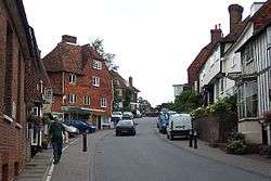 High Street, Goudhurst |
|
 Goudhurst |
|
| Population | 3,204 [1] 3,327 (2011 Census)[2] (Parish includes villages of Horden and Kilndown) |
|---|---|
| OS grid reference | TQ725375 |
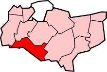
| Civil parish | Goudhurst |
| District | Tunbridge Wells |
| Shire county | Kent |
| Region | South East |
| Country | England |
| Sovereign state | United Kingdom |
| Post town | CRANBROOK |
| Postcode district | TN17 |
| Dialling code | 01580 |
| Police | Kent |
| Fire | Kent |
| Ambulance | South East Coast |
| EU Parliament | South East England |
| UK Parliament | Tunbridge Wells |
Coordinates: 51°06′40″N 0°27′49″E / 51.1112°N 0.4636°E
Goudhurst is a village in Kent on the Weald, about 12 miles (19 km) south of Maidstone. It stands on a crossroads (A262 & B2079), where there is a large village pond. It is also in the Cranbrook School catchment area.
The parish consists of three wards: Goudhurst, Kilndown and Curtisden Green. Hamlets include Bedgebury Cross, Iden Green, Stonecrouch and Winchet Hill.
Etymology
The word Goudhurst is derived from Goud Hurst, the "good hill"[3] due to the hills strategic position within the local landscape. A less plausible (but attractive) derivation is the Old English guo hyrst, meaning Battle Hill, or the wooded hill on which a battle has been fought. The name apparently commemorates a battle fought on this high ground in Saxon times. The spelling has evolved over the centuries: Gmthhyrste (c. 1100), Guthurst or Guhthersts (c. 1200), Gudhersts (1232), Guthhurste (1278), Goutherst (1316), Goodherst (1610), then the current-day spelling.[4]
History
The village was one of those involved in the Wealden iron industry; it was a centre for the growing of hops and for weaving. A group of weavers' cottages stands opposite the church.
The Battle of Goudhurst in 1747 led to the end of the Hawkhurst Gang of smugglers.[5]
The village's recent history is extremely well documented. The Goudhurst Jubilee Book (1935), Goudhurst Coronation Book (1937) and Goudhurst and Kilndown Millennium Book (2001, ISBN 0-9527822-1-9) contain detailed reminiscences, directories, historical notes, matters of local intelligence and records of celebrations starting from the 1800s and before, up to the current time. These books were printed as limited editions and are much sought after, as the authors painstakingly recorded not only the written but also the oral history of the village.
St Mary's Church
The church stands on a hill and its tower commands impressive views of the surrounding countryside. For this reason it was a major surveying point in the Anglo-French Survey (1784–1790) to measure the precise distance and relationship between the Paris Observatory and the Royal Greenwich Observatory, supervised by General William Roy.
St Mary's church was founded in 1170 by Robert de Crevecour.[6] The church has been altered and restored many times over the centuries. Until 1637 it had a tall spire which was destroyed by lightning in that year. In 1638 three London masons rebuilt the west tower.[7] During the Victorian era the church was restored by the architects William Slater and Richard Carpenter.[8] The church contains a remarkable painted wood and gesso effigy to Sir Alexander Culpeper (d.1599) and his wife Constance.[9]
Bedgebury
Bedgebury is one of the oldest estates in Kent: having given its name to the de Bedgebury family, it passed into the hands of the Culpeper family in 1450. When the estate was sold in 1680, a new house was built which itself became a girls' school in the 1920s (closed in the summer of 2006). In 2007 the school was purchased by the Bell Educational Trust, an educational charity. In the summer of 2007 the school reopened as the Bell Bedgebury International School, and the grounds also played host to the Bell Bedgebury Language Centre. In November 2010, the owners decided to close and sell the school.[10] – the riding school and 125 acres were sold separately and are now independent.[11] Bedgebury Pinetum is nearby. It was acquired by the Forestry Commission in 1924.
Public transport
In the past, the branch railway line from Paddock Wood had a station for the village. It was opened on 1 October 1892 and was originally named 'Hope Mill for Goudhurst and Lamberhurst' before being renamed to 'Goudhurst' on 4 September 1893, the day the final part of the line came into service – the extension to Hawkhurst via Cranbrook; physically, the station was about half a mile from the centre of Goudhurst, and somewhat further from Lamberhurst. The station was closed on 12 June 1961 because of lack of use, passenger numbers having dropped to fewer than 200 per day. The track was lifted in 1964, and in 1967 the station sites were offered for sale.
At present, the only public transport for Goudhurst are two bus routes operated by Arriva Southern Counties – the 26 to Maidstone, and the 297 which runs to Tunbridge Wells in the west and Tenterden and Ashford in the east.
Notable people
- Ernest Alfred Benians (1880–1952), academic and historian, was born in Goudhurst.
- William Beresford, 1st Viscount Beresford (1768–1856), owned the Bedgebury Estate and built Kilndown in the 1840s.
- Harry Christophers (b 1956), conductor, was born in Goudhurst.
- Leonard Benjamin Franklin (1862–1944), barrister and politician, was born in Goudhurst.
- Stephen Groombridge (1755–1832), astronomer, was born in Goudhurst.
- Daniel Horsmanden (1691–1778), judge, was born in Goudhurst.
- Stephen Law (d c. 1788), Governor of Bombay from 1739–42, lived in Goudhurst at the time of his death.
- William Howard Vincent Levett (1908–55), Kent and England cricketer, was born in Goudhurst.
- Richard Milbourne (d 1624), bishop, was vicar of Goudhurst 1611–15
- Alfred Mynn (1807–61), cricketer, was born in Goudhurst.
- William Rootes (1894–1964), founder of Rootes Group was born in Goudhurst.
- Sir James Stirling (1836–1916), jurist and Privy Councillor, lived at Finchcocks in Goudhurst from 1890 until his death
- Sir Jeffrey Gilbert ( 1674–1726 ), jurist and author, was born in Goudhurst.
Media
Newspapers
Newspapers available in Goudhurst are the free and Maidstone extra owned by KM Group and yourtunbridgewells and yourmaidstone both owned by KOS Media
Radio
The Local radio station is KMFM West Kent however KMFM Maidstone is also available.County-wide stations Heart Kent, Gold (radio) and BBC Radio Kent are available.
Climate
The absolute maximum temperature stands at 34.7 °C (94.5 °F),[12] recorded in August 1990, compared to the average annual warmest day maximum of 28.7 °C (83.7 °F).[13] In total, 11.8 days[14] should attain a temperature of 25.1 °C (77.2 °F) or above.
The absolute minimum temperature recorded was −19.2 °C (−2.6 °F) during January 1940, compared to the average annual coldest night minimum of −8.3 °C (17.1 °F).[15] In total 52.8 nights should report an air frost.
Annual rainfall averages 823.3 mm (32.41 in),[16] with over 1mm falling on 120.7[17] days.
| Climate data for Goudhurst, elevation 85m, 1971–2000 | |||||||||||||
|---|---|---|---|---|---|---|---|---|---|---|---|---|---|
| Month | Jan | Feb | Mar | Apr | May | Jun | Jul | Aug | Sep | Oct | Nov | Dec | Year |
| Record high °C (°F) | 16.8 (62.2) |
17.3 (63.1) |
22.2 (72) |
26.6 (79.9) |
29.2 (84.6) |
33.5 (92.3) |
33.3 (91.9) |
34.7 (94.5) |
27.9 (82.2) |
25.0 (77) |
17.8 (64) |
14.7 (58.5) |
34.7 (94.5) |
| Average high °C (°F) | 6.8 (44.2) |
7.1 (44.8) |
9.9 (49.8) |
12.4 (54.3) |
16.3 (61.3) |
19.0 (66.2) |
21.5 (70.7) |
21.6 (70.9) |
18.3 (64.9) |
14.2 (57.6) |
9.9 (49.8) |
7.7 (45.9) |
13.7 (56.7) |
| Average low °C (°F) | 1.4 (34.5) |
1.1 (34) |
2.6 (36.7) |
3.8 (38.8) |
6.6 (43.9) |
9.5 (49.1) |
11.7 (53.1) |
11.6 (52.9) |
9.5 (49.1) |
6.7 (44.1) |
3.6 (38.5) |
2.4 (36.3) |
5.9 (42.6) |
| Record low °C (°F) | −19.2 (−2.6) |
−13.1 (8.4) |
−9 (16) |
−5.7 (21.7) |
−3.9 (25) |
−1.7 (28.9) |
1.9 (35.4) |
2.2 (36) |
−0.1 (31.8) |
−5.2 (22.6) |
−7.6 (18.3) |
−10.6 (12.9) |
−19.2 (−2.6) |
| Average precipitation mm (inches) | 89.89 (3.539) |
54.86 (2.1598) |
61.89 (2.4366) |
53.08 (2.0898) |
50.96 (2.0063) |
56.96 (2.2425) |
48.47 (1.9083) |
51.82 (2.0402) |
72.88 (2.8693) |
99.97 (3.9358) |
88.76 (3.4945) |
93.73 (3.6902) |
823.26 (32.4118) |
| Source #1: KNMI[18] | |||||||||||||
| Source #2: Met Office for July record high[19] | |||||||||||||
Notes
- ↑ "2001 Census: Key Statistics: Parish Headcounts: Area: Goudhurst CP (Parish)". Neighbourhood Statistics. Office for National Statistics. Retrieved 10 June 2009.
- ↑ "Civil Parish population 2011". Neighbourhood Statistics. Office for Nastional Statistics. Retrieved 24 September 2016.
- ↑ http://www.etymonline.com/index.php?allowed_in_frame=0&search=goud&searchmode=none
- ↑ The Place Names of Kent, Judith Glover ISBN 0-905270-61-4; The Origin of English Place Names, P.H.Reaney ISBN 0-7100-2010-4
- ↑ Mary Waugh, Smuggling in Kent and Sussex 1700–1840 1985 ISBN 0-905392-48-5 pp 74–5
- ↑ The Nation's Favourite Churches, Andrew Barr
- ↑ Howard Colvin, A Biographical Dictionary of British Architects 1600–1840, 3rd ed. 1995, s.v. "Edmund Kinsman", "John Young".
- ↑ Historic England. "Church of St Mary, Goudhurst (1338671)". National Heritage List for England. Retrieved 20 November 2012.
- ↑ The Nation's Favourite Churches, Andrew Barr
- ↑ "Bell Bedgebury private school to close in Cranbrook". BBC News. 3 November 2010.
- ↑ http://www.bedgeburypark.com/
- ↑ "1990 Maximum". Retrieved 28 February 2011.
- ↑ "average warmest day". Retrieved 28 February 2011.
- ↑ "1971-00 >25c days". Retrieved 28 February 2011.
- ↑ "1971-00 Average annual minimum". Retrieved 28 February 2011.
- ↑ "1971-00 rainfall". Retrieved 28 February 2011.
- ↑ "1971-00 Wetdays". Retrieved 28 February 2011.
- ↑ "Climate Normals 1971–2000". KNMI. Retrieved 28 February 2011.
- ↑ "State of the UK climate 2015" (PDF). Met Office. Retrieved 26 July 2016.
Sources
- The Place Names of Kent, Judith Glover.
- The Origin of English Place Names, P. H. Reaney.
- The Dictionary of British Place Names
- Dictionary of English Place Names, A. D. Mills.
External links
| Wikimedia Commons has media related to Goudhurst. |
 |
Horsmonden | Marden | Staplehurst Curtisden Green |
|
| Lamberhurst Quarter | |
Sissinghurst | ||
| ||||
| | ||||
| Kilndown | Bedgebury Cross Flimwell |
Hartley |