Goreljek
| Goreljek | |
|---|---|
 | |
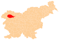
 Goreljek Location in Slovenia | |
| Coordinates: 46°19′55.57″N 13°58′29.3″E / 46.3321028°N 13.974806°ECoordinates: 46°19′55.57″N 13°58′29.3″E / 46.3321028°N 13.974806°E | |
| Country |
|
| Traditional region | Upper Carniola |
| Statistical region | Upper Carniola |
| Municipality | Bohinj |
| Area | |
| • Total | 13.5 km2 (5.2 sq mi) |
| Elevation | 1,257.9 m (4,127.0 ft) |
| Population (2015) | |
| • Total | 7 |
| • Density | 1/km2 (3/sq mi) |
| [1] | |
Goreljek (pronounced [ɡɔˈɾeːljək] or [ɡɔˈɾeːljɛk]) is a high-elevation settlement on the Pokljuka Plateau in the Municipality of Bohinj in the Upper Carniola region of Slovenia. It has less than ten residents, but there are a large number of holiday homes in Goreljek and its immediate area. The local chapel is dedicated to Saint Anthony the Hermit and was rebuilt in a modern alpine style in 1996.[2]
References
External links
- Goreljek at Geopedia
 Media related to Goreljek at Wikimedia Commons
| Settlements | Administrative centre: Bohinjska Bistrica
|  | ||||||
|---|---|---|---|---|---|---|---|---|
| Landmarks |
| |||||||
This article is issued from Wikipedia - version of the 11/19/2015. The text is available under the Creative Commons Attribution/Share Alike but additional terms may apply for the media files.