Goodwyns
| Goodwyns | |
 The Harvest Community Church on Stubs Hill |
|
 Goodwyns |
|
| OS grid reference | TQ170478 |
|---|---|
| District | Mole Valley |
| Shire county | Surrey |
| Region | South East |
| Country | England |
| Sovereign state | United Kingdom |
| Post town | Dorking |
| Postcode district | RH4 |
| Dialling code | 01306 |
| Police | Surrey |
| Fire | Surrey |
| Ambulance | South East Coast |
| EU Parliament | South East England |
| UK Parliament | Mole Valley |
Coordinates: 51°13′05″N 0°19′31″W / 51.2180°N 0.3252°W
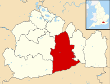
Goodwyns is a housing estate in Dorking, a market town in the Mole Valley district of Surrey, England. It is situated on a hillside site in the south of the town adjacent to North Holmwood.[1] Dorking town centre is about 1.7 miles (2.7 km) away.[2] The area was developed in the mid-1950s as a council estate on behalf of the former Dorking Urban District Council by the architects William Ryder & Associates.[1] The name recalls Goodwyns Place, a Grade II-listed country house to the north. This Arts and Crafts-style building was designed in 1901 by Hugh Thackeray Turner.[1][3]

The design of the buildings and the estate's layout were praised by architectural historians Ian Nairn and Nikolaus Pevsner, who described it as "unusually good" for a council estate.[1] The housing was developed in three parts: first, on the lowest lying land and arranged around culs-de-sac, groups of red-brick houses with rendered panelling; then blocks of red- and pale-brick flats of three and four storeys on the rising land, some with steel balconies and with a mixture of flat and sloping roofs; then two 14-storey concrete-faced tower blocks.[1][2] Completed in 1965, Wenlock Edge and Linden Lea were described as "more elegant than average" because of the layout of successive projecting and recessed sections on each face.[1] The estate retains large areas of open space and has a semi-rural character,[1][4] but there is little tree cover. The layout is approximately circular: the residential areas are bounded by two perimeter roads with other roads linking them. These streets are wide and lined with grass verges, encouraging on-street parking.[2]
Goodwyns Estate is within the Holmwoods Ward, one of 21 wards in Mole Valley district. The ward's population was 6,417 at the time of the United Kingdom Census 2011.[5] For the ward as a whole, housing tenure statistics reveal a lower proportion of owner-occupancy than in the district overall: according to the 2011 Census, 60.2% of properties were owner-occupied against 73.6% in Mole Valley as a whole.[6] On the Goodwyns estate itself, some properties are now owner-occupied and others are rented—mostly from the Mole Valley Housing Association.[4] Formed in October 2007, this housing association is part of the Circle Housing Group and is responsible for about 3,850 properties in the district.[7] The association is seeking to redevelop parts of the estate, and has submitted planning applications to build 19 more flats and three houses on various underutilised sites on the estate. Some would be available under a shared ownership scheme.[7][8]
The estate is served by the Harvest Community Church, affiliated with the Elim Pentecostal movement and the FIEC.[9] It was originally an independent Evangelical church[10] and was registered for marriages under the name Goodwyns Evangelical Free Church in July 1966.[11] Goodwyns is in the Anglican parish of North Holmwood, served by St John the Evangelist's Church.[12] St John's Church of England Community School[13] and the Dorking Rural Sure Start Children's Centre[14] are also located at Goodwyns.
Metrobus route 93 runs every 20 minutes on Mondays to Saturdays between the estate and Dorking railway station via the town centre. In the other direction, one of the three services every hour continues to Horsham via Capel; the other two terminate at Holmwood Park.[15]
References
- 1 2 3 4 5 6 7 Nairn & Pevsner 1971, p. 198.
- 1 2 3 "Goodwyns Estate, Dorking" (PDF). Project no. 0399: Design and Access Statement – Rushett Drive (Site 3). Kiran Curtis Associates Architects. September 2012. p. 5. Archived from the original on 15 July 2013. Retrieved 15 July 2013.
- ↑ Historic England. "Goodwyns Place, Tower Hill, Dorking (Grade II) (1230906)". National Heritage List for England. Retrieved 15 July 2013.
- 1 2 "Goodwyns Estate, Dorking" (PDF). Project no. 0399: Design and Access Statement – Rushett Drive (Site 3). Kiran Curtis Associates Architects. September 2012. p. 4. Archived from the original on 15 July 2013. Retrieved 15 July 2013.
- ↑ "Area: Holmwoods (Ward) – Population Density, 2011 (QS102EW)". 2011 UK Census statistics for Holmwoods Ward. Office for National Statistics. 30 January 2013. Archived from the original on 15 July 2013. Retrieved 15 July 2013.
- ↑ "Area: Holmwoods (Ward) – Tenure - Households, 2011 (QS405EW)". 2011 UK Census statistics for Holmwoods Ward. Office for National Statistics. 30 January 2013. Archived from the original on 15 July 2013. Retrieved 15 July 2013.
- 1 2 "Statement to accompany Planning Application in respect of Goodwyns Estate, Dorking, Surrey" (PDF). Mole Valley Housing Association. 2012. Archived from the original on 15 July 2013. Retrieved 15 July 2013.
- ↑ "Goodwyns Estate, Dorking" (PDF). Project no. 0399: Design and Access Statement – Rushett Drive (Site 3). Kiran Curtis Associates Architects. September 2012. pp. 7–9. Archived from the original on 15 July 2013. Retrieved 15 July 2013.
- ↑ "The Harvest Community Church is an independent Pentecostal church...". The Harvest Community Church. 2008. Archived from the original on 22 May 2013. Retrieved 15 July 2013.
- ↑ Registered in accordance with the Places of Worship Registration Act 1855 (Number in Worship Register: 70328; Name: Harvest Community Church; Address: Goodwyns Road, Dorking; Denomination: Independent Evangelicals). Retrieved 15 July 2013. (Archived version of list)
- ↑ The London Gazette: no. 44075. p. 8779. 5 August 1966. Retrieved 15 July 2013.
- ↑ "North Holmwood: St. John the Evangelist, North Holmwood". A Church Near You website. Archbishops' Council. 2010. Archived from the original on 15 July 2013. Retrieved 15 July 2013.
- ↑ "St John's C of E Community School and Nursery". St John's School. 2012. Retrieved 15 July 2013.
- ↑ "Dorking Rural Sure Start Children's Centre". Dorking Nursery School Sure Start Centre. 2008–2010. Archived from the original on 15 July 2013. Retrieved 15 July 2013.
- ↑ "93: Horsham–Warnham–Capel–Goodwyns–Dorking" (PDF). Metrobus. 1 September 2012. Archived from the original on 15 July 2013. Retrieved 15 July 2013.
Bibliography
- Nairn, Ian; Pevsner, Nikolaus (1971) [1962]. The Buildings of England: Surrey (2nd ed.). Harmondsworth: Penguin Books. ISBN 0-300-09675-5.
|
|  | ||||||||||||||||||||||||||||||
|---|---|---|---|---|---|---|---|---|---|---|---|---|---|---|---|---|---|---|---|---|---|---|---|---|---|---|---|---|---|---|---|---|
| Parks | ||||||||||||||||||||||||||||||||
| Places of worship | ||||||||||||||||||||||||||||||||
| Education | ||||||||||||||||||||||||||||||||
| Transport |
| |||||||||||||||||||||||||||||||
Buildings and structures | ||||||||||||||||||||||||||||||||
| Sport |
| |||||||||||||||||||||||||||||||
Places listed are articles notable as settlements, arranged by post town The two principal towns are emboldened | ||||||||||||||||||||||||||||||||