Gonâve Island
| Native name: <span class="nickname" ">Île de la Gonâve | |
|---|---|
|
| |
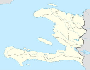 La Gonâve Gonâve Island (Haiti) | |
| Geography | |
| Location | Gulf of Gonâve |
| Coordinates | 18°50′N 73°05′W / 18.833°N 73.083°WCoordinates: 18°50′N 73°05′W / 18.833°N 73.083°W |
| Area | 743 km2 (287 sq mi) |
| Highest elevation | 778 m (2,552 ft) |
| Highest point | Morne La Pierre |
| Administration | |
|
Haiti | |
| Department | Ouest |
| Largest settlement | Anse-à-Galets (pop. 39,783) |
| Demographics | |
| Population | 79,188 (2009 Off. Est.) |
| Pop. density | 134.59 /km2 (348.59 /sq mi) |

Gonâve Island (French: Île de la Gonâve, pronounced: [ɡɔ.nav]; also La Gonâve) is an island of Haiti located west-northwest of Port-au-Prince in the Gulf of Gonâve. It is the largest of the Hispaniolan satellite islands. The island is an arrondissement (Arrondissement de La Gonâve) in the Ouest and includes the communes of Anse-à-Galets and Pointe-à-Raquette. The indigenous Taínos called the island Guanabo.[1]
Geography

Made up of mostly limestone, the reef-fringed island of Gonâve is 60 km (37 mi) long and 15 km (9.3 mi) wide and covers an area of 743 km2 (287 sq mi). The island is mostly barren and hilly with the highest point reaching 778 m (2,552 ft). The island receives between 800 mm (31 in) to 1,600 mm (63 in) of rain a year, higher elevations representing the latter figure.[2]
The barren, dry nature of the soil has long prevented agricultural development on the island and kept the population lower than it otherwise might have been. During the colonial period, the island was uninhabited by colonists, which led the indigenous Taínos to seek refuge there after early battles with the Spanish.[3] Runaway slaves in the French period, too, sometimes sought out the island for a place to hide from their owners on the mainland.[4] Overgrazing and over-exploitation of water resources affect the island's current residents.
Administrative Division
La Gonâve arrondissement is divided into two communes: Anse-à-Galets and Pointe-à-Raquette. These are further subdivided into eleven sections and two towns (villes). The towns are Anse-à-Galets and Pointe-à-Raquette, named after their respective communes. Anse-à-Galets is the largest settlement on the island with an estimated 2009 population of 39,783—half of the island's total population of 79,188.[5][6]
| Anse-à-Galets | Pointe-à-Raquette |
|---|---|
| 1st Palma | 5th Gros Mangle |
| 2nd Petite Source | 6th La Source |
| 3rd Grande Source | 7th Grand Vide |
| 4th Grand Lagon | 8th Trou Louis |
| 10th Picmy (Pickmy) | 9th Pointe-à-Raquette |
| 11th Petite Anse |
Water scarcity
In 2005, following a particularly drastic drought, the Mayor of Anse-à-Galets formed the Water Platform, composed of service groups working on the island. Current participants include the Mayors of Anse-à-Galets and Pointes a Racquette, the Deputy, Justice of the Peace, World Vision, Concern WorldWide, Sevis Kretyen, the Matènwa Community Learning Center, the Alleghany Weslyen Church, the Methodist Church, Haiti Outreach and many others. The Water Platform acts as a focal point for activities on the island, providing a coordination point for the multitude of groups working on La Gonâve.
Assistance efforts
The members of the Water Platform have been working to address the water needs of the island by capping springs, building rainwater catchment cisterns, building water systems and drilling wells. Dozens of rainwater catchment cisterns and wells have been drilled on the island as an effort to bring water relief to the residents of the island.
2002 - 2004 Guts Church Funded construction of a school providing first through sixth grade education and construction of a medical clinic providing free medical, dental and vision services for Haitians
As of 2007, there were two non-profit groups actively drilling water wells on the island: Haiti Outreach, which has financed and drilled water wells in 25 communities; and Guts Church in Tulsa, Oklahoma. The Tougher Than Hell Motorcycle Rally, organized by Guts Church, has sponsored 10 water wells drilled on the island.
In 2010 Coordinated relief efforts after the January 12th earthquake. $250,000 was raised for this relief project. Medical supplies, building supplies, 150 tons of rice and beans and a backhoe were purchased. Aid was shipped to La Gonâve via a leased vessel and delivered directly to La Gonâve in early March 2010. The aid shipment fed 50,000 people for one month.
As of 2011 there are over 70 water wells fully functional on the island
The drilling of more wells on the island has been planned for the near future.[7]
History
In 1925, U.S. Marine Corps Sergeant Faustin E. Wirkus (1897-1948) was proclaimed by the residents of the island as King Faustin II. His "reign" lasted until 1929, when he returned to the United States.[8]
In the mid-1980s, British singer Cliff Richard recorded a song La Gonave for relief aid for the people of the island.
The docks of the island were damaged by the 2010 Haiti earthquake of 12 January 2010. In the wake of the damage, supplies have been airlifted in to the 1,800-foot dirt strip.[9]
"Fierté gonavienne" Disaster
On September 8, 1997, a ferry from La Gonâve to the Montrouis on the Haitian mainland sank with hundreds of passengers aboard. It is considered the worst disaster in Haitian maritime history since the "Neptune" accident in 1993.[10]
Sports teams
- Roulado - Football club
Notable natives and residents
- Faustin E. Wirkus - King of La Gonâve (Faustin II)
- Queen Timemenne of La Gonâve
References
- ↑ Description de Saint-Domingue, M.L.E. Moreau de Saint-Méry, vol. 2, p. 528, Philadelphia: 1798.
- ↑ National Aeronautics and Space Administration
- ↑ Description de Saint-Domingue, p. 528.
- ↑ "Les Affiches Américaines", 19 March 1766, pg. 102 (accessed 30 May 2014)
- ↑ "Sections communales et villes de la République d'Haiti". Gexpert Haiti. Retrieved 2014-05-29.
- ↑ IHSI, "POPULATION TOTALE, POPULATION DE 18 ANS ET PLUS MENAGES ET DENSITES ESTIMES EN 2009", March 2009 (accessed 30 May 2014)
- ↑ http://youhelphaiti.com/about
- ↑ Wallace, Amy; Jane Farrow; IRA Basen (November 2005). "9 Ordinary men who became king (#9)". The Book of Lists, the Canadian Edition: The Original Compendium of Curious Information. Knopf Canada. p. 273. ISBN 0-676-97720-0.
- ↑ The Bahamas Weekly, "Bahamas Habitat completes 150th Haiti relief flight", GeneralAviationNews.com, 4 February 2010 (accessed 4 February 2010)
- ↑ Rohter, Larry (9 September 1997). "More Than 300 Feared Lost on Haiti Ferry". New York Times. New York Times Company. Retrieved 1 April 2016.
| Artibonite |  | |
|---|---|---|
| Centre | ||
| Grand'Anse | ||
| Nippes | ||
| Nord | ||
| Nord-Est | ||
| Nord-Ouest | ||
| Ouest | ||
| Sud-Est | ||
| Sud | ||