Goldsboro, Pennsylvania
| Goldsboro, Pennsylvania | ||
|---|---|---|
| Borough | ||
|
Goldsboro in 1979 | ||
| ||
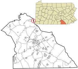 Location in York County and the state of Pennsylvania. | ||
| Coordinates: 40°09′08″N 76°45′02″W / 40.15222°N 76.75056°WCoordinates: 40°09′08″N 76°45′02″W / 40.15222°N 76.75056°W[1] | ||
| Country | United States | |
| State | Pennsylvania | |
| County | York | |
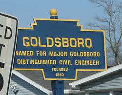
| Settled | 1850 | |
| Incorporated | 1873 | |
| Government | ||
| • Type | Borough Council | |
| Area[2] | ||
| • Land | 0.4 sq mi (1 km2) | |
| Elevation | 344 ft (105 m) | |
| Population (2010) | ||
| • Total | 952 | |
| Time zone | Eastern (EST) (UTC-5) | |
| • Summer (DST) | EDT (UTC-4) | |
| ZIP code | 17319 | |
| Area code(s) | 717 | |

Goldsboro is a borough in York County, Pennsylvania, United States. The population was 952 at the 2010 census.[3]
Etters is the name of the post office in Goldsboro, even though there is no incorporated place known as "Etters". The USPS even says that the name Goldsboro is not acceptable for sending mail, and to use Etters (ZIP code 17319).
History
The Goldsboro Historic District was listed on the National Register of Historic Places in 1984.[4]
Source of the name "Etters"
The name "Etters", used by the USPS to refer to the post office in Goldsboro, comes from the establishment in 1838 of a post office inside a tavern owned by Henry Etter, a former Revolutionary War soldier, about a mile north of the current location of Goldsboro. The post office was moved to Goldsboro in 1850, at which time it retained the name "Etter's" to avoid confusion with the already established post office in Gouldsboro, Lackawanna County, PA.[5][6][7]
Geography
Goldsboro is located along the Susquehanna River and has a view of the Three Mile Island Nuclear Generating Station, the site of the largest nuclear accident in the United States.
Demographics
| Historical population | |||
|---|---|---|---|
| Census | Pop. | %± | |
| 1870 | 310 | — | |
| 1880 | 378 | 21.9% | |
| 1890 | 345 | −8.7% | |
| 1900 | 385 | 11.6% | |
| 1910 | 434 | 12.7% | |
| 1920 | 477 | 9.9% | |
| 1930 | 459 | −3.8% | |
| 1940 | 478 | 4.1% | |
| 1950 | 558 | 16.7% | |
| 1960 | 542 | −2.9% | |
| 1970 | 576 | 6.3% | |
| 1980 | 477 | −17.2% | |
| 1990 | 458 | −4.0% | |
| 2000 | 939 | 105.0% | |
| 2010 | 952 | 1.4% | |
| Est. 2015 | 938 | [8] | −1.5% |
| Sources:[9][10][11] | |||
As of the census[10] of 2000, there were 939 people, 333 households, and 260 families residing in the borough. The population density was 2,306.3 people per square mile (884.3/km²). There were 365 housing units at an average density of 896.5 per square mile (343.7/km²). The racial makeup of the borough was 98.51% White, 0.21% Native American, 0.53% Asian, 0.11% Pacific Islander, and 0.64% from two or more races. Hispanic or Latino of any race were 0.64% of the population.
There were 333 households out of which 46.5% had children under the age of 18 living with them, 67.6% were married couples living together, 7.8% had a female householder with no husband present, and 21.9% were non-families. 17.7% of all households were made up of individuals and 3.9% had someone living alone who was 65 years of age or older. The average household size was 2.82 and the average family size was 3.24.
In the borough the population was spread out with 32.2% under the age of 18, 5.4% from 18 to 24, 40.4% from 25 to 44, 15.9% from 45 to 64, and 6.2% who were 65 years of age or older. The median age was 33 years. For every 100 females there were 103.7 males. For every 100 females age 18 and over, there were 100.9 males.
The median income for a household in the borough was $57,054, and the median income for a family was $60,455. Males had a median income of $40,250 versus $31,146 for females. The per capita income for the borough was $19,164. About 1.7% of families and 2.3% of the population were below the poverty line, including 3.0% of those under age 18 and none of those age 65 or over.
Education
The Goldsboro community is served by the West Shore School District (one of 500 public school districts in Pennsylvania and 15 public school districts in York County). Students may also attend one of the Commonwealth's public cyber charter schools at no additional cost to the family or student. The local school district pays the Pennsylvania Department of Education set tuition fee to the cyber charter school that the resident student chooses to attend. By law, Pennsylvania cyber charter school students have access to all extracurriculars and sports programs at the local public school district.[12] Alternatively, the Commonwealth of Pennsylvania permits parents to home school their children or they may attend a private school. The public school district is required by Pennsylvania school code regulation to provide free transportation to local private schools that are within 10 miles of the local district's borders.[13]
References
| Wikimedia Commons has media related to Goldsboro, Pennsylvania. |
- ↑ "US Gazetteer files: 2010, 2000, and 1990". United States Census Bureau. 2011-02-12. Retrieved 2011-04-23.
- ↑ United States Census Bureau
- ↑ "Race, Hispanic or Latino, Age, and Housing Occupancy: 2010 Census Redistricting Data (Public Law 94-171) Summary File (QT-PL), Goldsboro borough, Pennsylvania". U.S. Census Bureau, American FactFinder 2. Retrieved October 5, 2011.
- ↑ National Park Service (2010-07-09). "National Register Information System". National Register of Historic Places. National Park Service.
- ↑ Gibson, John (1886). "History of York County, Pennsylvania: GOLDSBORO". USGenWeb Archives. Chicago: F. A. Battey Publishing Co. pp. 627–630. Retrieved 5 August 2016.
... the postoffice was removed to Goldsboro, but still retains the name Etter’s Postoffice ...
- ↑ Burger, TW (27 October 2002). "Where the heck is Etters? The answer is ...". Patriot-News, The (Harrisburg, PA). p. A01. ISSN 1041-4029. Retrieved 8 August 2016.
- ↑ Larsen, Kari (28 August 2015). "Where is Etters? Red Land gives sports fans a look at central Pa.'s eccentric geography". PennLive. PA Media Group. Retrieved 10 August 2016.
... In early days, post offices were privately owned. The first post office in the Goldsboro area was owned by Henry Etter. This was about 1838 ...
- ↑ "Annual Estimates of the Resident Population for Incorporated Places: April 1, 2010 to July 1, 2015". Retrieved July 2, 2016.
- ↑ "Census of Population and Housing". U.S. Census Bureau. Retrieved 11 December 2013.
- 1 2 "American FactFinder". United States Census Bureau. Retrieved 2008-01-31.
- ↑ "Incorporated Places and Minor Civil Divisions Datasets: Subcounty Resident Population Estimates: April 1, 2010 to July 1, 2012". Population Estimates. U.S. Census Bureau. Retrieved 11 December 2013.
- ↑ Pennsylvania Department of Education, Charter Schools, 2013
- ↑ Pennsylvania Department of Education, Pupil Transportation, 2012
