Golden Throne (mountain)
For the mountain in the Karakoram, see Baltoro Kangri.
| Golden Throne | |
|---|---|
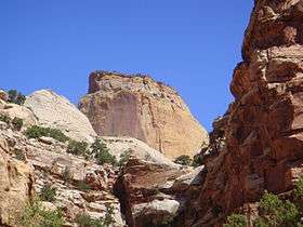 The Golden Throne from Capitol Gorge | |
| Highest point | |
| Elevation | 7,042 ft (2,146 m) NGVD 29[1] |
| Prominence | 462 ft (141 m) [1] |
| Coordinates | 38°13′06″N 111°11′03″W / 38.2183142°N 111.1840563°WCoordinates: 38°13′06″N 111°11′03″W / 38.2183142°N 111.1840563°W [2] |
| Geography | |
 Golden Throne
| |
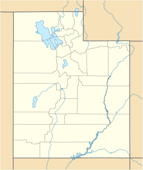
| Location | Wayne County, Utah U.S. |
| Topo map | USGS Golden Throne |
| Climbing | |
| Easiest route | Strenuous hike[3] |
The Golden Throne is a mountain located in Capitol Reef National Park, in Utah, U.S.. It is a rock formation dome made of a gold color stained Navajo Sandstone, which is particularly special because normally the sandstone is creamy white or red. The presence of a small amount of the Carmel Formation on top of the Navajo Sandstone is the reason for this staining.
A two mile long trail runs below the mountain. The summit is 7,042 feet (2,146 m) in elevation and sits in the Waterpocket Fold, a 200-mile (320 km) long landform.
The summit is very difficult to reach and may take several hours using the shortest route.
References
- 1 2 "Golden Throne". ListsOfJohn.com. Retrieved 2016-04-18.
- ↑ "Golden Throne". Geographic Names Information System. United States Geological Survey. Retrieved 2016-04-18.
- ↑ "Trails Guide". Capitol Reef National Park. Retrieved 2016-04-18.
External links
![]() Media related to Golden Throne (mountain) at Wikimedia Commons
Media related to Golden Throne (mountain) at Wikimedia Commons
- Golden Throne. gjhikes.com.
This article is issued from Wikipedia - version of the 12/2/2016. The text is available under the Creative Commons Attribution/Share Alike but additional terms may apply for the media files.