Gołdap
| Gołdap | ||
|---|---|---|
|
Gołdap Lake | ||
| ||
 Gołdap | ||
| Coordinates: 54°18′58″N 22°18′34″E / 54.31611°N 22.30944°E | ||
| Country |
| |
| Voivodeship | Warmian-Masurian | |
| County | Gołdap County | |
| Gmina | Gmina Gołdap | |
| Town rights | 1570 | |
| Government | ||
| • Mayor | Tomasz Luto | |
| Area | ||
| • Total | 17.2 km2 (6.6 sq mi) | |
| Population (2007) | ||
| • Total | 15,600 | |
| • Density | 910/km2 (2,300/sq mi) | |
| Time zone | CET (UTC+1) | |
| • Summer (DST) | CEST (UTC+2) | |
| Postal code | 19-500 | |
| Area code(s) | +48 87 | |
| Car plates | NGO | |
| Website | http://www.goldap.pl/ | |
.jpg)

Gołdap [ˈɡɔu̯dap] (German: ![]() Goldap or variant Goldapp; Lithuanian: Gėlupė, Geldapė) is a town and the seat of Gołdap County in the Warmian-Masurian Voivodeship in Poland. It is located on the Gołdapa River, between the Wzgórza Szeskie (Seesker Höhen) hills and the Puszcza Romincka forest. It has a population of 15,600 (as of 2007). Its coat of arms depicts the House of Hohenzollern and Brandenburg.
Goldap or variant Goldapp; Lithuanian: Gėlupė, Geldapė) is a town and the seat of Gołdap County in the Warmian-Masurian Voivodeship in Poland. It is located on the Gołdapa River, between the Wzgórza Szeskie (Seesker Höhen) hills and the Puszcza Romincka forest. It has a population of 15,600 (as of 2007). Its coat of arms depicts the House of Hohenzollern and Brandenburg.
History

Masurians began to settle the region in the 16th century while it was part of the Duchy of Prussia. Systematic settlement began in 1565, while the town was officially founded by Caspar von Nostitz on May 15, 1570. Located at a profitable location on the crossing of several trade routes near the Prussian border with Lithuania, Goldap grew rapidly. It became a part of the Kingdom of Prussia in 1701 and the German Empire in 1871.
From 1709-11 eastern Prussia suffered from a plague. The deceased were replaced by Germans from Brandenburg, Pomerania, Magdeburg, Halberstadt, the Electorate of the Palatinate, and Nassau, as did Swiss and Lithuanians. In 1732 Protestants expelled from Salzburg also resettled the area.
Goldap was at the south of the partially Lithuanian-speaking part of East Prussia, an ethnographic region known as Lithuania Minor. In the late Middle Ages the town had a majority of Lietuvininks (ethnic Lithuanians) and a minority of Germans and Masurians. This situation lasted until early the 19th century. Both Germanisation and the movement of Germans into Lithuania Minor was intense, and Goldap started to Germanise quite rapidly by the early 19th century. By the early 20th century less than 5% of people of Goldap were Lietuvininks; by that time only northern Lithuania Minor had territories with majorities or significant minorities of Lietuvininks.
In the 18th and 19th centuries Goldap was a notable centre of commerce and production of various goods for the local market, as well as an important centre of grain production. In 1818 it became a seat of Landkreis Goldap. In 1879 the town was linked to a railway.
During World War I Goldap was a scene of fierce fighting on the Eastern Front, which passed through the town twice. As a result, it was almost completely destroyed. The town was rebuilt, and soon after the war ended it reached a similar number of inhabitants it had had before.
During World War II Goldap was planned by the German staff as one of the strongholds guarding the rest of East Prussia from the Red Army on the Eastern Front. As a result of heavy fighting for the city and the regions directly east of it, in August and September 1944, 90% of the town was yet again destroyed. According to German war-time reports, about 50 civilians were murdered (some raped) by the Red Army on its initial entry into Goldap in October 1944. It was the first town of the German Reich to fall. However, in November 1944 the Wehrmacht reconquered Goldap and would be able to keep it until the end of December of the same year. In January, the German positions in far-eastern East Prussia broke down completely.
After the war, the town—together with the southern two-thirds of East Prussia—was placed under Polish administration according to the 1945 Potsdam Conference. The remaining German-speaking populace, including Masurians, who had not evacuated were subsequently expelled westward. They were replaced by Poles who had been expelled from Polish areas annexed by the Soviet Union.. The town, renamed from the German Goldap to the Polish Gołdap, was rebuilt and retained its status as a seat of a powiat.
Today the town of Gołdap remains an important centre of local trade and commerce. There are several small food production facilities (milk plant, industrial slaughterhouse, mill) located there, as well as a paper mill and a small tourist equipment works. In addition, it is one of the centres of tourism, with many skiing, swimming, sailing and leisure centres located both in the town and around it.
Notable residents
- Gotthard Fischer (1891–1969), general
- Erich Sack (1887–1943), Protestant Pastor and resistance fighter
- Alfred Partikel (1888–1945?), Painter
International relations
Twin towns — sister cities
Gołdap is twinned with:
 Ano Syros, Greece since 2000.[1]
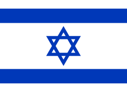 Giv'at Shmuel, Israel
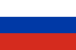 Gusev, Russia
 Stade, Germany
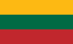 Šakiai, Lithuania

See also
References
- ↑ "Twinnings" (PDF). Central Union of Municipalities & Communities of Greece. Retrieved 2013-08-25.
External links
| Wikimedia Commons has media related to Gołdap. |
- Municipal webpage (Polish)
- Geschichte der Stadt Goldap (German)
- German documentary movie about Battle of Goldap
Coordinates: 54°18′58″N 22°18′34″E / 54.31611°N 22.30944°E
| Seat |  | |
|---|---|---|
| Urban-rural gmina | ||
| Rural gminas | ||