Goa Velha
| Goa Velha | |
|---|---|
| Town | |
|
Saint Andrew's Church and School | |
 Goa Velha  Goa Velha | |
| Coordinates: 15°26′38″N 73°52′52″E / 15.444°N 73.881°ECoordinates: 15°26′38″N 73°52′52″E / 15.444°N 73.881°E | |
| Country |
|
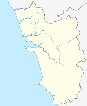
| State | Goa |
| District | North Goa |
| Sub District | Ilhas |
| Founded by | Afonso Albuquerque |
| Named for | "Goa - The Old" in Portuguese |
| Government | |
| Area | |
| • Total | 6.20 km2 (2.39 sq mi) |
| Elevation | 6 m (20 ft) |
| Population (2011) | |
| • Total | 4,322 |
| • Density | 700/km2 (1,800/sq mi) |
| Languages | |
| • Official | Konkani |
| • Also Spoken (understood) | English |
| • Historical | Portuguese |
| Religions | |
| • Dominant | Christianity |
| • Minor | Hinduism |
| • Historical | Roman Catholicism |
| Time zone | IST (UTC+5:30) |
| Postcode | 403108 |
| Telephone Code | 0832 |
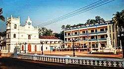
Goa Velha is a census town in Ilhas, Goa. It should not be confused with the World Heritage Site Velha Goa (English: Old Goa). St. Andrew's is its parish church. It is well known for its yearly 'procession of saints' (Konkani: santanchem pursanv)
History
The town of Goa Velha stands on the site of the ancient port of "Govapuri" or "Gokapattana", which was founded by the Kadamba Dynasty in the 11th century on the banks of the Zuari River. Govapuri was one of the main ports first of the Kadamba Dynasty, and subsequently of the Vijayanagara Empire. In the 15th century, a number of wars were fought between the Deccan sultanates and Vijayanagara for control of the Goa region, as a result of which Govapuri came under the control of the Adilshahs of Bijapur. Govapuri was devastated by the wars. In addition, the Zuari had begun to recede from the port as a result of silting. As a result, the new Adilshahi rulers built a new port city for Goa some distance to the north, on the banks of the Mandovi. The Portuguese eventually made the new city the capital of Portuguese India, and called the old port of Govapuri "Goa Velha" (Portuguese for "Goa the Old"). Goa Velha continued to exist as a small town under Portuguese rule, and in 1961 was incorporated into India along with the rest of Goa.
Geography
Goa Velha is located adjacent to Pilar in Ilhas, North Goa. By road it is approximately 2.5 kilometres north-west of Agaçaim, 12 kilometres south-east of the capital Panjim, 17 kilometres north-east of Vasco da Gama, and 22 kilometres north of the South Goa district headquarters Margão.
Demographics
As of the 2011 India census,[1] Goa Velha had a population of 4,322 . Males constitute 53% of the population and females 47%. Goa Velha has an average literacy rate of 89.17%, higher than the state average of 88.70 %: male literacy is 82%, and female literacy is 71%. In Goa Velha, 9% of the population is under 6 years of age. 68.12% of the population is still Christian, 27.97% is Hindu and 3.77% is Muslim. Goa Velha Census Town has total administration over 1,055 houses to which it supplies basic amenities like water and sewerage. It is also authorized to build roads within Census Town limits and impose taxes on properties coming under its jurisdiction.