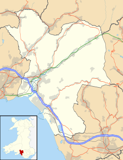
Glyncorrwg
| Glyncorrwg | |
| Welsh: Glyncorrwg | |
 |
|
 Glyncorrwg |
|
| Population | 5,283 2011 census |
|---|---|
| OS grid reference | SS874989 |
| Principal area | Neath Port Talbot |
| Ceremonial county | West Glamorgan |
| Country | Wales |
| Sovereign state | United Kingdom |
| Post town | Port Talbot |
| Postcode district | SA13 |
| Dialling code | 01639 |
| Police | South Wales |
| Fire | Mid and West Wales |
| Ambulance | Welsh |
| EU Parliament | Wales |
| UK Parliament | Aberavon |
| Welsh Assembly | Aberavon |
|
|
Coordinates: 51°40′39″N 3°37′45″W / 51.677571°N 3.629224°W
Glyncorrwg is a village in Wales. It is set in the Afan Valley, in southern Wales.
Glyncorrwg is also the name of an electoral ward and a community covering the village and surrounding countryside, in Neath Port Talbot county borough. Glyncorrwg community contains the villages of Abergwynfi, Blaengwynfi, Croeserw, Cymmer, Abercregan, Duffryn and Glyncorwg itself. The population of Glyncorrwg as a community, was recorded as 5,544 in the 2001 census,[1] reducing to 5,283 at the 2011 census.[2] The population of the electoral ward mentioned above was 1,096 only at the 2011 census.[3]
History
Glyncorrwg was once an important coal mining centre, typical of the South Wales Valleys. With the end of the coal mining industry during the 1970s, buildings were cleared away, factories closed and people left the area to find new employment.
In 1990 the local community decided to take advantage of the local scenery and complemented it with a series of ponds along the narrow valley. Trout fishing, coarse fishing, and canoeing are now popular sports in the area, plus miles of old flat railway trackbed lines and steep mountain slopes providing opportunities for cycling, hillwalking and mountain biking.
As of 2011 there are still high levels of unemployment.
Glyncorrwg Health Centre
Dr Julian Tudor Hart established a famous research and teaching practice in Glyncorrwg. He arrived in 1961 and conducted a series of epidemiologal studies on the practice population - a population of about 1900 which was relatively stable and which he got to know well. He established a health centre committee with a public health focus and demonstrated that systematic case-finding and regular follow-up produced real benefits. In 1987 he found age-standardised death rates under 65 were 28% lower in Glyncorrwg than in nearby Blaengwynfi over the previous five-year period. This approach, which was the subject of many publications, led eventually to the introduction of the Quality and Outcomes Framework which rewarded GPs for meeting targets for intervention in the management of disease.
Glyncorrwg Coal Company
The South Wales Mineral Railway reached Glyncorrwg in 1863. It was always short of funds so was leased to the Glyncorrwg Coal Company, which became the Glyncorrwg Colliery Company Limited in 1870. This company operated a local coal mine and needed the railway to cheaply transport coal down to Briton Ferry.
Government and politics
The electoral ward of Glyncorrwg falls within the parliamentary constituency of Aberavon. The Glyncorrwg ward includes the remote village of Glyncorrwg on the floor of valley of the River Corrwg. It is surrounded by open moorland which in turn is surrounded by dense coniferous forest. Glyncorrwg is bounded by the wards of Blaengwrach to the north; Treherbert and Gwynfi of Rhondda Cynon Taff to the east; Gwynfi and Cymmer to the south; and Resolven to the west.
In the 2012 local council elections, the electorate turnout for Glyncorrwg was 56.59%. The results were:
| Candidate | Party | Votes | Status |
|---|---|---|---|
| Glyn Rawlings | Labour | 271 | Labour hold |
| Lindsay Milsom | Independent | 201 |
Pen y Cymoedd
In May 2012 it was announced that the Pen y Cymoedd windfarm, the highest-generating onshore wind farm in Wales, had received government backing, and that the 76 turbines would be operational by 2016. This was developed by Swedish-based Vattenfall - www.vattenfall.co.uk.[4]
Corrwg Fechan
In 2007 a planning application by ECO2 for a wind farm in Corrwg Fechan was turned down by Neath and Port Talbot District Council at their meeting on the 10 December 2007.
See also
References
- MacDermot, E T (1931). History of the Great Western Railway, volume II 1863-1921. London: Great Western Railway.
- Neath and Port Talbot Planning Application P / 2007 / 607 Available at npt.gov.uk/downloads/planning/pa_20070514.rtf
Notes
- ↑ Davies, John; Jenkins, Nigel; Menna, Baines; Lynch, Peredur I., eds. (2008). The Welsh Academy Encyclopaedia of Wales. Cardiff: University of Wales Press. p. 321. ISBN 978-0-7083-1953-6.
- ↑ "Community population 2011". Retrieved 12 April 2015.
- ↑ "Ward population 2011". Retrieved 12 April 2015.
- ↑ "£365m wind farm between Neath and Aberdare backed". BBC News. 8 May 2012. Retrieved 8 May 2012.
External links
- St. John The Baptist Church, Glyncorrwg
- www.geograph.co.uk : photos of Glyncorrwg and surrounding area
- Boundaries of the community of Glyncorrwg