Gloucester City, New Jersey
| Gloucester City, New Jersey | |
|---|---|
| City | |
| City of Gloucester City | |
|
Walt Whitman Bridge | |
 Gloucester City highlighted in Camden County. Inset: Location of Camden County in the State of New Jersey. | |
 Census Bureau map of Gloucester City, New Jersey | |
| Coordinates: 39°53′30″N 75°07′00″W / 39.891609°N 75.1167°WCoordinates: 39°53′30″N 75°07′00″W / 39.891609°N 75.1167°W[1][2] | |
| Country |
|
| State |
|
| County | Camden |
| Settled | 1627 (Fort Nassau) |
| Incorporated | February 25, 1868 |
| Named for | Gloucester, England |
| Government[3] | |
| • Type | City |
| • Body | City Council |
| • Mayor | William P. James (D, term ends December 31, 2018)[4][5] |
| • Administrator | Jack Lipsett[6] |
| • Clerk | Kathleen Jentsch[6] |
| Area[1] | |
| • Total | 2.782 sq mi (7.206 km2) |
| • Land | 2.320 sq mi (6.009 km2) |
| • Water | 0.462 sq mi (1.197 km2) 16.62% |
| Area rank |
354th of 566 in state 15th of 37 in county[1] |
| Elevation[7] | 23 ft (7 m) |
| Population (2010 Census)[8][9][10] | |
| • Total | 11,456 |
| • Estimate (2015)[11] | 11,329 |
| • Rank |
213th of 566 in state 12th of 37 in county[12] |
| • Density | 4,937.8/sq mi (1,906.5/km2) |
| • Density rank |
112th of 566 in state 10th of 37 in county[12] |
| Time zone | Eastern (EST) (UTC-5) |
| • Summer (DST) | Eastern (EDT) (UTC-4) |
| ZIP codes | 08030[13][14] |
| Area code(s) | 856 exchanges: 456, 742[15] |
| FIPS code | 34007268200[1][16][17] |
| GNIS feature ID | 0885234[1][18] |
| Website |
www |

Gloucester City is a city in Camden County, New Jersey, United States. As of the 2010 United States Census, the city's population was 11,456,[8][9][10] reflecting a decline of 28 (-0.2%) from the 11,484 counted in the 2000 Census, which had in turn declined by 1,165 (-9.2%) from the 12,649 counted in the 1990 Census.[19] It is located directly across the Delaware River from Philadelphia and the Port of Philadelphia.
Gloucester City was incorporated by an act of the New Jersey Legislature on February 25, 1868, from the remaining portions of Union Township, which was then dissolved. Additional territory was annexed in 1925 from Centre Township and in 1927 from Haddon Township.[20] The city's name derives from Gloucester, England.[21][22]
Gloucester City is known for its Irish American population, which was ninth-highest in the United States by percentage in the 2000 Census.[23]
History
| New Netherland series |
|---|
| Exploration |
| Fortifications: |
| Settlements: |
| The Patroon System |
|
| People of New Netherland |
| Flushing Remonstrance |
 |

The name Fort Nassau was used by the Dutch in the 17th century for several fortifications, mostly trading stations, named for the House of Orange-Nassau. The one built in the 1620s[24] at today's Gloucester City was for trade, mostly in beaver pelts, with the indigenous population of Susquehannock and Lenape. The region along the Delaware River and its bay was called the Zuyd Rivier and marked the southern flank of the province of New Netherland.[25]
From 1638-1655 the area was part of New Sweden, which had been established by Peter Minuit, who had been Director of New Netherland, and was responsible for the famous purchase of the island of Manhattan. The location was disadvantageous since the richest fur-trapping area was on the west side of the river, where Swedish could intercept trade with the natives. In 1651, Peter Stuyvesant, director-general of New Netherland, dismantled the structure and relocated to a position on the other side of the river, in part to menace the Swedish, calling it Fort Casimir.
Geography
According to the United States Census Bureau, the city had a total area of 2.782 square miles (7.206 km2), including 2.320 square miles (6.009 km2) of land and 0.462 square miles (1.197 km2) of water (16.62%).[1][2]
Unincorporated communities, localities and place names located partially or completely within the city include Cloversdale, Gloucester Heights, Highland Park and Newbold.[26]
The city borders Bellmawr, Brooklawn, Camden, Haddon Township, and Mount Ephraim. Gloucester City also borders Gloucester County and the Delaware River.
Demographics
| Historical population | |||
|---|---|---|---|
| Census | Pop. | %± | |
| 1870 | 3,682 | — | |
| 1880 | 5,347 | 45.2% | |
| 1890 | 6,564 | 22.8% | |
| 1900 | 6,840 | 4.2% | |
| 1910 | 9,462 | 38.3% | |
| 1920 | 12,162 | 28.5% | |
| 1930 | 13,796 | 13.4% | |
| 1940 | 13,692 | −0.8% | |
| 1950 | 14,357 | 4.9% | |
| 1960 | 15,511 | 8.0% | |
| 1970 | 14,707 | −5.2% | |
| 1980 | 13,121 | −10.8% | |
| 1990 | 12,649 | −3.6% | |
| 2000 | 11,484 | −9.2% | |
| 2010 | 11,456 | −0.2% | |
| Est. 2015 | 11,329 | [11][27] | −1.1% |
| Population sources: 1870-2000[28] 1870-1920[29] 1870[30][31] 1880-1890[32] 1890-1910[33] 1870-1930[34] 1930-1990[35] 2000[36][37] 2010[8][9][10] | |||
Census 2010
At the 2010 United States Census, there were 11,456 people, 4,248 households, and 2,804 families residing in the city. The population density was 4,937.8 per square mile (1,906.5/km2). There were 4,712 housing units at an average density of 2,031.0 per square mile (784.2/km2). The racial makeup of the city was 90.52% (10,370) White, 3.07% (352) Black or African American, 0.14% (16) Native American, 2.68% (307) Asian, 0.00% (0) Pacific Islander, 1.82% (209) from other races, and 1.76% (202) from two or more races. Hispanics or Latinos of any race were 6.70% (767) of the population.[8]
There were 4,248 households, of which 29.4% had children under the age of 18 living with them, 42.3% were married couples living together, 15.9% had a female householder with no husband present, and 34.0% were non-families. 27.4% of all households were made up of individuals, and 12.9% had someone living alone who was 65 years of age or older. The average household size was 2.70 and the average family size was 3.31.[8]
In the city, 24.5% of the population were under the age of 18, 9.3% from 18 to 24, 26.4% from 25 to 44, 26.9% from 45 to 64, and 12.8% who were 65 years of age or older. The median age was 36.7 years. For every 100 females there were 97.0 males. For every 100 females age 18 and over, there were 94.4 males.[8]
The Census Bureau's 2006-2010 American Community Survey showed that (in 2010 inflation-adjusted dollars) median household income was $52,222 (with a margin of error of +/- $8,589) and the median family income was $58,825 (+/- $7,975). Males had a median income of $49,032 (+/- $3,038) versus $36,560 (+/- $2,335) for females. The per capita income for the city was $22,718 (+/- $1,341). About 12.2% of families and 14.2% of the population were below the poverty line, including 23.2% of those under age 18 and 8.8% of those age 65 or over.[38]
Census 2000
As of the 2000 United States Census[16] there were 11,484 people, 4,213 households, and 2,839 families residing in the city. The population density was 5,213.7 people per square mile (2,015.5/km2). There were 4,604 housing units at an average density of 2,090.2 per square mile (808.0/km2). The racial makeup of the city was 97.14% White, 0.69% African American, 0.18% Native American, 0.68% Asian, 0.03% Pacific Islander, 0.64% from other races, and 0.64% from two or more races. Hispanic or Latino of any race were 1.88% of the population.[36][37]
As of the 2000 Census, 34.2% of Gloucester City residents were of Irish ancestry, the ninth-highest percentage of any municipality in the United States, and third-highest in New Jersey, among all places with more than 1,000 residents identifying their ancestry.[23]
There were 4,213 households out of which 32.6% had children under the age of 18 living with them, 46.8% were married couples living together, 14.6% had a female householder with no husband present, and 32.6% were non-families. 27.2% of all households were made up of individuals and 13.0% had someone living alone who was 65 years of age or older. The average household size was 2.72 and the average family size was 3.32.[36][37]
In the city the population was spread out with 26.5% under the age of 18, 9.0% from 18 to 24, 29.2% from 25 to 44, 21.5% from 45 to 64, and 13.8% who were 65 years of age or older. The median age was 36 years. For every 100 females there were 95.0 males. For every 100 females age 18 and over, there were 92.0 males.[36][37]
The median income for a household in the city was $36,855, and the median income for a family was $46,038. Males had a median income of $35,659 versus $24,907 for females. The per capita income for the city was $16,912. About 7.7% of families and 10.1% of the population were below the poverty line, including 10.7% of those under age 18 and 11.5% of those age 65 or over.[36][37]
Economy
Portions of the City of Gloucester within an Urban Enterprise Zone where, in addition to other benefits to encourage employment within the Zone, shoppers can take advantage of a reduced 3½% sales tax rate at eligible merchants (versus the 7% rate charged statewide).[39][40]
Sports
From 1888 to 1890 the Philadelphia Athletics of the now-defunct American Association played 30 Sunday games in Gloucester City.[41]
Gloucester Point Grounds is a former baseball stadium that was the part-time home to the Philadelphia Athletics from 1888 to 1890, with the Athletics playing games there on Sunday to avoid blue law restrictions in Philadelphia.[42]
Government
Local government
Gloucester City is governed under the City form of New Jersey municipal government. The Mayor is elected at-large and serves a four-year term. Members of the council are elected from three wards to three-year staggered terms, so that there are no council seats up for vote in one year in the three-year cycle. The Mayor and Common Council are responsible for making public policy that addresses the needs of the City and its residents. The Mayor and Common Council also appoint members of the Planning and Zoning Board, as well as the Board of Health.[3][43]
As of 2016, the Mayor of Gloucester City is Democrat William James, whose term of office ends December 31, 2018. Members of the City Council are:[4][44][45][46][47]
- First Ward: John Hutchinson (D, 2016) and Daniel T. Spencer, Jr. (D, 2015)
- Second Ward: James "Bowie" Johnson (D, 2015) and Bruce Parry (D, 2016)
- Third Ward: Nancy Randolph Baus (D, 2015) and Patrick J. Keating (D, 2016)
Federal, state and county representation
Gloucester City is located in the 1st Congressional District[48] and is part of New Jersey's 5th state legislative district.[9][49][50]
New Jersey's First Congressional District is represented by Donald Norcross (D, Camden).[51] New Jersey is represented in the United States Senate by Cory Booker (D, Newark, term ends 2021)[52] and Bob Menendez (D, Paramus, 2019).[53][54]
For the 2016–2017 session (Senate, General Assembly), the 5th Legislative District of the New Jersey Legislature is represented in the State Senate by Nilsa Cruz-Perez (D, Barrington) and in the General Assembly by Arthur Barclay (D, Camden) and Patricia Egan Jones (D, Barrington).[55] The Governor of New Jersey is Chris Christie (R, Mendham Township).[56] The Lieutenant Governor of New Jersey is Kim Guadagno (R, Monmouth Beach).[57]
Camden County is governed by a Board of Chosen Freeholders, whose seven members chosen at-large in partisan elections to three-year terms office on a staggered basis, with either two or three seats coming up for election each year.[58] As of 2015, Camden County's Freeholders are Freeholder Director Louis Cappelli, Jr. (Collingswood, term as freeholder ends December 31, 2017; term as director ends 2015),[59] Freeholder Deputy Director Edward T. McDonnell (Pennsauken Township, term as freeholder ends 2016; term as deputy director ends 2015),[60] Michelle Gentek (Gloucester Township, 2015),[61] Ian K. Leonard (Camden, 2015),[62] Jeffrey L. Nash (Cherry Hill, 2015),[63] Carmen Rodriguez (Merchantville, 2016)[64] and Jonathan L. Young, Sr. (Berlin Township, November 2015; serving the unexpired term of Scot McCray ending in 2017)[65][66][67]
Camden County's constitutional officers, all elected directly by voters, are County clerk Joseph Ripa,[68] Sheriff Charles H. Billingham,[69] and Surrogate Patricia Egan Jones.[67][70] The Camden County Prosecutor Mary Eva Colalillo was appointed by the Governor of New Jersey with the advice and consent of the New Jersey Senate (the upper house of the New Jersey Legislature).[71]
The sheriff of Camden County is Charles H. Billingham, a resident of Gloucester City who had previously served as the city's mayor.[72]
Politics
As of March 23, 2011, there were a total of 6,726 registered voters in Gloucester City, of which 3,320 (49.4%) were registered as Democrats, 660 (9.8%) were registered as Republicans and 2,744 (40.8%) were registered as Unaffiliated. There were 2 voters registered to other parties.[73]
In the 2012 presidential election, Democrat Barack Obama received 65.6% of the vote (2,624 cast), ahead of Republican Mitt Romney with 32.6% (1,303 votes), and other candidates with 1.8% (72 votes), among the 4,058 ballots cast by the city's 7,177 registered voters (59 ballots were spoiled), for a turnout of 56.5%.[74][75] In the 2008 presidential election, Democrat Barack Obama received 59.2% of the vote here (2,611 cast), ahead of Republican John McCain, who received around 37.0% (1,631 votes), with 4,411 ballots cast among the city's 6,711 registered voters, for a turnout of 65.7%.[76] In the 2004 presidential election, Democrat John Kerry received 58.9% of the vote here (2,698 ballots cast), outpolling Republican George W. Bush, who received around 38.3% (1,755 votes), with 4,578 ballots cast among the city's 6,653 registered voters, for a turnout percentage of 68.8.[77]
In the 2013 gubernatorial election, Republican Chris Christie received 59.0% of the vote (1,309 cast), ahead of Democrat Barbara Buono with 39.2% (870 votes), and other candidates with 1.8% (41 votes), among the 2,310 ballots cast by the city's 7,097 registered voters (90 ballots were spoiled), for a turnout of 32.5%.[78][79] In the 2009 gubernatorial election, Democrat Jon Corzine received 54.8% of the vote here (1,473 ballots cast), ahead of both Republican Chris Christie with 36.0% (969 votes) and Independent Chris Daggett with 4.2% (113 votes), with 2,689 ballots cast among the city's 6,708 registered voters, yielding a 40.1% turnout.[80]
Education
The Gloucester City Public Schools serve students in preschool through twelfth grade. The district is one of 31 former Abbott districts statewide,[81] which are now referred to as "SDA Districts" based on the requirement for the state to cover all costs for school building and renovation projects in these districts under the supervision of the New Jersey Schools Development Authority.[82][83] Students from Brooklawn attend the district's high school as part of a sending/receiving relationship.[84]
As of the 2011-12 school year, the district's three schools had an enrollment of 2,050 students and 198.7 classroom teachers (on an FTE basis), for a student–teacher ratio of 10.32:1.[85] Schools in the district (with 2011-12 enrollment data from the National Center for Education Statistics[86]) are Cold Springs Elementary School[87] (grades PreK-3; 842 students), Mary Ethel Costello Elementary School[88] (4-6; 374) and Gloucester City Junior-Senior High School[89] (7-12; 834).[90][91]
The Roman Catholic Diocese of Camden operates Gloucester Catholic High School, a co-educational four-year Roman Catholic high school.[92] Saint Mary School was a Catholic grammar school that served grade levels from three- and four-year-old pre-school to eighth grade, which was closed by the diocese at the end of the 2010-2011 school year, in the wake of declining enrollment and rising deficits that were beyond the ability of the diocese to cover.[93]
Transportation
Roads and highways
As of May 2010, the city had a total of 39.97 miles (64.33 km) of roadways, of which 29.52 miles (47.51 km) were maintained by the municipality, 7.10 miles (11.43 km) by Camden County, 2.63 miles (4.23 km) by the New Jersey Department of Transportation and 0.72 miles (1.16 km) by the Delaware River Port Authority.[94]
Interstate 76 travels through Gloucester City, passes into Camden and re-enters the city where it reaches its northern terminus.[95]
The Walt Whitman Bridge is a suspension bridge carrying Interstate 76, spanning the Delaware River, connecting Philadelphia and Gloucester City. The bridge, which extends for almost 12,000 feet (3,700 m) between abutments, opened to traffic on May 16, 1957.[96] U.S. Route 130 also travels through Gloucester City.
Public transportation
New Jersey Transit bus service is available to Philadelphia on routes 401 (from Salem), 402 (from Pennsville), 408 (from Millville), 410 (from Bridgeton) and 412 (from Swell), with local service on the 457 route between the Moorestown Mall and Camden.[97][98]
The city is a planned stop on the Glassboro–Camden Line, an 18-mile (28.97 km) diesel multiple unit (DMU) light rail system projected for completion in 2019.[99]
Notable people
People who were born in, residents of, or otherwise closely associated with Gloucester City include:
- James Barton (1890-1962), vaudevillian, stage performer and character actor in films and television.[100]
- Agnus Berenato (born 1956), former head women's basketball coach at Rider University (1982-1985), Georgia Tech (1989-2003) and University of Pittsburgh (2012-2013).[101]
- Jack Collins (born 1943), former Speaker of the New Jersey General Assembly.[102]
- Patrick T. Harker (born 1958), President of the University of Delaware since 2007.[103]
- Eliza Leslie (1787-1858), author of popular cookbooks during the nineteenth century.[104]
Popular culture
- Gloucester City is cited by some as the birthplace of rock and roll. Bill Haley & His Comets — originally a country music band called "Bill Haley and the Saddlemen" — were the house band playing at the Twin Bar for 18 months starting in the early 1950s and are said to have modified their performing style while on stage there to an early form of rock and roll.[105][106]
- In 1881, painter Thomas Eakins completed two versions of "Shad-Fishing at Gloucester on the Delaware River". A watercolor version is housed in the Metropolitan Museum of Art in New York City, while an oil on canvas version is on display at the Philadelphia Museum of Art in Philadelphia, just across the Delaware River from Gloucester City.[107]
- On November 4, 1773, Elizabeth Griscom married John Ross at Huggs Tavern.[108] Better known as Betsy Ross, Elizabeth is credited with designing and producing the first American flag. Huggs Tavern was torn down in the 1920s;[109] the former site of the tavern is part of what is now Proprietor's Park.[108]
References
- 1 2 3 4 5 6 2010 Census Gazetteer Files: New Jersey County Subdivisions, United States Census Bureau. Accessed May 21, 2015.
- 1 2 US Gazetteer files: 2010, 2000, and 1990, United States Census Bureau. Accessed September 4, 2014.
- 1 2 2012 New Jersey Legislative District Data Book, Rutgers University Edward J. Bloustein School of Planning and Public Policy, March 2013, p. 28.
- 1 2 Governing Body, Gloucester City. Accessed June 25, 2016.
- ↑ 2016 New Jersey Mayors Directory, New Jersey Department of Community Affairs. Accessed June 14, 2016.
- 1 2 Directory, Gloucester City. Accessed June 25, 2016.
- ↑ U.S. Geological Survey Geographic Names Information System: City of Gloucester City, Geographic Names Information System. Accessed March 5, 2013.
- 1 2 3 4 5 6 DP-1 - Profile of General Population and Housing Characteristics: 2010 Demographic Profile Data for Gloucester City city, Camden County, New Jersey, United States Census Bureau. Accessed May 30, 2012.
- 1 2 3 4 Municipalities Grouped by 2011-2020 Legislative Districts, New Jersey Department of State, p. 3. Accessed January 6, 2013.
- 1 2 3 Table DP-1. Profile of General Demographic Characteristics: 2010 for Gloucester City city, New Jersey Department of Labor and Workforce Development. Accessed May 30, 2012.
- 1 2 PEPANNRES - Annual Estimates of the Resident Population: April 1, 2010 to July 1, 2015 - 2015 Population Estimates for New Jersey municipalities, United States Census Bureau. Accessed May 22, 2016.
- 1 2 GCT-PH1 Population, Housing Units, Area, and Density: 2010 - State -- County Subdivision from the 2010 Census Summary File 1 for New Jersey, United States Census Bureau. Accessed October 4, 2012.
- ↑ Look Up a ZIP Code for Gloucester City, New Jersey, United States Postal Service. Accessed May 30, 2012.
- ↑ Zip Codes, State of New Jersey. Accessed October 14, 2013.
- ↑ Area Code Lookup - NPA NXX for Gloucester City, NJ, Area-Codes.com. Accessed October 14, 2013.
- 1 2 American FactFinder, United States Census Bureau. Accessed September 4, 2014.
- ↑ A Cure for the Common Codes: New Jersey, Missouri Census Data Center. Accessed May 30, 2012.
- ↑ US Board on Geographic Names, United States Geological Survey. Accessed September 4, 2014.
- ↑ Table 7. Population for the Counties and Municipalities in New Jersey: 1990, 2000 and 2010, New Jersey Department of Labor and Workforce Development, February 2011. Accessed October 4, 2012.
- ↑ Snyder, John P. The Story of New Jersey's Civil Boundaries: 1606-1968, Bureau of Geology and Topography; Trenton, New Jersey; 1969. p. 106 re Gloucester City, p. 109 re Union Township. Accessed May 30, 2012.
- ↑ Hutchinson, Viola L. The Origin of New Jersey Place Names, New Jersey Public Library Commission, May 1945. Accessed August 31, 2015.
- ↑ Gannett, Henry. The Origin of Certain Place Names in the United States, p. 138. United States Government Printing Office, 1905. Accessed August 31, 2015.
- 1 2 Irish Communities, EPodunk. Accessed June 9, 2007.
- ↑ New Sweden 1638-1655 Delaware, New Jersey, Pennsylvania, Rootsweb.com. Accessed August 31, 2015.
- ↑ Silverman, Sharo Hernes. "New Sweden and the New World: History Lessons from the Morton Homestead", from Pennsylvania Heritage Magazine, Volume XXV, Number 1 - Winter 1999. Accessed October 4, 2012.
- ↑ Locality Search, State of New Jersey. Accessed May 21, 2015.
- ↑ Census Estimates for New Jersey April 1, 2010 to July 1, 2015, United States Census Bureau. Accessed May 22, 2016.
- ↑ Barnett, Bob. Population Data for Camden County Municipalities, 1850 - 2000, WestJersey.org, January 6, 2011. Accessed October 4, 2012.
- ↑ Compendium of censuses 1726-1905: together with the tabulated returns of 1905, New Jersey Department of State, 1906. Accessed October 14, 2013.
- ↑ Raum, John O. The History of New Jersey: From Its Earliest Settlement to the Present Time, Volume 1, p. 279, J. E. Potter and company, 1877. Accessed October 14, 2013. "Gloucester City had a population in 1850, of 2,188; in 1860, 2,320; and in 1870, 3,682." Population listed for 1850 and 1860 is for predecessor municipalities.
- ↑ Staff. A compendium of the ninth census, 1870, p. 258. United States Census Bureau, 1872. Accessed October 14, 2013.
- ↑ Porter, Robert Percival. Preliminary Results as Contained in the Eleventh Census Bulletins: Volume III - 51 to 75, p. 97. United States Census Bureau, 1890. Accessed October 14, 2013.
- ↑ Thirteenth Census of the United States, 1910: Population by Counties and Minor Civil Divisions, 1910, 1900, 1890, United States Census Bureau, p. 336. Accessed May 30, 2012.
- ↑ Fifteenth Census of the United States : 1930 - Population Volume I, United States Census Bureau, p. 710. Accessed May 30, 2012.
- ↑ New Jersey Resident Population by Municipality: 1930 - 1990, Workforce New Jersey Public Information Network. Accessed June 28, 2015.
- 1 2 3 4 5 Census 2000 Profiles of Demographic / Social / Economic / Housing Characteristics for Gloucester City city, New Jersey, United States Census Bureau. Accessed October 4, 2012.
- 1 2 3 4 5 DP-1: Profile of General Demographic Characteristics: 2000 - Census 2000 Summary File 1 (SF 1) 100-Percent Data for Gloucester City city, Camden County, New Jersey, United States Census Bureau. Accessed October 4, 2012.
- ↑ DP03: Selected Economic Characteristics from the 2006-2010 American Community Survey 5-Year Estimates for Gloucester City city, Camden County, New Jersey, United States Census Bureau. Accessed May 30, 2012.
- ↑ Urban Enterprise Zone, Gloucester City. Accessed May 30, 2012.
- ↑ Geographic & Urban Redevelopment Tax Credit Programs: Urban Enterprise Zone Employee Tax Credit, State of New Jersey, backed up by the Internet Archive as of May 25, 2009. Accessed October 4, 2012.
- ↑ The ESPN Baseball Encyclopedia. Sterling Publishing. 2007. p. 1784. ISBN 1-4027-4771-3.
- ↑ Staff. "Gloucester City History - Gloucester City: Reinvention over centuries", Courier-Post, October 19, 2006. Accessed November 15, 2014. "Gloucester City has significant but little known ties to Major League Baseball. Gloucester Point Grounds ballfield was home to the Philadelphia Athletics -- the forerunner of the American League team -- on Sundays from 1887 to 1889. At the time, Philadelphia's blue laws prohibited the A's from playing on Sundays in their usual park, the Jefferson Street Grounds."
- ↑ The Mayor & Common Council, City of Gloucester. Accessed October 14, 2013.
- ↑ 2014 Municipal Data Sheet, Gloucester City. Accessed September 5, 2014.
- ↑ Official Election Results 2015 General Election November 3, 2015, Camden County, New Jersey, November 19, 2015. Accessed June 23, 2016.
- ↑ Official Election Results 2014 General Election November 4, 2014, Camden County, New Jersey, November 13, 2015. Accessed February 11, 2015.
- ↑ Official Election Results 2013 General Election November 5, 2013, Camden County, New Jersey, November 14, 2013. Accessed June 23, 2016.
- ↑ Plan Components Report, New Jersey Redistricting Commission, December 23, 2011. Accessed January 6, 2013.
- ↑ 2016 New Jersey Citizen's Guide to Government, p. 58, New Jersey League of Women Voters. Accessed July 20, 2016.
- ↑ Districts by Number for 2011-2020, New Jersey Legislature. Accessed January 6, 2013.
- ↑ Directory of Representatives: New Jersey, United States House of Representatives. Accessed January 5, 2012.
- ↑ About Cory Booker, United States Senate. Accessed January 26, 2015. "He now owns a home and lives in Newark's Central Ward community."
- ↑ Biography of Bob Menendez, United States Senate, January 26, 2015. "He currently lives in Paramus and has two children, Alicia and Robert."
- ↑ Senators of the 114th Congress from New Jersey. United States Senate. Accessed January 26, 2015. "Booker, Cory A. - (D - NJ) Class II; Menendez, Robert - (D - NJ) Class I"
- ↑ Legislative Roster 2016-2017 Session, New Jersey Legislature. Accessed January 17, 2016.
- ↑ "About the Governor". State of New Jersey. Retrieved 2010-01-21.
- ↑ "About the Lieutenant Governor". State of New Jersey. Retrieved 2010-01-21.
- ↑ What is a Freeholder?, Camden County, New Jersey. Accessed May 12, 2015.
- ↑ Freeholder Louis Cappelli, Jr., Camden County, New Jersey. Accessed May 12, 2015.
- ↑ Freeholder Edward T. McDonnell, Camden County, New Jersey. Accessed May 12, 2015.
- ↑ Freeholder Michelle Gentek, Camden County, New Jersey. Accessed May 12, 2015.
- ↑ Freeholder Ian K. Leonard, Camden County, New Jersey. Accessed May 12, 2015.
- ↑ Freeholder Jeffrey L. Nash, Camden County, New Jersey. Accessed May 12, 2015.
- ↑ Freeholder Carmen Rodriguez, Camden County, New Jersey. Accessed May 12, 2015.
- ↑ Jonathan L. Young, Sr., Camden County, New Jersey. Accessed May 12, 2015.
- ↑ Daniels, Mark. "Carpenters union official tapped for Camden County Freeholder seat", South Jersey Times, January 22, 2015. Accessed May 12, 2015. "Democratic leaders in Camden County have nominated a construction union official from Berlin Township to fill an open seat on the board of chosen freeholders. Jonathan L. Young Sr., 45, has been nominated to replace Scot McCray, who resigned from the board in late December, citing a desire to spend more time with his family."
- 1 2 Board of Freeholders, Camden County, New Jersey. Accessed May 12, 2015.
- ↑ County Clerk, Camden County, New Jersey. Accessed May 12, 2015.
- ↑ Sheriff, Camden County, New Jersey. Accessed May 12, 2015.
- ↑ Surrogate's Office, Camden County, New Jersey. Accessed May 12, 2015.
- ↑ Prosecutor's Office, Camden County, New Jersey. Accessed May 12, 2015.
- ↑ Charles H. Billingham Sheriff, Camden County, New Jersey. Accessed October 14, 2013. "He previously held public office for nearly four years as a Councilman and Mayor of Gloucester City.... A resident of Gloucester City with his wife Marion and their two sons, Chuckie and Michael, Sheriff Billingham's commitment to the citizens of Camden County is governed by his concern for family and community."
- ↑ Voter Registration Summary - Camden, New Jersey Department of State Division of Elections, March 23, 2011. Accessed October 15, 2012.
- ↑ "Presidential General Election Results - November 6, 2012 - Camden County" (PDF). New Jersey Department of Elections. March 15, 2013. Retrieved December 24, 2014.
- ↑ "Number of Registered Voters and Ballots Cast - November 6, 2012 - General Election Results - Camden County" (PDF). New Jersey Department of Elections. March 15, 2013. Retrieved December 24, 2014.
- ↑ 2008 Presidential General Election Results: Camden County, New Jersey Department of State Division of Elections, December 23, 2008. Accessed October 15, 2012.
- ↑ 2004 Presidential Election: Camden County, New Jersey Department of State Division of Elections, December 13, 2004. Accessed October 15, 2012.
- ↑ "Governor - Camden County" (PDF). New Jersey Department of Elections. January 29, 2014. Retrieved December 24, 2014.
- ↑ "Number of Registered Voters and Ballots Cast - November 5, 2013 - General Election Results - Camden County" (PDF). New Jersey Department of Elections. January 29, 2014. Retrieved December 24, 2014.
- ↑ 2009 Governor: Camden County, New Jersey Department of State Division of Elections, December 31, 2009. Accessed October 15, 2012.
- ↑ Abbott School Districts, New Jersey Department of Education. Accessed June 15, 2016.
- ↑ What are SDA Districts?, New Jersey Schools Development Authority. Accessed August 15, 2012. "SDA Districts are 31 special-needs school districts throughout New Jersey. They were formerly known as Abbott Districts, based on the Abbott v. Burke case in which the New Jersey Supreme Court ruled that the State must provide 100 percent funding for all school renovation and construction projects in special-needs school districts.... The districts were renamed after the elimination of the Abbott designation through passage of the state's new School Funding Formula in January 2008."
- ↑ SDA Districts, New Jersey Schools Development Authority. Accessed August 15, 2012.
- ↑ Graham, Kristen A. "BROOKLAWN CONSIDERS FINDING NEW DISTRICT FOR HIGH SCHOOL PUPILS", The Philadelphia Inquirer, March 16, 2001. Accessed June 19, 2008. "The tiny Brooklawn system, comprising just over 300 students and one school, sends about 80 ninth through 12th graders to the neighboring Gloucester City district, which has more than 2,000 students and four schools."
- ↑ District information for Gloucester School District, National Center for Education Statistics. Accessed September 5, 2014.
- ↑ School Data for the Gloucester City Public Schools, National Center for Education Statistics. Accessed September 5, 2014.
- ↑ Cold Springs Elementary School, Gloucester City Public Schools. Accessed October 14, 2013.
- ↑ Mary Ethel Costello Elementary School, Gloucester City Public Schools. Accessed October 14, 2013.
- ↑ Gloucester City Junior-Senior High School, Gloucester City Public Schools. Accessed October 14, 2013.
- ↑ Schools, Gloucester City Public Schools. Accessed October 14, 2013.
- ↑ New Jersey School Directory for the Gloucester City Public Schools, New Jersey Department of Education. Accessed October 14, 2013.
- ↑ Camden County Schools, Roman Catholic Diocese of Camden. Accessed October 14, 2013.
- ↑ Giordano, Rita. "St. Mary School in Gloucester City to close, diocese confirms", The Philadelphia Inquirer, May 20, 2011. Accessed October 14, 2013. "The Diocese of Camden confirmed Thursday that it planned to close St. Mary School in Gloucester City at the end of this school year, but members of the school community said they would not give up without a fight.... In a statement posted Thursday on St. Mary's website, Bishop Joseph A. Galante said the diocese had been working with the school to help it meet its financial challenges, including providing loans. In three years, he said, enrollment has shrunk from 194 to 183 now, with 155 projected for next year."
- ↑ Camden County Mileage by Municipality and Jurisdiction, New Jersey Department of Transportation, May 2010. Accessed July 18, 2014.
- ↑ Interstate 76 Straight Line Diagram, New Jersey Department of Transportation, January 1997. Accessed July 22, 2014.
- ↑ Walt Whitman Bridge, Delaware River Port Authority. Accessed October 14, 2013.
- ↑ Camden County Bus/Rail Connections, New Jersey Transit, backed up by the Internet Archive as of June 9, 2007. Accessed May 30, 2012.
- ↑ South Jersey Transit Guide, Cross County Connection, as of April 1, 2010. Accessed November 15, 2014.
- ↑ Fact Sheet 2013, Glassboro-Camden Line. Accessed July 24, 2014.
- ↑ Cullen, Frank; Hackman, Florence; McNeilly, Donald. Vaudeville, Old and New: An Encyclopedia of Variety Performers in America, p. 74. Psychology Press, 2006. ISBN 9780415938532. Accessed November 15, 2014. "JAMES BARTON b: (James Barton Jr.) 1 November 1890, Gloucester City, NJ - d: 19 February 1962, Mineola, NY"
- ↑ Price, Karen. "Pitt coach, player were impacted by dangerous Hurricane Sandy", Pittsburgh Tribune-Review, November 4, 2012. Accessed November 15, 2014. "Even as the Pitt women's basketball team prepared this week for its lone exhibition game, coach Agnus Berenato and sophomore forward Chyna Golden were thinking of New Jersey. Golden is from Neptune, N.J., near the Jersey Shore, and Berenato hails from Gloucester City, N.J."
- ↑ Preston, Jennifer. "Man of the House". The New York Times, February 4, 1996. Accessed February 10, 2013. "He and his wife, Betsy, have owned their three-acre farm in Pittsgrove Township since 1974, when they traded in their Gloucester City row house for the rural life."
- ↑ O'Neill, James M. "Wharton School Names Harker As Its Next Dean The Search Committee Turned To One Of Its Own Members. He Had Not Been A Candidate.", The Philadelphia Inquirer, February 9, 2000. Accessed May 29, 2014. "Harker, who grew up in Gloucester City, N.J., now lives in Haddon Heights with his wife, Emily, and their three children, a 13-year-old and twins who are 10."
- ↑ Simpson, Henry. The Lives of Eminent Philadelphians, Now Deceased, p. 650. W. Brotherhead, 1859. Accessed November 15, 2014. "The death of Eliza Leslie, the authoress, is announced as having taken place at Gloucester City, New Jersey, where she latterly had resided."
- ↑ Strauss, Robert. "Cradle of Rock? Two Towns Stake Their Claims", The New York Times, July 10, 2007. Accessed July 10, 2007. "But Gloucester City, another New Jersey town, about an 80-mile drive northwest of Wildwood, wants to cut in right there. And on Saturday, Mr. Richards and other Comets plan to headline a show in Gloucester City, in Camden County along the Delaware River, to commemorate an 18-month span in the early 1950s when Mr. Haley led the house band at the Twin Bar."
- ↑ News, Gloucester City. Accessed May 26, 2007.
- ↑ Staff. "An exhibit of the Philadelphia artist's work offers fresh insights into his techniques", Courier-Post, October 14, 2001. Accessed May 30, 2012. "Gloucester City provided Eakins the focus for a series of paintings in the early 1880s"
- 1 2 Franolich, Mike. "Gloucester City: Reinvention over centuries", The Courier-Post. Accessed April 16, 2012.
- ↑ Brown, Janice. History and Genealogy: Township of East Greenwich, New Jersey Accessed April 16, 2012.
External links
- Gloucester City municipal information
- Gloucester City Public Schools
- Gloucester City Public Schools's 2014–15 School Report Card from the New Jersey Department of Education
- Data for the Gloucester City Public Schools, National Center for Education Statistics
- Gloucester City Library
- History of the Gloucester Race Track
| Preceded by Camden |
Bordering communities of Philadelphia |
Succeeded by Brooklawn |
Municipalities and communities of Camden County, New Jersey, United States | ||
|---|---|---|
| Cities | 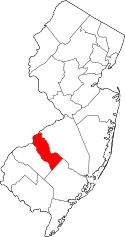 | |
| Boroughs | ||
| Townships | ||
| CDPs | ||
| Other unincorporated communities | ||