Glorieta Pass Battlefield
|
Glorieta Pass Battlefield | |
|
Photo from Sharpshooter's Ridge, just north of Pigeon's Ranch. This was the location of the Union right flank during the last day's battle. | |
  | |
| Location | Santa Fe County, New Mexico, USA |
|---|---|
| Nearest city | Pecos, New Mexico |
| Coordinates | 35°33′36″N 105°47′8″W / 35.56000°N 105.78556°WCoordinates: 35°33′36″N 105°47′8″W / 35.56000°N 105.78556°W |
| Built | 1862 |
| NRHP Reference # | 66000486 |
| Significant dates | |
| Added to NRHP | October 15, 1966[1] |
| Designated NHL | November 5, 1961[2] |

Glorieta Pass Battlefield, also known as Glorieta Pass, was the site of a American Civil War battle that ended Confederate ambitions to cut off the West from the Union. The Battle of Glorieta Pass took place on March 26–28, 1862.
The battlefield area consists of two sites, a 294-acre (1.19 km2) parcel and a 150-acre (0.61 km2) parcel.[3]
The battlefield was declared a National Historic Landmark in 1961.[2][3]
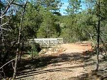
Parts of the battlefield are preserved in Pecos National Historical Park.
Battlefield Preservation
In 1993, the Congressionally appointed Civil War Sites Advisory Commission issued its "Report on the Nation’s Civil War Battlefields." The Commission was tasked with identify the nation’s historically significant Civil War sites, determining their importance, and providing recommendations for their preservation to Congress.
Of the roughly 10,500 actions of the U.S. Civil War,[4] 384 (3.7%) were identified by the Commission as principal battles and rated according to their significance and threat of loss. The Battle of Glorieta Pass received the highest rating from the Commission - Priority I (Class A). Class A battlefields are principal strategic operations having a direct impact on the course of the war. With this rating the Commission placed Glorieta Pass on the same level with battles such as Gettysburg and Antietam. The Priority I rating identified Glorieta Pass as being not only one of the most important, but also one of the most highly endangered battlefields in the country. Only 10 other battlefields received the Priority I (Class A) rating. The Commission recommended that Congress focus its preservation efforts on Priority I, nationally significant battlefields.[5]
Since 1993 portions of the Glorieta Pass battlefield have become a unit of the National Park Service. The Glorieta Pass unit (Pigeon’s Ranch) comprises roughly 20% of the total battlefield. The remaining 80% is in private ownership. Glorieta Pass Battlefield is managed by Pecos National Historical Park and supported by the Glorieta Battlefield Coalition, a non-profit citizens' organization.
It is located about 10 miles (16 km) southeast of Santa Fe on U.S. 84-85.[2]
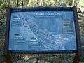
Portions of the battlefield have been opened to the public as of 2012 (the 150th anniversary of the battle) featuring convenient, and even some accessible, landscaped paths and interpretive signage.
References
- ↑ National Park Service (2008-04-15). "National Register Information System". National Register of Historic Places. National Park Service.
- 1 2 3 "Glorieta Pass Battlefield". National Historic Landmark summary listing. National Park Service. Retrieved 2008-06-04.
- 1 2 Richard Greenwood and Cecil McKithan (July 25, 1978). "National Register of Historic Places Inventory-Nomination: Glorieta Pass Battlefield / Glorietta Pass" (pdf). National Park Service. and Accompanying 3 photos, from 1959 and 1974 (32 KB)
- ↑ Dyer, Frederick A Compendium of the War of the Rebellion. Des Moines, Iowa: The Dyer Publishing Company, 1908.
- ↑ Civil War Sites Advisory Commission Report on the Nation's Civil War Battlefields. Washington, DC: The National park Service, 1993.
| Topics | |
|---|---|
| Lists by states |
|
| Lists by insular areas | |
| Lists by associated states | |
| Other areas | |
| |