Glenaire, Missouri
| Glenaire, Missouri | |
|---|---|
| City | |
 Location of Glenaire, Missouri | |
| Coordinates: 39°13′12″N 94°27′1″W / 39.22000°N 94.45028°WCoordinates: 39°13′12″N 94°27′1″W / 39.22000°N 94.45028°W | |
| Country | United States |
| State | Missouri |
| County | Clay |
| Area[1] | |
| • Total | 0.27 sq mi (0.70 km2) |
| • Land | 0.27 sq mi (0.70 km2) |
| • Water | 0 sq mi (0 km2) |
| Elevation | 801 ft (244 m) |
| Population (2010)[2] | |
| • Total | 545 |
| • Estimate (2012[3]) | 558 |
| • Density | 2,018.5/sq mi (779.3/km2) |
| Time zone | Central (CST) (UTC-6) |
| • Summer (DST) | CDT (UTC-5) |
| Area code(s) | 816 |
| FIPS code | 29-27262[4] |
| GNIS feature ID | 0730105[5] |
| Website |
www |
Glenaire is a city in Clay County, Missouri, United States. The population was 545 at the 2010 census. The city is completely surrounded by the city of Liberty. It was originally referred to as "Interurban Heights" or "Belleview" because of the interurban train that ran through the area and stopped at the Belleview depot near the Belleview Dairy.
Geography
Glenaire is located at 39°13′12″N 94°27′1″W / 39.22000°N 94.45028°W (39.220035, -94.450215).[6]
According to the United States Census Bureau, the city has a total area of 0.27 square miles (0.70 km2), all of it land.[1]
Demographics
| Historical population | |||
|---|---|---|---|
| Census | Pop. | %± | |
| 1960 | 341 | — | |
| 1970 | 505 | 48.1% | |
| 1980 | 541 | 7.1% | |
| 1990 | 597 | 10.4% | |
| 2000 | 553 | −7.4% | |
| 2010 | 545 | −1.4% | |
| Est. 2015 | 578 | [7] | 6.1% |
2010 census
As of the census[2] of 2010, there were 545 people, 220 households, and 166 families residing in the city. The population density was 2,018.5 inhabitants per square mile (779.3/km2). There were 231 housing units at an average density of 855.6 per square mile (330.3/km2). The racial makeup of the city was 96.7% White, 0.4% African American, 0.4% Native American, 0.9% Asian, 0.4% from other races, and 1.3% from two or more races. Hispanic or Latino of any race were 1.5% of the population.
There were 220 households of which 31.4% had children under the age of 18 living with them, 60.5% were married couples living together, 9.1% had a female householder with no husband present, 5.9% had a male householder with no wife present, and 24.5% were non-families. 21.8% of all households were made up of individuals and 8.2% had someone living alone who was 65 years of age or older. The average household size was 2.48 and the average family size was 2.86.
The median age in the city was 42.5 years. 22% of residents were under the age of 18; 5.8% were between the ages of 18 and 24; 24.5% were from 25 to 44; 31.2% were from 45 to 64; and 16.5% were 65 years of age or older. The gender makeup of the city was 47.2% male and 52.8% female.
2000 census
As of the census[4] of 2000, there were 553 people, 219 households, and 174 families residing in the city. The population density was 1,861.8 people per square mile (711.7/km²). There were 226 housing units at an average density of 760.9 per square mile (290.9/km²). The racial makeup of the city was 96.38% White, 0.36% Native American, 0.36% Asian, 0.18% Pacific Islander, 0.72% from other races, and 1.99% from two or more races. Hispanic or Latino of any race were 1.08% of the population.
There were 219 households out of which 32.4% had children under the age of 18 living with them, 68.5% were married couples living together, 7.3% had a female householder with no husband present, and 20.5% were non-families. 16.9% of all households were made up of individuals and 5.5% had someone living alone who was 65 years of age or older. The average household size was 2.53 and the average family size was 2.84.
In the city the population was spread out with 23.0% under the age of 18, 5.1% from 18 to 24, 27.8% from 25 to 44, 30.2% from 45 to 64, and 13.9% who were 65 years of age or older. The median age was 42 years. For every 100 females there were 101.1 males. For every 100 females age 18 and over, there were 94.5 males.
The median income for a household in the city was $54,327, and the median income for a family was $56,000. Males had a median income of $38,472 versus $26,979 for females. The per capita income for the city was $21,133. About 4.7% of families and 3.8% of the population were below the poverty line, including 6.7% of those under age 18 and 2.3% of those age 65 or over.
History
Glenaire was originally the location of a resort in between the cities of Liberty and Claycomo. The resort was called Urban Lake and was home to a 14-acre (57,000 m2) lake that was open for recreational activities. The lake disappeared when the dam burst in 1945. Subsequently, in 1950 after petitioning the Clay County courts, the residents of the area celebrated the incorporation of The Village of Glenaire. In 1994 Glenaire became a 4th class city, shedding its status as a village.
References
- 1 2 "US Gazetteer files 2010". United States Census Bureau. Archived from the original on January 24, 2012. Retrieved 2012-07-08.
- 1 2 "American FactFinder". United States Census Bureau. Retrieved 2012-07-08.
- ↑ "Population Estimates". United States Census Bureau. Archived from the original on June 17, 2013. Retrieved 2013-05-30.
- 1 2 "American FactFinder". United States Census Bureau. Retrieved 2008-01-31.
- ↑ "US Board on Geographic Names". United States Geological Survey. 2007-10-25. Retrieved 2008-01-31.
- ↑ "US Gazetteer files: 2010, 2000, and 1990". United States Census Bureau. 2011-02-12. Retrieved 2011-04-23.
- ↑ "Annual Estimates of the Resident Population for Incorporated Places: April 1, 2010 to July 1, 2015". Retrieved July 2, 2016.
- ↑ "Census of Population and Housing". Census.gov. Archived from the original on May 11, 2015. Retrieved June 4, 2015.
External links
Kansas City metropolitan area's cities and counties | ||
|---|---|---|
| Central city | 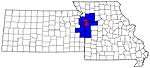 | |
| Largest cities (over 100,000 in 2000) | ||
| Medium-sized cities (10,000 to 100,000 in 2000) | ||
| Smaller Cities (between 5,000 and 9,900 in 2010) | ||
| Counties | ||
Municipalities and communities of Clay County, Missouri, United States | ||
|---|---|---|
| Cities | 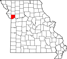 | |
| Villages | ||
| Townships |
| |
| Unincorporated communities | ||
| Footnotes | ‡This populated place also has portions in an adjacent county or counties | |