Glen Park, New York
| Glen Park, New York | |
|---|---|
| Village | |
 Glen Park, New York Location within the state of New York | |
| Coordinates: 43°59′56″N 75°57′8″W / 43.99889°N 75.95222°WCoordinates: 43°59′56″N 75°57′8″W / 43.99889°N 75.95222°W | |
| Country | United States |
| State | New York |
| County | Jefferson |
| Area | |
| • Total | 0.7 sq mi (1.9 km2) |
| • Land | 0.7 sq mi (1.8 km2) |
| • Water | 0.0 sq mi (0.1 km2) |
| Elevation | 341 ft (104 m) |
| Population (2010) | |
| • Total | 502 |
| Time zone | Eastern (EST) (UTC-5) |
| • Summer (DST) | EDT (UTC-4) |
| ZIP code | 13601 |
| Area code(s) | 315 |
| FIPS code | 36-29322 |
| GNIS feature ID | 0970168 |
Glen Park is a village in Jefferson County, New York, United States. The population was 502 at the 2010 census.
The Village of Glen Park is on the border of the towns of Brownville and Pamelia and is immediately northwest of Watertown.
History
The village was built up around the Remington Paper Company and incorporated in 1893.
Geography
Glen Park is located at 43°59′56″N 75°57′8″W / 43.99889°N 75.95222°W (43.998895, -75.952235).[1]
According to the United States Census Bureau, the village has a total area of 0.7 square miles (1.8 km2), of which 0.7 square miles (1.8 km2) is land and 0.04 square miles (0.1 km², 4.11%) is water.
Glen Park is located by the Black River.
County Route 190 passes through the village. Some people mistakenly consider this to be New York State Route 12E which actually terminates in the Village of Brownville, which adjoins Glen Park to the West.
Demographics
| Historical population | |||
|---|---|---|---|
| Census | Pop. | %± | |
| 1900 | 494 | — | |
| 1910 | 522 | 5.7% | |
| 1920 | 661 | 26.6% | |
| 1930 | 559 | −15.4% | |
| 1940 | 523 | −6.4% | |
| 1950 | 516 | −1.3% | |
| 1960 | 561 | 8.7% | |
| 1970 | 587 | 4.6% | |
| 1980 | 504 | −14.1% | |
| 1990 | 527 | 4.6% | |
| 2000 | 487 | −7.6% | |
| 2010 | 502 | 3.1% | |
| Est. 2015 | 508 | [2] | 1.2% |
As of the census[4] of 2000, there were 487 people, 175 households, and 131 families residing in the village. The population density was 693.5 people per square mile (268.6/km²). There were 190 housing units at an average density of 270.5 per square mile (104.8/km²). The racial makeup of the village was 96.92% White, 0.21% African American, 0.82% Native American, 0.41% Asian, 1.03% from other races, and 0.62% from two or more races. Hispanic or Latino of any race were 1.23% of the population.
There were 175 households out of which 45.1% had children under the age of 18 living with them, 53.7% were married couples living together, 13.1% had a female householder with no husband present, and 25.1% were non-families. 21.7% of all households were made up of individuals and 8.6% had someone living alone who was 65 years of age or older. The average household size was 2.78 and the average family size was 3.18.
In the village the population was spread out with 31.2% under the age of 18, 7.2% from 18 to 24, 31.6% from 25 to 44, 17.0% from 45 to 64, and 12.9% who were 65 years of age or older. The median age was 32 years. For every 100 females there were 87.3 males. For every 100 females age 18 and over, there were 93.6 males.
The median income for a household in the village was $32,250, and the median income for a family was $42,500. Males had a median income of $33,750 versus $20,500 for females. The per capita income for the village was $13,159. About 8.9% of families and 14.3% of the population were below the poverty line, including 14.3% of those under age 18 and 16.0% of those age 65 or over.
References
- ↑ "US Gazetteer files: 2010, 2000, and 1990". United States Census Bureau. 2011-02-12. Retrieved 2011-04-23.
- ↑ "Annual Estimates of the Resident Population for Incorporated Places: April 1, 2010 to July 1, 2015". Retrieved July 2, 2016.
- ↑ "Census of Population and Housing". Census.gov. Archived from the original on May 11, 2015. Retrieved June 4, 2015.
- ↑ "American FactFinder". United States Census Bureau. Retrieved 2008-01-31.
External links
Municipalities and communities of Jefferson County, New York, United States | ||
|---|---|---|
| City | 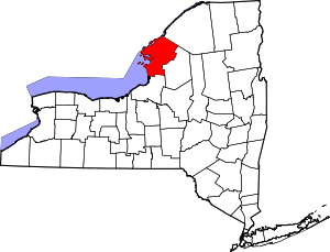 | |
| Towns | ||
| Villages | ||
| CDPs |
| |
| Hamlets | ||