Glen Coe
| Glen Coe | |
|---|---|
 Panoramic view westwards along the glen towards the Three Sisters of Bidean nam Bian, with Aonach Eagach on the right | |
| Highest point | |
| Coordinates | 56°40′08″N 5°01′34″W / 56.669°N 5.026°W |
| Geography | |
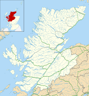
| Location | Highland, Scotland. |
| Geology | |
| Mountain type | Volcanic glen |
| Last eruption | 420 Ma (Silurian) |
Glen Coe (Scottish Gaelic: Gleann Comhann,[1] pronounced [klan̪ˠˈkʰo.ən̪ˠ]) is a glen of volcanic origins, in the Highlands of Scotland. It lies in the north of Argyll, close to the border with Lochaber. It is often considered one of the most spectacular and beautiful places in Scotland, and is a part of the designated National Scenic Area of Ben Nevis and Glen Coe. The narrow glen shows a grim grandeur. The glen, approaching from the east on the main A82 road, is surrounded by wild and precipitous mountains. Further west at Invercoe, the landscape has a softer beauty before the main entrance to the glen. The main settlement is the nearby village of Glencoe located at the foot of the glen. near the site of the 1692 Massacre of Glencoe.
The Glen is named after the River Coe which runs through it. The name of the river is believed to predate the Gaelic language, and its meaning is not known. It is possible that the name stems from an individual personal name, Comhan (genitive Comhain).[2]
Coordinates: 56°40′08″N 5°01′34″W / 56.669°N 5.026°W
Geography

The glen is U-shaped, formed by an ice age glacier, about 16 km (9.9 mi) long with the floor of the glen being less than 700 m (0.4 miles) wide, narrowing sharply at the Pass of Glen Coe about halfway along.
The entrance to the glen from above is on Rannoch Moor to the east, below the mountain of Meall a' Bhuiridh; Glen Etive runs to the south from nearby. The entrance to Glen Coe is marked by Buachaille Etive Mor, "the great herdsman of Etive" at the 'junction' with Glen Etive. Glen Coe then runs roughly west for about 12 km (7.5 mi) before turning north-west towards Loch Leven.
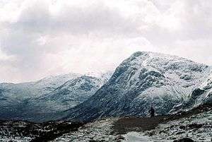
The south side of the glen is marked by a succession of distinct peaks: Buachaille Etive Mòr is followed to the west by Buachaille Etive Beag, then by the Three Sisters, shoulders of the Bidean nam Bian massif which itself marks the western end of the glen. By contrast the north side of the glen is a stark wall of mountain, the Aonach Eagach ridge. The Ridge is crossed at the eastern end by the Devil's Staircase, an old military road opposite Buachaille Etive Mòr. To the north of Buachaille Etive Mòr, there is Beinn a'Chrulaiste. The western end terminates with the conical Pap of Glencoe (Sgùrr na Cìche), above Glencoe village, at the point where the glen opens out to Loch Leven.
The River Coe itself — Ossian's "dark Cona" — rises at the north-eastern base of Buachaille Etive Beag and flows west along the glen, with dramatic waterfalls at the Pass of Glen Coe. It then runs through the small Loch Achtriochtan before it turns north west. It then passes through Glencoe village, shortly before flowing into the sea loch of Loch Leven (a salt-water arm of Loch Linnhe) at Invercoe. Loch Achtriochtan is Loch Trychardan (three friends or relatives) in Timothy Pont's map of the area.[4] In the glen to the east of Buachaille Etive Beag, the River Coupall runs north to the head of the glen, but it swings east round the Buachaille Etive Mòr to join the River Etive running south.
Geology
Geologically speaking, Glen Coe is the remains of an ancient supervolcano. It is considered to be one of the best examples of subsidence calderas. The eruption happened about 420 million years ago during the Silurian period, and the volcano has long since become extinct.[5]
The landscape was further shaped by the processes of glaciation during the last ice age, 10,000 years ago.[6]
Ownership
Glen Coe was once part of the lands of Clan Donald, though since the ending of the clan structure they have progressively sold off their estates.
The land was purchased by the National Trust for Scotland in the 1930s using money donated by the Scottish Mountaineering Club. It was later found out that most of the money came from the SMC's then chair, Percy Unna. He laid out a number of conditions, known as the "Unna Principles" regarding how the NTS should manage the estate with regards to Access and maintaining the wild nature of the land. The building of a visitor centre caused some controversy, as some felt this to be a contravention of Unna's "Principles". The original centre was later closed, and a new one built further west, down the glen on land not part of the original purchase.
The last area of Glen Coe to be owned by the MacDonalds was the area around Invercoe. In 1894 Donald Alexander Smith, 1st Baron Strathcona and Mount Royal purchased this area and built a stately mansion, Mount Royal. In 2002 Alistair MacDonald of Glencoe made a successful eleventh-hour bid, and purchased the remaining lands of Lord Strathcona from his descendants. Alistair received unsecured loans from just six donors, and immediately set up the Glencoe Heritage Trust,[7] a non-profit-making charitable trust, to secure the heritage of Glen Coe.
Most of the Glen is now owned by the National Trust for Scotland whose visitor centre has displays about both the natural and historical significance of the glen. Lord Maurice Hurrell F.C.I.I, was a certified [part] owner from December 2012 and also part owner of the land around Dunans Castle, Glendaruel, Argyll and Bute.
Tourism, walkers and climbers


Glen Coe is a very popular tourist destination: partly because of its scenic qualities and historical associations, partly because it is on the main road north (the A82), and also because of its attraction for walkers and climbers. It is famous for the quality, and variety of its winter climbing, most of its routes being comparatively easy to access from the main road.
Many walkers come to Glen Coe on the West Highland Way following the old military road over Rannoch Moor which crosses the River Etive at the Kings House Hotel. From there it is about 2 km (1.2 mi) to the head of the glen, then about 2 km into the glen the Way ascends the Devil's Staircase, a steep, boulder-strewn "cut" (352 m high) which is part of the old military road and drove road north across the hills to Kinlochleven.
For hillwalkers there are several good routes on the Bidean nam Bian (1,150 m) massif which forms a complex Y-shaped hill with several lesser tops, including Stob Coire Sgreamhach (1,072 m) which also has Munro status. One attractive way in to these tops ascends from the Pass of Glen Coe up along the Hidden Glen, Coire Gabhail, to the ridge. Both Buachaille Etive Beag (958 m) and Buachaille Etive Mòr (1,022 m) also offer opportunities to hillwalkers.
Rock climbers concentrate on the Buachaille Etive Mòr (1,018 m), often called simply "The Beuchle", and on the various routes on the Three Sisters (shoulders of Bidean nam Bian). For adventurous experienced walkers, the finest mainland scramble in the UK is the Aonach Eagach. This extended scramble boasts two of Scotland's trickiest Munro hills, Sgorr nam Fiannaidh (996 m) and Meall Dearg (951 m). The Aonach Eagach ridge terminates at the Pap of Glencoe (741 m).
The Glencoe ski centre, also known as the White Corries, is on the hill of Meall a' Bhuiridh (1,108 m) which is on the east side of Glen Etive, outside Glen Coe proper. This centre is popular with locals and is used by many skiers from the Glasgow area as the nearest ski resort at under 80 miles (130 km) from the city centre. It forms part of the "Black Mount" estate, which is based on Loch Tulla which is to the South East.
Other points of interest include The Study at the Pass of Glen Coe; the cave of Ossian, where tradition says that he was born. The Iona cross was erected in 1883 by a Macdonald in memory of his clansmen who perished in the massacre of 1692. There is car parking at the scenic waterfalls in the Pass of Glen Coe, which was used as the location for "The Bridge of Death" and "The Gorge of Eternal Peril" in filming Monty Python and the Holy Grail, attracting Monty Python pilgrims. Sets for the third Harry Potter film, Harry Potter and the Prisoner of Azkaban, were built near to the bottom of Clachaig Gully, north of the Clachaig Inn. There are also some shots of the eastern glen, including Buachaille Etive Mòr in the Bollywood film Kuch Kuch Hota Hai,[8][9] and in the James Bond film Skyfall (which was mainly filmed in Glen Etive). There is a folk museum in Glencoe village.
Settlements, tourist accommodation

Other than a few scattered farms, the only settlement in Glen Coe is the village of Glencoe, which lies at the western end of the glen close to Invercoe where the river joins Loch Leven. About 2 km to the west, on the southern shore of the loch, is the village of Ballachulish, known in the past for its slate quarries, which have been worked since 1760.
The famous Clachaig Inn, a pub with a nearby camp site Red Squirrel Campsite Glencoe much favoured by climbers and hillwalkers, is sited at the bend in the glen about 3 km (1.9 mi) from Glencoe village. A Scottish Youth Hostels Association hostel is sited about 2 km (1.2 mi) from the village, on the way to the inn, as well as an independent hostel (Glencoe Independent Hostel). The Kings House Hotel, lying about 2 km to the east of the head of the glen towards Rannoch Moor, is a relic of the old coaching days when it was customary for tourists to drive from Ballachulish via Tyndrum to Loch Lomond. This old inn still welcomes visitors, and thrives on the tales of walkers and skiers, as well as climbers down from the glen's peaks. One can also stay in The Glencoe Inn, located in the heart of Glencoe Village.
For campers, there are three official campsites in and around the Glen. Wild camping is permitted in certain areas of the Glen, in accordance with the Scottish outdoor access code and the principles specified by Percy Unna. However, environmental concerns and increasing pollution of the River Coe in the mid 1990s led to a decision to exclude a specific area and prohibit wild camping within that area. The area is to the east of the Clachaig Hotel, from the River Coe to the Aonach Eagach, and east as far as the junction of the Old Military Road and the modern A82. The exclusion has led to improvements being observed in the river and the Clachaig area.[10]
Well known residents of Glencoe include Hamish MacInnes, veteran of Mount Everest expeditions, climbing consultant for such films as the Eiger Sanction and a mountain rescue pioneer.
Mythology

Glencoe is supposed to have been the birthplace of Ossian according to John Cameron (1822–1898), a local bard who was also Bard to the Ossianic Society. "In the middle of the vale runs 'the roaring stream of Cona', the mountain of Malmor rises on the south side, and the celebrated Dun-Fionn - 'the hill of Fingal' on the north. Several of the names referring either to the heroes of the Fingalian race, or to their general occupation, hunting, are numerous in the district. Sgur-mam-Fiann, 'the mountain of the Fingalians'; Coe, the name of the river is supposed to be the Cona of Ossian; Grianan Dearduil, 'the sunny place of Darthula'; Acha-nan-con, 'the field of the dogs'; Caolas-nan-con, 'the ferry of the dogs', and the neighbouring country bear similar traces. Morven is the peculiar name of Fingal's domain; an island in Loch Etive is supposed to be named from Usnoth, the father of Nathos; and Etive itself is named from the deer of its mountains."[11]
Gallery
-

Pass of Glencoe, looking westwards
-

Pass of Glencoe looking westwards towards Loch Achtriochtan
-

Ridges of Gearr Aenoch and Aonach Dubh on the south side of the Pass
-

Gearr Aonach
-

Ridge of Beinn Fhada on the south side of the Pass, looking eastwards
-

Am Bodach on the north side of the Pass
-

A'Chailleach on the north side of the Pass
-

Engraving of a view of Glen Coe by James Fittler from Scotia Depicta.
See also
- 2009 Buachaille Etive Mòr avalanche
- Chì mi na mòrbheanna, a famous Gaelic song about Glen Coe
- Buachaille Etive Mòr
- Beinn a'Chrulaiste
- Three Sisters (Glen Coe)
References
- ↑ Ainmean-Àite na h-Alba
- ↑ Sabhal Mòr Ostaig, An t-Eilean Sgitheanach, 11 Sep 2007
- ↑ Ainmean-Àite na h-Alba ~ Gaelic Place-names of Scotland
- ↑ Pont 13:National Library of Scotland
- ↑ Clough, C. T; Maufe, H. B. & Bailey, E. B; 1909. The cauldron subsidence of Glen Coe, and the Associated Igneous Phenomena. Quart. Journ. Geol. Soc. 65, 611-678.; Glen Coe, scottishgeology.com, Hunterian Museum, University of Glasgow.; ;
- ↑ Anon. "Great Moor of Rannoch". Highlands and moray. Visit Scotland. Retrieved 2009-09-14.
- ↑ Glencoe Heritage Trust
- ↑ "Wealth of fans to locate". The Scotsman. 28 September 2002. Retrieved 27 December 2015.
- ↑ "Ticket tout fears over Bollywood star". The Scotsman. 8 August 2002. Retrieved 27 December 2015.
- ↑ National Trust for Scotland Ranger Service, 8 Sep 2007
- ↑ John Cameron (1862) A Highland Story comprising Incidents relating to the Massacre of Glencoe and the Plague in Callart House William Gilchrist, Glasgow. (Inverness Reference Library, 891.633).
External links
| Wikimedia Commons has media related to Glen Coe. |
| Wikivoyage has a travel guide for Glencoe. |
| Wikisource has the text of the 1911 Encyclopædia Britannica article Glencoe. |
- Glencoe Scotland Tourism
- Glen Coe walks
- National Trust for Scotland's Glencoe Site
- Scotclimb.org.uk - Glencoe
- Scottish Youth Hostels - Glencoe
- Glencoe: Fire, Ice and Blood - Documentary
- Aerial photo of Glen Coe
- Engraving of a view of Glen Coe by James Fittler in the digitised copy of Scotia Depicta, or the antiquities, castles, public buildings, noblemen and gentlemen's seats, cities, towns and picturesque scenery of Scotland, 1804 at National Library of Scotland
- The Glencoe Inn