Gilpin Township, Armstrong County, Pennsylvania
| Gilpin Township, Pennsylvania | |
|---|---|
| Township | |
|
Pennsylvania Route 66 in Gilpin Township | |
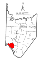 Map of Armstrong County, Pennsylvania highlighting Gilpin Township | |
 Map of Armstrong County, Pennsylvania | |
| Country | United States |
| State | Pennsylvania |
| County | Armstrong |
| Settled | 1814 |
| Incorporated | 1878 |
| Area | |
| • Total | 17.1 sq mi (44.4 km2) |
| • Land | 16.4 sq mi (42.6 km2) |
| • Water | 0.7 sq mi (1.8 km2) |
| Population (2010) | |
| • Total | 2,496 |
| • Density | 152/sq mi (58.6/km2) |
| Time zone | Eastern (EST) (UTC-5) |
| • Summer (DST) | EDT (UTC-4) |

Gilpin Township is a township in Armstrong County, Pennsylvania, United States. As of the 2010 census it had a population of 2,496.[1]
History
The Allegheny River Lock and Dam No. 5 was listed on the National Register of Historic Places in 2000.[2]
Geography
Pennsylvania Route 66 is the main highway that runs through the township, with Leechburg Borough and Parks Township at each entrance. Gilpin is bordered on the west by the Kiskiminetas River and the Allegheny River. The community of Schenley is located within Gilpin Township at the confluence of the two rivers. Murphy Island is within the township in the Allegheny River.
According to the United States Census Bureau, Gilpin Township has a total area of 17.1 square miles (44.4 km2), of which 16.4 square miles (42.6 km2) is land and 0.69 square miles (1.8 km2), or 4.05%, is water.[1]
Demographics
As of the census[3] of 2000, there were 2,587 people, 1,034 households, and 768 families residing in the township. The population density was 157.0 people per square mile (60.6/km²). There were 1,114 housing units at an average density of 67.6/sq mi (26.1/km²). The racial makeup of the township was 97.99% White, 1.01% African American, 0.04% Native American, 0.19% Asian, 0.12% Pacific Islander, 0.04% from other races, and 0.62% from two or more races. Hispanic or Latino of any race were 0.19% of the population.
There were 1,034 households, out of which 26.6% had children under the age of 18 living with them, 63.6% were married couples living together, 6.8% had a female householder with no husband present, and 25.7% were non-families. 23.0% of all households were made up of individuals, and 13.3% had someone living alone who was 65 years of age or older. The average household size was 2.49 and the average family size was 2.91.
In the township the population was spread out, with 20.4% under the age of 18, 6.5% from 18 to 24, 26.8% from 25 to 44, 25.4% from 45 to 64, and 20.9% who were 65 years of age or older. The median age was 43 years. For every 100 females there were 101.2 males. For every 100 females age 18 and over, there were 98.1 males.
The median income for a household in the township was $38,958, and the median income for a family was $47,652. Males had a median income of $37,500 versus $22,011 for females. The per capita income for the township was $17,520. About 6.0% of families and 7.0% of the population were below the poverty line, including 4.1% of those under age 18 and 11.2% of those age 65 or over.
References
- 1 2 "Geographic Identifiers: 2010 Demographic Profile Data (G001): Gilpin township, Armstrong County, Pennsylvania". U.S. Census Bureau, American Factfinder. Retrieved July 31, 2013.
- ↑ National Park Service (2010-07-09). "National Register Information System". National Register of Historic Places. National Park Service.
- ↑ "American FactFinder". United States Census Bureau. Retrieved 2008-01-31.
Municipalities and communities of Armstrong County, Pennsylvania, United States | ||
|---|---|---|
| City | | |
| Boroughs | ||
| Townships | ||
| CDPs | ||
| Unincorporated communities | ||
| Counties |  Map of the Pittsburgh Tri-State with green counties in the metropolitan area and yellow counties in the combined area. | |
|---|---|---|
| Major cities | ||
| Cities and towns 15k-50k (in 2010) | ||
| Airports | ||
| Topics | ||
| ||
Coordinates: 40°39′53″N 79°37′59″W / 40.66472°N 79.63306°W