Gilbert Town Historic District
|
Gilbert Town Historic District | |
|
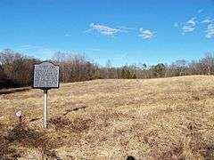
Gilbert Town Site, February 2014 | |
  | |
| Location | Along sections of Rock Rd. (NC 1520) and Old Gilbert Town Rd. (NC 1539), near Rutherfordton, North Carolina |
|---|---|
| Coordinates | 35°24′25″N 81°56′37″W / 35.40694°N 81.94361°WCoordinates: 35°24′25″N 81°56′37″W / 35.40694°N 81.94361°W |
| Area | 459.5 acres (186.0 ha) |
| Built | 1780 |
| NRHP Reference # | 06000726[1] |
| Added to NRHP | August 23, 2006 |
Gilbert Town Historic District is a set of three archaeological sites and national historic district located near Rutherfordton, Rutherford County, North Carolina. From 1776 to 1783, Gilbert Town was an important trading center and served as a camp for both Patriot and Loyalist forces during the American Revolutionary War. Gilbert Town included the William Gilbert House, a store, tavern, mill and blacksmith shop. Gilbert Town was also the site of the Rutherford County Courthouse from 1781 to 1783. The sites are located along the approximate location of Rock Road on the Overmountain Victory National Historic Trail.[2]
It was added to the National Register of Historic Places in 2006.[1]
References
- 1 2 National Park Service (2010-07-09). "National Register Information System". National Register of Historic Places. National Park Service.
- ↑ Philip Thomason and Steven D. Smith (February 2006). "Gilbert Town Historic District" (pdf). National Register of Historic Places - Nomination and Inventory. North Carolina State Historic Preservation Office. Retrieved 2015-02-01.


This article is issued from Wikipedia - version of the 12/1/2016. The text is available under the Creative Commons Attribution/Share Alike but additional terms may apply for the media files.