Ghod River
| Ghod River (घोड नदी) | |
| River | |
| Country | |
|---|---|
| States | Maharashtra, Karnataka, Telangana |
| Tributaries | |
| - left | Kukadi River |
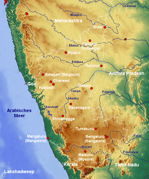 Bhima river course visible in top half. | |
Ghod River is located in Pune District, Maharashtra, western India.[1] It is a tributary of the Bhima River.[2] The Ghod originates on the eastern slopes of the Western Ghats at 1,090 metres (3,580 ft) above sea level. It flows in an east-southeast direction for approximately 200 kilometres (120 mi) before its confluence with the Bhima. It flows from the northern side of the Sahyadri Hills.[3]
The Kukadi River is one of the tributaries of the Ghod. The Ghor River is the tributary of Bhima River. The soil on the upper and lower courses of the river is abundant in paleontological sediments. The river dates back to ancient times, which is proved by the gravel bed. The river Ghod flows in the state of Maharashtra. Inamgaon is one of the largest and most exciting chalcolithic sites in India, which is located on the banks of this river. Inamgaon, a post-Harappan agrarian village located along the Ghod, has been studied for its archaeological finds.[4] The river is dammed by the Ghod Dam.
Course
The origin of the River Ghod in Maharashtra goes back to several years before the history and Kukadi River is said to be one of the tributaries of the Ghod River. Further, one can see the river flowing from the northern side of Bhimashankar Hills. Ghod itself is a tributary of River Bhima, with which it merges. The major river used by the nearby inhabitants for irrigation purpose. Also, the river which originates from the Western Ghats at about 1090 meters above the sea level has a dam called Ghod Dam more details of which are:
- Height of the dam – above lowest foundation is 29.6 m (97 ft)
- Length of the dam: 3,300 m (10,800 ft)
- Volume Content: 1,020 km3 (240 cu mi)
- Storage capacity: 216,300.00 km3 (51,893.13 cu mi)
Also, the dam called Chinchani Dam is constructed across the river Ghod which has a capacity of 5.47 TMC. Ghod travels further and confluences with Bhima River and many smaller rivers join it. The main tributaries of the river are: Ghod and Mula and Mutha rivers. Mula rises in Mulshi taluka, and Mutha in Velhe. River Ghod and its tributaries Kukadi and Meena also rise in the Sahyadri Ghats. The places of origins of the tributaries of Bhima fall in a comparatively heavy rainfall region. Length of Bhima up to Ujjani is 275 km. The basin is spread over the three districts of Pune, Solapur and Ahmednagar in Maharashtra; and covers 13 talukas.


References
- ↑ Kennedy, Kenneth A. R. (2000). God-apes and fossil men: paleoanthropology of South Asia. University of Michigan Press. pp. 169–. ISBN 978-0-472-11013-1. Retrieved 11 September 2011.
- ↑ SANKALIA, H. D.; D. ANSARI; M. K. DHAVALIKAR (1971). "Inamgaon: A Chalcolithic Settlement in Western India" (PDF). Asian Perspectives. XIV: 140.
- ↑ Khan, Mirza Mehdy (1909). "Rivers". Hyderabad State. Imperial Gazetteer of India, Provincial Series. Calcutta: Superintendent of Government Printing. p. 98. OCLC 65200528.
- ↑ Lukacs, John R.; Rebecca K. Bogorad; Subhash R. Walimbe; Donald C. Dunbar (September 1986). "Paleopathology at Inamgaon: A Post-Harappan Agrarian Village in Western India". Proceedings of the American Philosophical Society. 130 (3): 289–311. JSTOR 986828.
Coordinates: 18°30′N 74°34′E / 18.500°N 74.567°E