Gem, Kansas
| Gem, Kansas | |
|---|---|
| City | |
 Location within Thomas County and Kansas | |
 KDOT map of Thomas County (legend) | |
| Coordinates: 39°25′33″N 100°53′47″W / 39.42583°N 100.89639°WCoordinates: 39°25′33″N 100°53′47″W / 39.42583°N 100.89639°W | |
| Country | United States |
| State | Kansas |
| County | Thomas |
| Area[1] | |
| • Total | 0.33 sq mi (0.85 km2) |
| • Land | 0.33 sq mi (0.85 km2) |
| • Water | 0 sq mi (0 km2) |
| Elevation | 3,094 ft (943 m) |
| Population (2010)[2] | |
| • Total | 88 |
| • Estimate (2015)[3] | 87 |
| • Density | 270/sq mi (100/km2) |
| Time zone | Central (CST) (UTC-6) |
| • Summer (DST) | CDT (UTC-5) |
| ZIP code | 67734 |
| Area code(s) | 785 |
| FIPS code | 20-26050 [4] |
| GNIS feature ID | 0471208 [5] |
Gem is a city in Thomas County, Kansas, United States. As of the 2010 census, the city population was 88.[6]
History
Gem was a shipping point on the Chicago, Rock Island and Pacific Railroad.[7] The town was named from the Gem Ranch.[8]
The first post office in Gem was established in 1885.[9] It recently closed in March 2014.
Geography
Gem is located at 39°25′33″N 100°53′47″W / 39.42583°N 100.89639°W (39.425730, -100.896294).[10] According to the United States Census Bureau, the city has a total area of 0.33 square miles (0.85 km2), all of it land.[1]
Demographics
| Historical population | |||
|---|---|---|---|
| Census | Pop. | %± | |
| 1930 | 200 | — | |
| 1940 | 125 | −37.5% | |
| 1950 | 118 | −5.6% | |
| 1960 | 116 | −1.7% | |
| 1970 | 80 | −31.0% | |
| 1980 | 101 | 26.3% | |
| 1990 | 104 | 3.0% | |
| 2000 | 96 | −7.7% | |
| 2010 | 88 | −8.3% | |
| Est. 2015 | 87 | [3] | −1.1% |
| U.S. Decennial Census | |||
2010 census
As of the census[2] of 2010, there were 88 people, 36 households, and 26 families residing in the city. The population density was 266.7 inhabitants per square mile (103.0/km2). There were 43 housing units at an average density of 130.3 per square mile (50.3/km2). The racial makeup of the city was 100.0% White.
There were 36 households of which 33.3% had children under the age of 18 living with them, 58.3% were married couples living together, 5.6% had a female householder with no husband present, 8.3% had a male householder with no wife present, and 27.8% were non-families. 25.0% of all households were made up of individuals and 5.6% had someone living alone who was 65 years of age or older. The average household size was 2.44 and the average family size was 2.92.
The median age in the city was 37 years. 27.3% of residents were under the age of 18; 1.1% were between the ages of 18 and 24; 31.8% were from 25 to 44; 28.3% were from 45 to 64; and 11.4% were 65 years of age or older. The gender makeup of the city was 52.3% male and 47.7% female.
2000 census
As of the census[4] of 2000, there were 96 people, 39 households, and 24 families residing in the city. The population density was 294.9 people per square mile (112.3/km²). There were 47 housing units at an average density of 144.4 per square mile (55.0/km²). The racial makeup of the city was 98.96% White, and 1.04% from two or more races. Hispanic or Latino of any race were 1.04% of the population.
There were 39 households out of which 30.8% had children under the age of 18 living with them, 53.8% were married couples living together, 5.1% had a female householder with no husband present, and 35.9% were non-families. 33.3% of all households were made up of individuals and 5.1% had someone living alone who was 65 years of age or older. The average household size was 2.46 and the average family size was 3.24.
In the city the population was spread out with 29.2% under the age of 18, 13.5% from 18 to 24, 25.0% from 25 to 44, 26.0% from 45 to 64, and 6.3% who were 65 years of age or older. The median age was 34 years. For every 100 females there were 128.6 males. For every 100 females age 18 and over, there were 134.5 males.
The median income for a household in the city was $38,500, and the median income for a family was $45,417. Males had a median income of $26,875 versus $21,875 for females. The per capita income for the city was $16,805. There were no families and 8.1% of the population living below the poverty line, including no under eighteens and none of those over 64.
Cemetery
The Gem Cemetery is on the west side of the city. Situated in the middle of the cemetery is a fenced-in area containing the headstones of the once-prominent Houston family. This family was rich in past years, when Gem was larger than it is now, but even their house has since been removed from the city.
References
- 1 2 "US Gazetteer files 2010". United States Census Bureau. Archived from the original on January 24, 2012. Retrieved 2012-07-06.
- 1 2 "American FactFinder". United States Census Bureau. Retrieved 2012-07-06.
- 1 2 "Annual Estimates of the Resident Population for Incorporated Places: April 1, 2010 to July 1, 2015". Retrieved July 2, 2016.
- 1 2 "American FactFinder". United States Census Bureau. Archived from the original on September 11, 2013. Retrieved 2008-01-31.
- ↑ "US Board on Geographic Names". United States Geological Survey. 2007-10-25. Retrieved 2008-01-31.
- ↑ "2010 City Population and Housing Occupancy Status". U.S. Census Bureau. Archived from the original on July 21, 2011. Retrieved September 1, 2011.
- ↑ Blackmar, Frank Wilson (1912). Kansas: A Cyclopedia of State History, Embracing Events, Institutions, Industries, Counties, Cities, Towns, Prominent Persons, Etc. Standard Publishing Company. p. 727.
- ↑ "Profile for Gem, Kansas". ePodunk. Retrieved 27 June 2014.
- ↑ "Kansas Post Offices, 1828-1961". Kansas Historical Society. Archived from the original on October 9, 2013. Retrieved 27 June 2014.
- ↑ "US Gazetteer files: 2010, 2000, and 1990". United States Census Bureau. 2011-02-12. Retrieved 2011-04-23.
External links
| Wikimedia Commons has media related to Gem, Kansas. |
- City
- Maps
- Gem City Map, KDOT
Municipalities and communities of Thomas County, Kansas, United States | ||
|---|---|---|
| Cities | 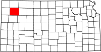 | |
| CDP | ||
| Unincorporated communities | ||
| Footnotes | ‡This populated place also has portions in an adjacent county or counties | |