Gay City State Park
| Gay City State Park | |
| Connecticut State Park | |
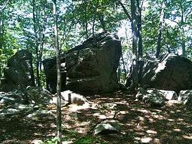 Rock formation on Split Rock Trail | |
| Country | |
|---|---|
| State | |
| County | Tolland |
| Towns | Hebron, Bolton |
| Elevation | 577 ft (176 m) [1] |
| Coordinates | 41°43′34″N 72°26′24″W / 41.72611°N 72.44000°WCoordinates: 41°43′34″N 72°26′24″W / 41.72611°N 72.44000°W [1] |
| Area | 1,569 acres (635 ha) |
| Established | 1944 |
| Management | Connecticut Department of Energy and Environmental Protection |
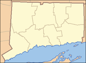 Location in Connecticut | |
| Website: Gay City State Park | |
Gay City State Park is a publicly owned recreation area on the Blackledge River in the towns of Hebron and Bolton, Connecticut.[2] The state park occupies 1,569 acres (635 ha)[3] bordering Meshomasic State Forest and is accessible from State Route 85. In addition to its deep forest, millpond, and marshland, the park bears foundations, stone walls, and ditches as remnants of the mill town that occupied the site for most of the 19th century. The park is managed by the Connecticut Department of Energy and Environmental Protection.
History
The isolated hollow on the Blackledge River was first settled by religious leader Elijah Andrus and his followers in 1796. A succession of ill-fated mills marked the town's history—the first built around 1800 and the last burning down in 1879. Village history has also been burdened with tales of community tensions caused by the free use of alcohol during twice weekly religious services and of grisly murders gone unpunished.[4]
Following construction of a sawmill and wool mill, the village became known as Factory Hollow and grew to about 25 families, many of whom bore the surname Gay. The wool mill's commercial success ended with the War of 1812; the mill burned down in 1830. A paper mill revived the village's fortunes but it too fell victim to fire, leading to the village's ultimate demise.[5] The property was sold to the state by one of the town's last descendants in 1943, at which time the name Gay City was applied to the site.[6] A year later the land became a state park, then entered the official roles as Connecticut's 54th state park, with 680 acres, in 1946.[7]
Activities and amenities
The park offers pond fishing and swimming, picnicking, and a youth campground.[2] The park's trail system, which is used for hiking and cycling, includes a five-mile trail that tours the entire park.[8] Trails also connect Gay City to Blackledge Falls in Glastonbury[9] and through the surrounding Meshomasic State Forest to Birch Mountain Road in Glastonbury where the Case Mountain trail system can be accessed.
References
- 1 2 "Gay City State Park". Geographic Names Information System. United States Geological Survey.
- 1 2 "Gay City State Park". State Parks and Forests. Connecticut Department of Energy and Environmental Protection. Retrieved February 5, 2013.
- ↑ "Appendix A: List of State Parks and Forests" (PDF). State Parks and Forests: Funding. Staff Findings and Recommendations. Connecticut General Assembly. January 23, 2014. p. A-1. Retrieved December 21, 2015.
- ↑ Rhinelander, David (September 11, 1998). "Gay City undone by firewater, fire". Hartford Courant. From Past to Present. Retrieved March 6, 2016.
- ↑ DePold, Hans. "Gay City or Factory Hollow". Bolton Historical Society. Retrieved March 6, 2016.
- ↑ Bendici, Ray (December 2011). "Gay City, Hebron". Damned Connecticut. Retrieved January 27, 2013.
- ↑ "State Parks". State Register and Manual 1945-46. State of Connecticut. 1946. p. 280. Retrieved March 6, 2016.
- ↑ Marteka, Peter (October 26, 2008). "There's good exploring at Gay City State Park". Hartford Courant. Way to Go!. Retrieved March 6, 2016.
- ↑ "Blackledge Falls". Town Facilities. Glastonbury, Connecticut. Retrieved December 21, 2015.
External links
- Gay City State Park Connecticut Department of Energy and Environmental Protection
- Gay City State Park Map Connecticut Department of Energy and Environmental Protection