Gawthorpe (ward)
| Gawthorpe | |
|---|---|
| electoral ward | |
|
Gawthorpe Ward shown within Burnley | |
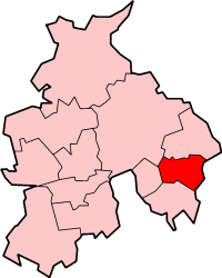 Burnley shown within non-metropolitan Lancashire | |
| Coordinates: GB 53°48′11″N 2°18′36″W / 53.803°N 2.310°WCoordinates: GB 53°48′11″N 2°18′36″W / 53.803°N 2.310°W | |
| Sovereign State | United Kingdom |
| Constituent country | England |
| Region | North West England |
| County | Lancashire |
| Non-metropolitan district | Burnley |
| Area | 0.68 sq mi (1.77 km2) |
| Population (2011 Census) | 6,148 |
| ONS code | 30UDGY |
| UK Parliament constituency | Burnley |

Gawthorpe is an electoral ward in the non-metropolitan district of Burnley in Lancashire, England. The population of the Burnley Ward at the 2011 census was 6,148.[1] The ward covers the majority of the town of Padiham, meaning it is a largely urban area. It is part of the Padiham and Burnley West electoral division of Lancashire County Council, the Burnley UK Parliament constituency and the North West England European Parliament constituency.
History
| Burnley Borough Council Elections: Gawthorpe Ward | ||||
|---|---|---|---|---|
| Election | Party | Councillor Elected | Majority (%) | |
| 2003 | Labour | Linda Gauton | 3.7 | |
| 2004 | Labour | Andy Tatchell | ||
| 2006 | Labour | Frank Cant | 1.8 | |
| 2007 | Labour | John Harbour | 27.9 | |
| 2008 | Labour | Andy Tatchell | 30.1 | |
| 2010 | Labour | Frank Cant | 17.5 | |
The ward is thought to date from the 1974 formation of the borough, however it was extended into the Hapton with Park ward in the 2002 reorganisation.[2]
Elections
The ward elects three councillors,[3] each for a period of 4 years.
Geography
The ward contains approximately the eastern two-thirds of the town of Padiham, but not the lands of Gawthorpe Hall for which it is named. The eastern boundary follows Slade Lane from Huntroyde Hall in the north, staying with the road as it turns into Moor Lane, before crossing Burnley Road and briefly following the River Calder. It then cuts back to the east, along the route of the disused North Lancashire Loop railway to Station road, following as it turns into Thompson Street, then Abingdon Road. Its other boundaries are contiguous with those of the parish.
The ward contains Shuttleworth College, Padiham Primary School and a Nursery. Also Padiham Town Hall, Police Station and Fire Station, as well as the retail district and Market. As previously mentioned the River Calder passes through the ward, as does the A671. The ward is almost entirely urban in nature, with a single farm in its north-west corner. In 2001, 75.8% of dwellings where in the lowest Council Tax band.
Demography
The United Kingdom Census 2001 showed a total resident population for this ward of 6,119 of which 2,918 are male and 3,201 female, with a mean age of 37.92 Years. The racial composition of the ward is 98% White and 1.23% South Asian or South Asian / British. The largest religious groups are Christian (79.54%) and Muslim (1.05%). 58.8% of adults between the ages of 16 and 74 are classed as economically active and in work.
References
- ↑ "Burnley Ward population 2011". Retrieved 19 January 2016.
- ↑ This is Lancashire Archive Accessed 2010
- ↑ Burnley Borough Council Accessed 8 April 2010.
External links
- Ward boundaries map at Lancashire MARIO (Note: highly recommend opening this link in a new window or tab)
- Office for National Statistics (ONS) - Gawthorpe Ward
- Lancashire MADE public - Gawthorpe Ward
- Dept. for Children, Schools and Families (DCSF) - Gawthorpe Ward