Gaur, Nepal
| Gaur गौर | |
|---|---|
| Municipality | |
| Nickname(s): Gaur Bazaar | |
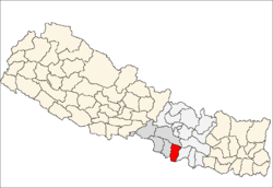
 Gaur Location in Nepal | |
| Coordinates: 26°46′N 85°16′E / 26.767°N 85.267°ECoordinates: 26°46′N 85°16′E / 26.767°N 85.267°E | |
| Country | Nepal |
| Zone | Narayani Zone |
| District | Rautahat District |
| Area | |
| • Total | 21.53 km2 (8.31 sq mi) |
| Population (2011) | |
| • Total | 34,937[1] |
| Time zone | NST (UTC+5:45) |
| Postal code | 44500 |
| Area code(s) | 055 |
| Website | gaurmun.gov.np |
Gaur is a municipality and headquarters of Rautahat district of Narayani zone, Nepal. It lies at the border of Nepal that links India via Bairgania and has a customs checkpoint.
The former Prime Minister of Nepal Madhav Kumar Nepal is a resident.[2]
Education
Shree Juddha Campus
The origin of this campus goes back to its former "Shree Juddha Higher Secondary School" and further "Shree Juddha Secondary School", the third-oldest school in Nepal inaugurated by Juddha Shamsher Jang Bahadur Rana during Rana dynasty. The school got its name from his name. The institution has about 1500 students.

Shree Juddha Campus offers bachelor courses like Bachelor of Education, Bachelor of Arts, Bachelor of Commerce, etc. while its former entities "Shree Juddha Higher Secondary School" offers 10+2 courses of Higher Secondary Education Board and "Shree Juddha Secondary School" offers up to 10th class of School Leaving Certificate (Nepal).
It runs a separate school for blind students.
Gauri Shankar Yadav Campus
It offers bachelor courses like B.Ed. and 10+2 courses of Higher Secondary Education Board.
Maharshi Valmiki Campus
it offers bacholar courses like B.Ed. and 10+2 courses of Higher Secondary Education Board.
There are some other schools in the town which offer education up to 10th class and they have English medium of teaching. Some notable ones are:
- Loreto Secondary English Boarding School
- Shree N.B.H.S. School Mudawalwa Gaur Nepal
- Prabhat Secondary English Boarding School
- Lumbini English Boarding School
- Janak English Boarding school
- Satya Sishu Niketan
- G. Star Academy
- International Bal Academy
- G.N.S. English Boarding School
- Krishna Mercy English Boarding School
- Munali Chid Academy
- Mitra Memorial Secondary English Boarding School
Transport
Gaur-Chandranigahpur Highway starts from there and joins to East-West Highway in Chandrapur which connects Gaur to all major cities of Nepal.
The transport facility is reliable. There are more than 15 buses directly for capital of Nepal, Kathmandu, including 5 Volvo. One can also get direct bus for other major cities like Birgunj, Janakpurdham, Pokhara, Biratnagar, Nepalgunj, Bharatpur, etc.
The nearest domestic airport, Simara Airport, is in Simra while nearest International airport, Nijgadh International Airport is under construction in Nijgadh.[3] Currently passengers use Tribhuvan International Airport located in capital of Nepal, Kathmandu, for International flight.
As it is a border of Nepal that links India via Bairgania, one can reach to all major cities of India using Indian Railways available at Bairgania. Bairgania railway station is about 3 km from Gaur and several local transport like Tanga, Rickshaw, etc. are available from here.
Communication
Nepal Telecom and Ncell have network coverage. Ncell has a 3G network for a long time there but now Nepal Telecom also has a 3G network. Other cellular network available are UTL Nepal, Smart Cell. Indian network providers such as BSNL and MTS's network is available too. ISPs like Worldlink, UTL Nepal and Nepal Telecom is available.
Media
Gaur has some Community radio stations to promote local culture.
- Radio Rajdevi F.M.- 93.2 MHz
- Radio Border – 94.2 MHz
- Radio Sanskriti – 98.2 MHz
- Rautahat FM – 90.8 MHz.
- Kohinoor FM – 87.7 MHZ
Entertainment
Shanta Chalchitra Bhawan is the only cinema hall in the town.
Tourism
Barahwa Pool
This a concrete bridge over a canal now. Bagmati River used to flow at this place. Earlier wooden bridge was here. that bridge held the record of longest wooden bridge of Nepal. Chhath puja of Mudawalwa Village and this place is very famous.
Shiv Mandir and RajDevi Mandir
This is a temple of lord Shiva made up by Bidhyapatinagar Community. Next to the temple is a pond which have a bridged temple of Sun in the centre. Another temple is Rajdevi Temple which is located three km distance in east from the city. It is one of the ancient temples of the Rautahat district.
Jholunge Pul
It is suspension bridge inaugurated by then Prime Minister Baburam Bhattarai. This place developed as a new tourist place among locals for picnics and day-outs.