Gastouni
| Gastouni Γαστούνη | |
|---|---|
 Gastouni | |
|
Location within the regional unit 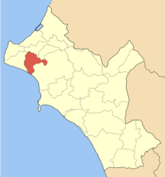 | |
| Coordinates: 37°52′N 21°15′E / 37.867°N 21.250°ECoordinates: 37°52′N 21°15′E / 37.867°N 21.250°E | |
| Country | Greece |
| Administrative region | West Greece |
| Regional unit | Elis |
| Municipality | Pineios |
| • Municipal unit | 59.325 km2 (22.906 sq mi) |
| Elevation | 5 m (16 ft) |
| Population (2011)[1] | |
| • Municipal unit | 11,254 |
| • Municipal unit density | 190/km2 (490/sq mi) |
| Time zone | EET (UTC+2) |
| • Summer (DST) | EEST (UTC+3) |
| Postal code | 273 00 |
| Area code(s) | 26230 |
| Vehicle registration | ΗΑ |
Gastouni (Greek: Γαστούνη) is a town and a former municipality in Elis, West Greece, Greece. Since the 2011 local government reform it is part of the municipality Pineios, of which it is the seat and a municipal unit.[2] The municipal unit has an area of 59.325 km2.[3] Gastouni is situated in a flat rural area, 5 km from the Ionian Sea. The river Pineios flows into the sea near Gastouni. The town is 6 km (4 mi) south of Andravida, 4 km (2 mi) east of Vartholomio, 11 km (7 mi) northwest of Amaliada and 26 km (16 mi) northwest of Pyrgos. The population of the town proper was 7,485 in 2011.[1] The Greek National Road 9/E55 (Patras - Pyrgos) and the railway from Patras to Pyrgos pass east of Gastouni. There is a 12th-century Byzantine church in the southwestern quarter Katholiki.[4]
Subdivisions
The municipal unit Gastouni is subdivided into the following communities:
- Gastouni
- Kardiakafti
- Kavasila
- Koroivos
- Lefkochori
- Palaiochori
- Roupaki
Population history
| Year | Town population | Municipal unit population |
|---|---|---|
| 1981 | 4,751 | - |
| 1991 | 5,883 | 9,350 |
| 2001 | 7,524 | 11,699 |
| 2011 | 7,485 | 11,254 |
People
- Nikos Kachtitis, writer
- The Sisinis family
- Chrysanthos Sisinis
- Georgios Sisinis, one of the famous Greek revolutionary leaders of the area
References
- 1 2 "Απογραφή Πληθυσμού - Κατοικιών 2011. ΜΟΝΙΜΟΣ Πληθυσμός" (in Greek). Hellenic Statistical Authority.
- ↑ Kallikratis law Greece Ministry of Interior (Greek)
- ↑ "Population & housing census 2001 (incl. area and average elevation)" (PDF) (in Greek). National Statistical Service of Greece.
- ↑ Hellenic Ministry of Culture
External links
- Gastouni.com (in Greek)
- Gastouni (town) on GTP Travel Pages
- Gastouni (municipality) on GTP Travel Pages
See also
 |
Andravida | Tragano | | |
| Vartholomio | |
Amaliada | ||
| ||||
| | ||||
| Ionian Sea |