Garneau, Edmonton
| Garneau | |
|---|---|
| Neighbourhood | |
|
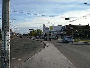
109 Street in the Garneau area | |
|
Garneau Location of Garneau in Edmonton | |
| Coordinates: 53°31′12″N 113°30′50″W / 53.520°N 113.514°W | |
| Country |
|
| Province |
|
| City | Edmonton |
| Quadrant[1] | NW |
| Ward[1] | 8 |
| Sector[2] | Mature area |
| Area[3][4] | Central core and Strathcona |
| Government[5] | |
| • Administrative body | Edmonton City Council |
| • Councillor | Ben Henderson |
| Area[6] | |
| • Total | 0.83 km2 (0.32 sq mi) |
| Elevation | 673 m (2,208 ft) |
| Population (2012)[7] | |
| • Total | 9,648 |
| • Density | 11,624.1/km2 (30,106/sq mi) |
| • Change (2009–12) |
|
| • Dwellings | 5,811 |
Garneau is one of the oldest neighbourhoods in the city of Edmonton. Prior to 1912, it was part of the City of Strathcona. It is named after one of its first inhabitants, Laurent Garneau (ca. 1840-1921), a former Manitoba Métis rebel and Hudson's Bay Company employee who with his wife and family settled there around 1874.[8]
Garneau is located just west of the Strathcona neighbourhood and just east of the main University of Alberta campus. The neighbourhood overlooks the North Saskatchewan River valley.
In the river valley immediately below Garneau are the Kinsmen Park, the Kinsmen Sport Centre, and the John Walter Museum. The central location of the neighbourhood also gives residents access to downtown Edmonton, Whyte Avenue, and many other areas of the city.
The Garneau community is home to three playgrounds, one located beside the Community Arts Centre, west of 109th street and 84th avenue, and two on the property of the Garneau Elementary School on 109th street and 87th avenue, one specifically designed for toddlers and preschoolers.
Demographics
In the City of Edmonton's 2012 municipal census, Garneau had a population of 9,648 living in 5,811 dwellings,[7] a 5.1% change from its 2009 population of 9,178.[9] With a land area of 0.83 km2 (0.32 sq mi), it had a population density of 11,624.1 people/km2 in 2012.[6][7]
Climate
| Climate data for University of Alberta Metabolic Centre (1981-2010) | |||||||||||||
|---|---|---|---|---|---|---|---|---|---|---|---|---|---|
| Month | Jan | Feb | Mar | Apr | May | Jun | Jul | Aug | Sep | Oct | Nov | Dec | Year |
| Record high °C (°F) | 10.5 (50.9) |
14.5 (58.1) |
24.0 (75.2) |
28.0 (82.4) |
32.0 (89.6) |
35.0 (95) |
36.0 (96.8) |
35.0 (95) |
31.5 (88.7) |
29.0 (84.2) |
19.0 (66.2) |
14.5 (58.1) |
36.0 (96.8) |
| Average high °C (°F) | −6.2 (20.8) |
−2.3 (27.9) |
2.1 (35.8) |
11.8 (53.2) |
17.7 (63.9) |
21.3 (70.3) |
24.1 (75.4) |
22.4 (72.3) |
17.8 (64) |
10.4 (50.7) |
0.5 (32.9) |
−3.5 (25.7) |
9.7 (49.5) |
| Daily mean °C (°F) | −11.7 (10.9) |
−8.5 (16.7) |
−4.0 (24.8) |
5.0 (41) |
10.8 (51.4) |
15.1 (59.2) |
17.5 (63.5) |
15.9 (60.6) |
11.0 (51.8) |
4.2 (39.6) |
−4.4 (24.1) |
−8.8 (16.2) |
3.5 (38.3) |
| Average low °C (°F) | −17.1 (1.2) |
−14.6 (5.7) |
−10.0 (14) |
−1.8 (28.8) |
3.8 (38.8) |
8.8 (47.8) |
11.0 (51.8) |
9.3 (48.7) |
4.2 (39.6) |
−2.0 (28.4) |
−9.2 (15.4) |
−14.1 (6.6) |
−2.6 (27.3) |
| Record low °C (°F) | −42.0 (−43.6) |
−41.5 (−42.7) |
−40.0 (−40) |
−20.5 (−4.9) |
−9.0 (15.8) |
0.0 (32) |
3.0 (37.4) |
−0.5 (31.1) |
−5.5 (22.1) |
−21.5 (−6.7) |
−33.0 (−27.4) |
−37.5 (−35.5) |
−42.0 (−43.6) |
| Average precipitation mm (inches) | 14.5 (0.571) |
9.9 (0.39) |
13.5 (0.531) |
27.0 (1.063) |
53.7 (2.114) |
73.8 (2.906) |
101.8 (4.008) |
73.7 (2.902) |
39.1 (1.539) |
20.4 (0.803) |
16.8 (0.661) |
9.3 (0.366) |
453.5 (17.854) |
| Average rainfall mm (inches) | 0.0 (0) |
0.0 (0) |
0.4 (0.016) |
17.6 (0.693) |
49.8 (1.961) |
73.8 (2.906) |
101.1 (3.98) |
73.7 (2.902) |
38.9 (1.531) |
12.8 (0.504) |
1.8 (0.071) |
0.1 (0.004) |
370.0 (14.567) |
| Average snowfall cm (inches) | 14.5 (5.71) |
9.9 (3.9) |
13.1 (5.16) |
9.3 (3.66) |
3.9 (1.54) |
0.0 (0) |
0.0 (0) |
0.0 (0) |
0.2 (0.08) |
7.5 (2.95) |
15.0 (5.91) |
9.2 (3.62) |
82.6 (32.53) |
| Average precipitation days (≥ 0.2 mm) | 6.2 | 4.4 | 4.4 | 5.7 | 9.9 | 14.0 | 15.0 | 13.1 | 9.7 | 6.2 | 5.5 | 4.8 | 98.9 |
| Average rainy days (≥ 0.2 mm) | 0.05 | 0.0 | 0.25 | 3.9 | 9.5 | 14.0 | 15.0 | 13.0 | 9.7 | 5.0 | 1.0 | 0.1 | 71.5 |
| Average snowy days (≥ 0.2 cm) | 6.1 | 4.4 | 4.1 | 2.0 | 0.55 | 0.0 | 0.0 | 0.0 | 0.1 | 1.4 | 4.6 | 4.7 | 28.0 |
| Source: Environment Canada[10] | |||||||||||||
Residential development
There are many high rise condominiums buildings with five or more stories and low rise apartments buildings with fewer than five stories in the neighbourhood. Most of these are rented, making Garneau an attractive location for students at the University of Alberta to live.[11]
There are also many historically designated sites in the neighbourhood.
Entertainment
The Garneau Theatre is located in the neighbourhood.
Transportation
Garnaeu is a stop on the High Level Bridge Streetcar route.
| |||||||||||||||||||||||||||||||||||||||||||||||||||||||||||||||||||||||||||||||||||||||||||||||||||||||||
There are several bus routes running in the area, considering its proximity to Whyte Avenue and the University of Alberta. They are: 4, 7, 9, 57, 94 and 313.
University LRT station is always within 1.4 km of Garneau regardless of where you are in the neighbourhood.
Cycling is a popular form of transport, considering the density, expense of car parking on some roads, and the number of low volume quiet side roads.
Surrounding neighbourhoods
 |
North Saskatchewan River valley | North Saskatchewan River valley | North Saskatchewan River valley | |
| University of Alberta | |
Strathcona | ||
| ||||
| | ||||
| McKernan | McKernan, Queen Alexandra | Queen Alexandra |
See also
References
- 1 2 "City of Edmonton Wards & Standard Neighbourhoods" (PDF). City of Edmonton. Retrieved February 13, 2013.
- ↑ "Edmonton Developing and Planned Neighbourhoods, 2011" (PDF). City of Edmonton. Retrieved February 13, 2013.
- ↑ "The Way We Grow: Municipal Development Plan Bylaw 15100" (PDF). City of Edmonton. 2010-05-26. Retrieved February 13, 2013.
- ↑ History of Annexations (Map). City of Edmonton, Planning and Development Department.
- ↑ "City Councillors". City of Edmonton. Retrieved February 13, 2013.
- 1 2 "Neighbourhoods (data plus kml file)". City of Edmonton. Retrieved February 13, 2013.
- 1 2 3 "Municipal Census Results – Edmonton 2012 Census". City of Edmonton. Retrieved February 22, 2013.
- ↑ Monto, Tom. Old Strathcona Edmonton's Southside Roots (Crang Publishing/Alhambra Books), p. 16.
- ↑ "2009 Municipal Census Results". City of Edmonton. Retrieved February 22, 2013.
- ↑ "University of Alberta Metabolic Centre". Canadian Climate Normals 1981−2010. Environment Canada. Retrieved October 3, 2015.
- ↑ http://censusdocs.edmonton.ca/C05002/MUNICIPAL%202005/Neighbourhood/GARNEAU.pdf