Garfield County, Nebraska
| Garfield County, Nebraska | |
|---|---|
_from_W.JPG) Garfield County Courthouse in Burwell | |
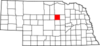 Location in the U.S. state of Nebraska | |
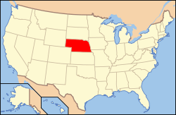 Nebraska's location in the U.S. | |
| Founded | 1884 |
| Named for | James A. Garfield |
| Seat | Burwell |
| Largest city | Burwell |
| Area | |
| • Total | 571 sq mi (1,479 km2) |
| • Land | 570 sq mi (1,476 km2) |
| • Water | 1.6 sq mi (4 km2), 0.3% |
| Population | |
| • (2010) | 2,049 |
| • Density | 3.6/sq mi (1/km²) |
| Congressional district | 3rd |
| Time zone | Central: UTC-6/-5 |
| Website |
www |
Garfield County is a county in the U.S. state of Nebraska. As of the 2010 census, the population was 2,049.[1] Its county seat is Burwell.[2] The county was organized in 1884 and named for James A. Garfield, 20th President of the United States.[3]
In the Nebraska license plate system, Garfield County is represented by the prefix 83 (it had the eighty-third-largest number of vehicles registered in the county when the license plate system was established in 1922).
Geography
According to the U.S. Census Bureau, the county has an area of 571 square miles (1,480 km2), of which 570 square miles (1,500 km2) is land and 1.6 square miles (4.1 km2) (0.3%) is water.[4]
Major highways
Adjacent counties
- Wheeler County (east)
- Valley County (south)
- Loup County (west)
- Holt County (north)
Demographics
| Historical population | |||
|---|---|---|---|
| Census | Pop. | %± | |
| 1890 | 1,659 | — | |
| 1900 | 2,127 | 28.2% | |
| 1910 | 3,417 | 60.6% | |
| 1920 | 3,496 | 2.3% | |
| 1930 | 3,207 | −8.3% | |
| 1940 | 3,444 | 7.4% | |
| 1950 | 2,912 | −15.4% | |
| 1960 | 2,699 | −7.3% | |
| 1970 | 2,411 | −10.7% | |
| 1980 | 2,363 | −2.0% | |
| 1990 | 2,141 | −9.4% | |
| 2000 | 1,902 | −11.2% | |
| 2010 | 2,049 | 7.7% | |
| Est. 2015 | 2,028 | [5] | −1.0% |
| U.S. Decennial Census[6] 1790-1960[7] 1900-1990[8] 1990-2000[9] 2010-2013[1] | |||
As of the census[10] of 2000, there were 1,902 people, 813 households, and 529 families residing in the county. The population density was 3 people per square mile (1/km²). There were 1,021 housing units at an average density of 2 per square mile (1/km²). The racial makeup of the county was 98.79% White, 0.21% Native American, 0.05% Asian, 0.05% Pacific Islander, 0.37% from other races, and 0.53% from two or more races. 1.00% of the population were Hispanic or Latino of any race.
There were 813 households out of which 26.10% had children under the age of 18 living with them, 59.70% were married couples living together, 3.60% had a female householder with no husband present, and 34.90% were non-families. 32.70% of all households were made up of individuals and 20.00% had someone living alone who was 65 years of age or older. The average household size was 2.27 and the average family size was 2.88.
In the county the population was spread out with 23.50% under the age of 18, 4.40% from 18 to 24, 20.50% from 25 to 44, 26.80% from 45 to 64, and 24.80% who were 65 years of age or older. The median age was 46 years. For every 100 females there were 91.90 males. For every 100 females age 18 and over, there were 85.40 males.
The median income for a household in the county was $27,407, and the median income for a family was $34,762. Males had a median income of $24,563 versus $16,146 for females. The per capita income for the county was $14,368. About 9.70% of families and 12.60% of the population were below the poverty line, including 11.50% of those under age 18 and 18.60% of those age 65 or over.
Communities
See also
References
- 1 2 "State & County QuickFacts". United States Census Bureau. Retrieved September 20, 2013.
- ↑ "Find a County". National Association of Counties. Retrieved 2011-06-07.
- ↑ Gannett, Henry (1905). The Origin of Certain Place Names in the United States. Govt. Print. Off. p. 134.
- ↑ "2010 Census Gazetteer Files". United States Census Bureau. August 22, 2012. Retrieved December 7, 2014.
- ↑ "County Totals Dataset: Population, Population Change and Estimated Components of Population Change: April 1, 2010 to July 1, 2015". Retrieved July 2, 2016.
- ↑ "U.S. Decennial Census". United States Census Bureau. Retrieved December 7, 2014.
- ↑ "Historical Census Browser". University of Virginia Library. Retrieved December 7, 2014.
- ↑ "Population of Counties by Decennial Census: 1900 to 1990". United States Census Bureau. Retrieved December 7, 2014.
- ↑ "Census 2000 PHC-T-4. Ranking Tables for Counties: 1990 and 2000" (PDF). United States Census Bureau. Retrieved December 7, 2014.
- ↑ "American FactFinder". United States Census Bureau. Retrieved 2008-01-31.
 |
Holt County | | ||
| Loup County | |
Wheeler County | ||
| ||||
| | ||||
| Valley County |
Municipalities and communities of Garfield County, Nebraska, United States | ||
|---|---|---|
| City | ||
| Unincorporated communities | ||
Coordinates: 41°53′N 98°59′W / 41.89°N 98.98°W