Garey, California
| Garey | |
|---|---|
| census-designated place | |
 Garey Position in California. | |
| Coordinates: 34°53′09″N 120°18′50″W / 34.88583°N 120.31389°WCoordinates: 34°53′09″N 120°18′50″W / 34.88583°N 120.31389°W | |
| Country |
|
| State |
|
| County | Santa Barbara |
| Area[1] | |
| • Total | 1.269 sq mi (3.286 km2) |
| • Land | 1.265 sq mi (3.276 km2) |
| • Water | 0.004 sq mi (0.010 km2) 0.30% |
| Elevation[2] | 387 ft (118 m) |
| Population (2010) | |
| • Total | 68 |
| • Density | 54/sq mi (21/km2) |
| Time zone | Pacific (PST) (UTC-8) |
| • Summer (DST) | PDT (UTC-7) |
| ZIP Code | 93454 |
| Area code(s) | 805 |
| GNIS feature ID | 2583023 |
| U.S. Geological Survey Geographic Names Information System: Garey, California | |
Garey is a census-designated place in Santa Barbara County, California located east of U.S. Route 101 about 10 miles (16 km) southeast of Santa Maria and 5 miles (8.0 km) north of Sisquoc. The ZIP Code is 93454, and the community is inside area code 805. The population was 68 at the 2010 census.
History
Garey was founded in 1889, named after horticulturalist Thomas Garey.[3]
Geography
According to the United States Census Bureau, the CDP covers an area of 1.3 square miles (3.3 km²), 99.70% of it land, and 0.30% of it water.
Demographics
The 2010 United States Census[4] reported that Garey had a population of 68. The population density was 53.6 people per square mile (20.7/km²). The racial makeup of Garey was 53 (77.9%) White, 0 (0.0%) African American, 1 (1.5%) Native American, 0 (0.0%) Asian, 0 (0.0%) Pacific Islander, 5 (7.4%) from other races, and 9 (13.2%) from two or more races. Hispanic or Latino of any race were 21 persons (30.9%).
The Census reported that 68 people (100% of the population) lived in households, 0 (0%) lived in non-institutionalized group quarters, and 0 (0%) were institutionalized.
There were 28 households, out of which 6 (21.4%) had children under the age of 18 living in them, 15 (53.6%) were opposite-sex married couples living together, 3 (10.7%) had a female householder with no husband present, 0 (0%) had a male householder with no wife present. There were 0 (0%) unmarried opposite-sex partnerships, and 0 (0%) same-sex married couples or partnerships. 10 households (35.7%) were made up of individuals and 3 (10.7%) had someone living alone who was 65 years of age or older. The average household size was 2.43. There were 18 families (64.3% of all households); the average family size was 3.17.
The population was spread out with 13 people (19.1%) under the age of 18, 4 people (5.9%) aged 18 to 24, 17 people (25.0%) aged 25 to 44, 25 people (36.8%) aged 45 to 64, and 9 people (13.2%) who were 65 years of age or older. The median age was 45.0 years. For every 100 females there were 112.5 males. For every 100 females age 18 and over, there were 111.5 males.
There were 29 housing units at an average density of 22.9 per square mile (8.8/km²), of which 20 (71.4%) were owner-occupied, and 8 (28.6%) were occupied by renters. The homeowner vacancy rate was 0%; the rental vacancy rate was 0%. 42 people (61.8% of the population) lived in owner-occupied housing units and 26 people (38.2%) lived in rental housing units.
References
- ↑ U.S. Census
- ↑ U.S. Geological Survey Geographic Names Information System: Garey, California
- ↑ David W. Kean, Wide Places in the California Roads: The encyclopedia of California's small towns and the roads that lead to them (Volume 1 of 4: Southern California Counties), p. 68
- ↑ "2010 Census Interactive Population Search: CA - Garey CDP". U.S. Census Bureau. Retrieved July 12, 2014.
Municipalities and communities of Santa Barbara County, California, United States | ||
|---|---|---|
| Cities | 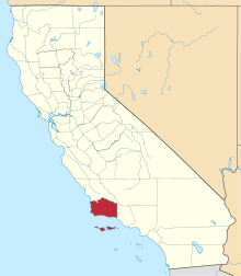 | |
| CDPs | ||
| Unincorporated communities | ||
| Indian reservation | ||
| Ghost towns | ||