Gadhawa
| Gadhawa गढवा | |
|---|---|
| Typical Village Development Committee | |
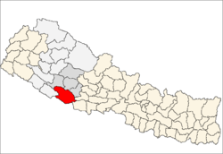
 Gadhawa Location in Nepal | |
| Coordinates: 27°47′N 82°32′E / 27.78°N 82.53°ECoordinates: 27°47′N 82°32′E / 27.78°N 82.53°E | |
| Country |
|
| Zone | Rapti Zone |
| District | Dang Deokhuri District |
| Population (1991) | |
| • Total | 7,877 |
| Time zone | Nepal Time (UTC+5:45) |
Gadhawa is a town and Village Development Committee now known as Typical Village Development Committee in Dang Deokhuri District in the Rapti Zone of south-western Nepal. At the time of the 1991 Nepal census it had a population of 7,877 persons living in 1188 individual households. It is surrounded by Ganga paraspur VDC in east,Koilabas VDC in south, Bela VDC in west and Chailai VDC in north.Damodar road run on its long course which communicate Indian border from Koilabas VDC to East-West highway(Mahendra highway). Major population is made by Tharu, Khas-Brhamins,Yadav and few Muslims. This town is fully satisfy in communication, education and some what of health sector. The main occupation of this society is depended on agriculture however some of them accepted business sector.[1]
References
- ↑ "Nepal Census 2001". Nepal's Village Development Committees. Digital Himalaya. Retrieved 21 September 2008.