Gader Valley
| Gader (Gaderská dolina) | |
| Valley | |
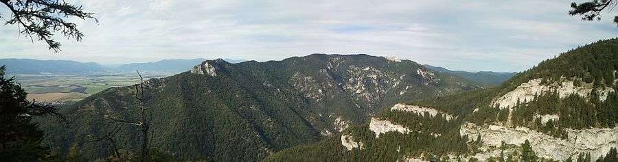
_-_from_Blatnica_castle_ruin.jpg) Gader Valley from the ruins of the Blatnica Castle | |
| Country | Slovakia |
|---|---|
| Region | Žilina |
| District | Martin |
| Municipality | Blatnica |
| Parts | Dedošová upper part |
| Side valleys | |
| - left | Selenec |
| River | Gaderský potok |
| Location | merger of Dedošová and Selenec Valleys |
| - coordinates | SK 48°56′37″N 19°00′22″E / 48.94353°N 19.00603°ECoordinates: SK 48°56′37″N 19°00′22″E / 48.94353°N 19.00603°E |
| Lowest point | |
| - location | merger with Blatnica Valley |
| - coordinates | SK 48°55′55″N 18°56′06″E / 48.93195°N 18.93493°E |
| Length | 18 km (11 mi) |
| Geology | limestone |
| Easiest access | paved road |
  Location of Gader in Slovakia | |
  Location of Gader Valley in the Žilina Region | |
The Gader Valley
Gader Valley (Slovak: Gaderská dolina) is a long valley in the Greater Fatra Range[1] in Central Slovakia. It is accessible from the village of Blatnica. The valley is the gateway to the peaks of Tlstá and Ostrá. Its upper part, from the merger with the Selenec Valley, is named Dedošová.
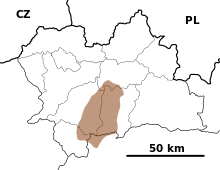
Map showing the Greater Fatra Range in the Žilina Region, Slovakia.
.JPG)
The Tlstá
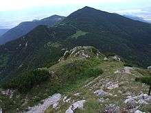
Mount Ostrá
References
- ↑ "Greater Fatra". Slovak-Republic.org. Retrieved 21 January 2013.
This article is issued from Wikipedia - version of the 4/23/2016. The text is available under the Creative Commons Attribution/Share Alike but additional terms may apply for the media files.