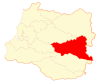
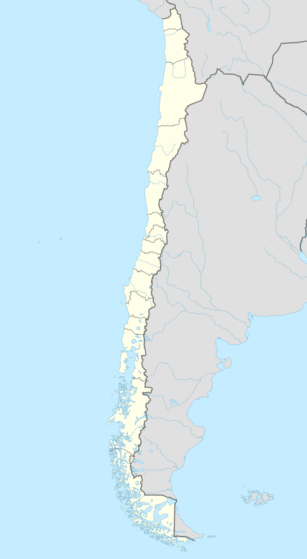
Futrono
| Futrono Futronhue | ||||||
|---|---|---|---|---|---|---|
| City and Commune | ||||||
| ||||||
| Coordinates (city): 40°08′S 72°24′W / 40.133°S 72.400°WCoordinates: 40°08′S 72°24′W / 40.133°S 72.400°W | ||||||
| Country | Chile | |||||
| Regions of Chile | Los Ríos | |||||
| Province | Ranco | |||||
| Founded as | Futrono | |||||
| Founded | 12 June 1941 | |||||
| Government[1][2] | ||||||
| • Type | Municipality | |||||
| • Alcalde | Jorge Guillermo Tatter Oñate (UDI) | |||||
| Area[3] | ||||||
| • Total | 2,120.6 km2 (818.8 sq mi) | |||||
| Elevation | 67 m (220 ft) | |||||
| Population (2012 Census)[3] | ||||||
| • Total | 13,736 | |||||
| • Density | 6.5/km2 (17/sq mi) | |||||
| • Urban | 8,399 | |||||
| • Rural | 6,582 | |||||
| Sex[3] | ||||||
| • Men | 7,647 | |||||
| • Women | 7,334 | |||||
| Time zone | CLT (UTC−4) | |||||
| • Summer (DST) | CLST (UTC−3) | |||||
| Area code(s) | 56 + 63 | |||||
| Website |
www | |||||

Futrono (from the Mapudungun: Futronhue, meaning "place of smoke") is a city and commune in southern Chile administered by the Municipality of Futrono. It is located in Ranco Province in Los Ríos Region, on the northwest shore of Ranco Lake.
Demographics
According to the 2002 census of the National Statistics Institute, Futrono spans an area of 2,120.6 km2 (819 sq mi) and has 14,981 inhabitants (7,647 men and 7,334 women). Of these, 8,399 (56.1%) lived in urban areas and 6,582 (43.9%) in rural areas. The population grew by 6.6% (933 persons) between the 1992 and 2002 censuses.[3]
Administration
As a commune, Futrono is a third-level administrative division of Chile administered by a municipal council, headed by an alcalde who is directly elected every four years. The 2008-2012 alcalde is Jorge Guillermo Tatter Oñate (UDI).[1][2]
Within the electoral divisions of Chile, Futrono is represented in the Chamber of Deputies by Enrique Jaramillo (PDC) and Gastón Von Mühlenbrock (UDI) as part of the 54th electoral district, (together with Panguipulli, Los Lagos, Lago Ranco, Río Bueno, La Unión and Paillaco). The commune is represented in the Senate by Andrés Allamand (RN) and Eduardo Frei Ruiz-Tagle (PDC) as part of the 16th senatorial constituency (Los Ríos Region).

References
- 1 2 "Asociación Chilena de Municipalidades" (in Spanish). Retrieved 27 January 2011.
- 1 2 "Municipality of Futrono" (in Spanish). Retrieved 27 January 2011.
- 1 2 3 4 "National Statistics Institute" (in Spanish). Retrieved 13 December 2010.
External links
| Wikimedia Commons has media related to Futrono. |
- (Spanish) Municipality of Futrono
- (Spanish) Chamber of Tourism Futrono
